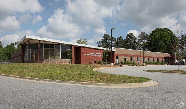
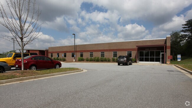
Property Record
854 Winder Hwy, Lawrenceville, GA 30045

Property Detail
854 Winder Hwy
5-207-002
BORDERED BY WINDER HWY & BRISCOE RD
Communitycenter
GWINNETT
RA200
Georgia
B and X Area of moderate flood hazard, usually the area between the limits of the 100-year and 500-year floods.
103.66 AC
2025
Lawrenceville/Lilburn
2025
Atlanta
050583
Atlanta-Sandy Springs-Roswell, GA
190,485 SF
NEARBY LISTINGS FOR SALE OR LEASE
-
-
View all Lawrenceville listings for sale on LoopNet.com
DEMOGRAPHICS near 854 Winder Hwy
1 mile
3 mile
5 mile
2025 Total Population
9,279
61,643
179,940
2030 Population
9,708
65,001
188,736
Pop Growth 2025-2030
+ 4.62%
+ 5.45%
+ 4.89%
Average Age
35
36
37
2025 Total Households
2,434
18,741
56,507
HH Growth 2025-2030
+ 4.97%
+ 5.69%
+ 5.01%
Median Household Inc
$72,395
$78,958
$90,750
Avg Household Size
3.10
3.10
3.10
2025 Avg HH Vehicles
2.00
2.00
2.00
Median Home Value
$337,479
$379,150
$400,408
Median Year Built
2003
2000
1999
Nearby Places
Map Layers
Map Styles
 Street
 Aerial
Transit
 Traffic
 Biking
Places
Listings with unknown addresses are not visible on the map
- Restaurants
- Banks
- Shops
- Fitness
- Groceries
Nearby Properties
Address
Land Use
TOTAL SIZE
Lot Size
Zoning
Address
Land Use
TOTAL SIZE
Lot Size
Zoning
1,218,930 SF
66.65 AC
OI
Address
Land Use
TOTAL SIZE
Lot Size
Zoning
2,260,742 SF
285.40 AC
M1
Address
Land Use
TOTAL SIZE
Lot Size
Zoning
1,071,116 SF
69.77 AC
OI
Address
Land Use
TOTAL SIZE
Lot Size
Zoning
939,709 SF
159.36 AC
RS180
Address
Land Use
TOTAL SIZE
Lot Size
Zoning
275,917 SF
13.34 AC
BG
Address
Land Use
TOTAL SIZE
Lot Size
Zoning
493,520 SF
12.67 AC
BG2
Address
Land Use
TOTAL SIZE
Lot Size
Zoning
321,476 SF
38.63 AC
RMM
Address
Land Use
TOTAL SIZE
Lot Size
Zoning
16,062 SF
89.78 AC
BG
Address
Land Use
TOTAL SIZE
Lot Size
Zoning
812,946 SF
82.22 AC
BG2
Address
Land Use
TOTAL SIZE
Lot Size
Zoning
439,272 SF
18 AC
RM24
Address
Land Use
TOTAL SIZE
Lot Size
Zoning
298,990 SF
24.16 AC
RM12
Address
Land Use
TOTAL SIZE
Lot Size
Zoning
279,207 SF
19.14 AC
RM13
Address
Land Use
TOTAL SIZE
Lot Size
Zoning
213,116 SF
15.09 AC
RM12
Address
Land Use
TOTAL SIZE
Lot Size
Zoning
220,161 SF
9.71 AC
OI
Address
Land Use
TOTAL SIZE
Lot Size
Zoning
93,022 SF
68.90 AC
R100
Address
Land Use
TOTAL SIZE
Lot Size
Zoning
240,509 SF
19.18 AC
RM
Address
Land Use
TOTAL SIZE
Lot Size
Zoning
175,190 SF
11.17 AC
RM
Address
Land Use
TOTAL SIZE
Lot Size
Zoning
231,373 SF
3.82 AC
OI
Address
Land Use
TOTAL SIZE
Lot Size
Zoning
270,396 SF
4.57 AC
OI
Address
Land Use
TOTAL SIZE
Lot Size
Zoning
571,230 SF
64.70 AC
LM
Address
Land Use
TOTAL SIZE
Lot Size
Zoning
126,160 SF
15.15 AC
BG2
Address
Land Use
TOTAL SIZE
Lot Size
Zoning
240,800 SF
28.74 AC
M1
Address
Land Use
TOTAL SIZE
Lot Size
Zoning
127,844 SF
7.76 AC
RM8
Address
Land Use
TOTAL SIZE
Lot Size
Zoning
176,034 SF
92.85 AC
RA200
Address
Land Use
TOTAL SIZE
Lot Size
Zoning
369,729 SF
22.16 AC
TC-MU
Address
Land Use
TOTAL SIZE
Lot Size
Zoning
134,512 SF
5.03 AC
RS150
Address
Land Use
TOTAL SIZE
Lot Size
Zoning
132,916 SF
10.23 AC
BG
Address
Land Use
TOTAL SIZE
Lot Size
Zoning
212,571 SF
31.30 AC
RA200
Address
Land Use
TOTAL SIZE
Lot Size
Zoning
179,498 SF
6.05 AC
HSB
The World's #1 Commercial Real Estate Marketplace
Connect with us
© 2026 CoStar Group
The information above has been obtained from sources believed reliable. While we do not doubt its accuracy we have not verified it and make no guarantee, warranty or representation about it. It is your responsibility to independently confirm its accuracy and completeness. Any projections, opinions, assumptions, or estimates used are for example only and do not represent the current or future performance of the property. The value of this transaction to you depends on tax and other factors which should be evaluated by your tax, financial, and legal advisors. You and your advisors should conduct a careful, independent investigation of the property to determine to your satisfaction the suitability of the property for your needs.