Property Record
855 L And P Pkwy, Monroe, GA 30655

NEARBY LISTINGS FOR SALE OR LEASE
Property Detail
855 L And P Pkwy
Atlanta-Sandy Springs-Roswell, GA
09171-County Industrial
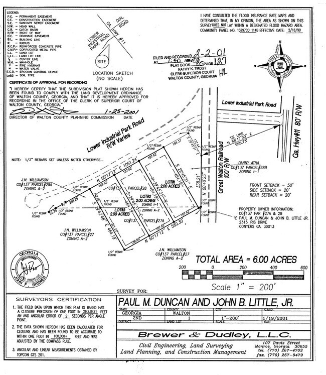
C137000000028000
TR#2 2.00AC
Warehouse
Walton
X
Georgia
13297C0139F
1
2024
2 AC
2024
South Walton County
110702
Atlanta
19,832 SF
DEMOGRAPHICS near 855 L And P Pkwy
1 Mile
3 Mile
5 Mile
2024 Total Population
831
17,039
31,888
2029 Population
1,111
22,567
42,152
Pop Growth 2024-2029
+ 33.69%
+ 32.44%
+ 32.19%
Average Age
40
39
39
2024 Total Households
279
6,460
11,860
HH Growth 2024-2029
+ 34.05%
+ 32.69%
+ 32.42%
Median Household Inc
$64,038
$49,637
$55,158
Avg Household Size
2.60
2.60
2.60
2024 Avg HH Vehicles
2.00
2.00
2.00
Median Home Value
$321,250
$317,720
$315,347
Median Year Built
1998
1990
1993
Nearby Places
Map Layers
Map Styles
 Street
 Aerial
- Restaurants
- Banks
- Shops
- Fitness
- Groceries
Nearby Properties
Address
Land Use
TOTAL SIZE
Lot Size
Zoning
Address
Land Use
TOTAL SIZE
Lot Size
Zoning
9,424 SF
76 AC
MIX WP2
Address
Land Use
TOTAL SIZE
Lot Size
Zoning
122,949 SF
28.37 AC
R1 P
Address
Land Use
TOTAL SIZE
Lot Size
Zoning
2,736 SF
8.96 AC
P
Address
Land Use
TOTAL SIZE
Lot Size
Zoning
468,275 SF
59.49 AC
I1
Address
Land Use
TOTAL SIZE
Lot Size
Zoning
95,350 SF
48.62 AC
A1
Address
Land Use
TOTAL SIZE
Lot Size
Zoning
78,644 SF
9.90 AC
B3
Address
Land Use
TOTAL SIZE
Lot Size
Zoning
4,319 SF
12.16 AC
PRD
Address
Land Use
TOTAL SIZE
Lot Size
Zoning
2,900 SF
30.02 AC
M1
Address
Land Use
TOTAL SIZE
Lot Size
Zoning
2,640 SF
64.81 AC
R1A
Address
Land Use
TOTAL SIZE
Lot Size
Zoning
7,200 SF
18 AC
A1
Address
Land Use
TOTAL SIZE
Lot Size
Zoning
52,185 SF
3.64 AC
PCD
Address
Land Use
TOTAL SIZE
Lot Size
Zoning
27,300 SF
8 AC
PCD
Address
Land Use
TOTAL SIZE
Lot Size
Zoning
90,557 SF
11.46 AC
B3
Address
Land Use
TOTAL SIZE
Lot Size
Zoning
24,553 SF
5.32 AC
P
Address
Land Use
TOTAL SIZE
Lot Size
Zoning
30,722 SF
2.54 AC
B2
Address
Land Use
TOTAL SIZE
Lot Size
Zoning
4,830 SF
9.65 AC
PCD
Address
Land Use
TOTAL SIZE
Lot Size
Zoning
3,912 SF
221.14 AC
MIX
Address
Land Use
TOTAL SIZE
Lot Size
Zoning
2,576 SF
23.95 AC
I1
Address
Land Use
TOTAL SIZE
Lot Size
Zoning
32,343 SF
4.11 AC
P
Address
Land Use
TOTAL SIZE
Lot Size
Zoning
11,953 SF
1.39 AC
B2
Address
Land Use
TOTAL SIZE
Lot Size
Zoning
485.60 AC
A1 WP2
Address
Land Use
TOTAL SIZE
Lot Size
Zoning
3,000 SF
4.65 AC
MIX
Address
Land Use
TOTAL SIZE
Lot Size
Zoning
20,239 SF
2.62 AC
B2
Address
Land Use
TOTAL SIZE
Lot Size
Zoning
50,968 SF
6.51 AC
B3
Address
Land Use
TOTAL SIZE
Lot Size
Zoning
1,440 SF
25.75 AC
MIX
Address
Land Use
TOTAL SIZE
Lot Size
Zoning
19,918 SF
2.56 AC
R1
Address
Land Use
TOTAL SIZE
Lot Size
Zoning
15,000 SF
1.50 AC
B2
Address
Land Use
TOTAL SIZE
Lot Size
Zoning
6,820 SF
153.31 AC
R1
Address
Land Use
TOTAL SIZE
Lot Size
Zoning
18,958 SF
13.63 AC
A1
Address
Land Use
TOTAL SIZE
Lot Size
Zoning
68.64 AC
A1 WP2
The World's #1 Commercial Real Estate Marketplace
Connect with us
© 2025 CoStar Group
The information above has been obtained from sources believed reliable. While we do not doubt its accuracy we have not verified it and make no guarantee, warranty or representation about it. It is your responsibility to independently confirm its accuracy and completeness. Any projections, opinions, assumptions, or estimates used are for example only and do not represent the current or future performance of the property. The value of this transaction to you depends on tax and other factors which should be evaluated by your tax, financial, and legal advisors. You and your advisors should conduct a careful, independent investigation of the property to determine to your satisfaction the suitability of the property for your needs.