Property Record
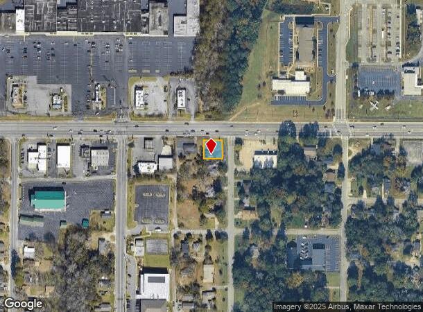
855 Shurling Dr, Macon, GA 31211

NEARBY LISTINGS FOR SALE OR LEASE
Property Detail
855 Shurling Dr
Macon-Bibb County, GA
Clerks Office,
S063-0197
WOOLFOLK
Officebuilding
Bibb
X
Georgia
13169C0325E
1-a
2025
0.24 AC
2025
Suburban Macon
011100
Atlanta
918 SF
DEMOGRAPHICS near 855 Shurling Dr
1 Mile
3 Mile
5 Mile
2024 Total Population
6,660
29,800
71,042
2029 Population
6,809
29,880
71,160
Pop Growth 2024-2029
+ 2.24%
+ 0.27%
+ 0.17%
Average Age
40
39
39
2024 Total Households
2,943
13,129
29,411
HH Growth 2024-2029
+ 1.94%
+ 0.30%
+ 0.26%
Median Household Inc
$24,605
$32,638
$38,299
Avg Household Size
2.20
2.10
2.30
2024 Avg HH Vehicles
1.00
1.00
1.00
Median Home Value
$76,654
$108,782
$116,029
Median Year Built
1964
1963
1964
Nearby Places
Map Layers
Map Styles
 Street
 Aerial
- Restaurants
- Banks
- Shops
- Fitness
- Groceries
SALE & LEASE HISTORY
LISTING DATE
SALE/LEASE

Sep 26, 2016
For Lease
Sep 24, 2016
For Sale
Jun 13, 2019
For Sale
Jan 10, 2018
For Sale
Nearby Properties
Address
Land Use
TOTAL SIZE
Lot Size
Zoning
Address
Land Use
TOTAL SIZE
Lot Size
Zoning
55,368 SF
9.53 AC
CBD-2
Address
Land Use
TOTAL SIZE
Lot Size
Zoning
213,690 SF
2.25 AC
CBD-1
Address
Land Use
TOTAL SIZE
Lot Size
Zoning
154,196 SF
44.86 AC
R-1A
Address
Land Use
TOTAL SIZE
Lot Size
Zoning
63,394 SF
5.30 AC
M-1/R-3
Address
Land Use
TOTAL SIZE
Lot Size
Zoning
100,599 SF
0.43 AC
CBD-1
Address
Land Use
TOTAL SIZE
Lot Size
Zoning
158,480 SF
0.90 AC
CBD-2
Address
Land Use
TOTAL SIZE
Lot Size
Zoning
241,380 SF
12.38 AC
C-2
Address
Land Use
TOTAL SIZE
Lot Size
Zoning
127,536 SF
3.56 AC
PDE
Address
Land Use
TOTAL SIZE
Lot Size
Zoning
155,678 SF
3.85 AC
CBD-2
Address
Land Use
TOTAL SIZE
Lot Size
Zoning
171,386 SF
36.41 AC
CBD-2
Address
Land Use
TOTAL SIZE
Lot Size
Zoning
92,712 SF
2.93 AC
CBD-2
Address
Land Use
TOTAL SIZE
Lot Size
Zoning
145,967 SF
2.53 AC
C-4
Address
Land Use
TOTAL SIZE
Lot Size
Zoning
114,156 SF
0.86 AC
CBD-1
Address
Land Use
TOTAL SIZE
Lot Size
Zoning
246,724 SF
0.75 AC
CBD-1
Address
Land Use
TOTAL SIZE
Lot Size
Zoning
141,816 SF
16.44 AC
C-2
Address
Land Use
TOTAL SIZE
Lot Size
Zoning
69,260 SF
0.41 AC
CBD-1
Address
Land Use
TOTAL SIZE
Lot Size
Zoning
60,432 SF
0.98 AC
CBD-1
Address
Land Use
TOTAL SIZE
Lot Size
Zoning
94,540 SF
6.15 AC
R-2
Address
Land Use
TOTAL SIZE
Lot Size
Zoning
140 SF
29.43 AC
R-1
Address
Land Use
TOTAL SIZE
Lot Size
Zoning
72,073 SF
0.96 AC
CBD-1
Address
Land Use
TOTAL SIZE
Lot Size
Zoning
21,112 SF
1.11 AC
HR-3
Address
Land Use
TOTAL SIZE
Lot Size
Zoning
72,048 SF
2.84 AC
R-2
Address
Land Use
TOTAL SIZE
Lot Size
Zoning
8,480 SF
7.92 AC
HPD-BH
Address
Land Use
TOTAL SIZE
Lot Size
Zoning
143,280 SF
5.06 AC
HR-3
Address
Land Use
TOTAL SIZE
Lot Size
Zoning
145 SF
15.97 AC
R-3
Address
Land Use
TOTAL SIZE
Lot Size
Zoning
53,678 SF
0.58 AC
C-2
Address
Land Use
TOTAL SIZE
Lot Size
Zoning
80,546 SF
5.03 AC
CBD-1
Address
Land Use
TOTAL SIZE
Lot Size
Zoning
215,664 SF
1.12 AC
CBD-1
Address
Land Use
TOTAL SIZE
Lot Size
Zoning
103,740 SF
1.21 AC
CBD-1
Address
Land Use
TOTAL SIZE
Lot Size
Zoning
77,346 SF
1.56 AC
PDE
The World's #1 Commercial Real Estate Marketplace
Connect with us
© 2025 CoStar Group
The information above has been obtained from sources believed reliable. While we do not doubt its accuracy we have not verified it and make no guarantee, warranty or representation about it. It is your responsibility to independently confirm its accuracy and completeness. Any projections, opinions, assumptions, or estimates used are for example only and do not represent the current or future performance of the property. The value of this transaction to you depends on tax and other factors which should be evaluated by your tax, financial, and legal advisors. You and your advisors should conduct a careful, independent investigation of the property to determine to your satisfaction the suitability of the property for your needs.