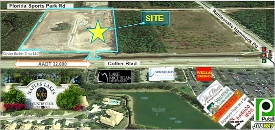
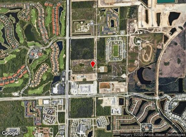
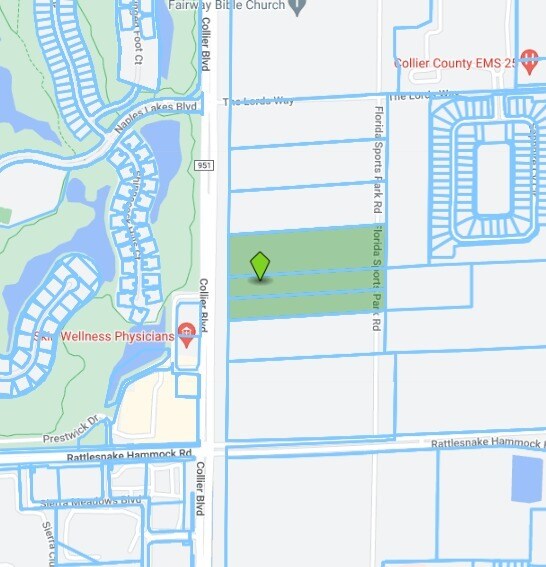
Property Record
8706 Fiori Dr, Naples, FL 34114
NEARBY LISTINGS FOR SALE OR LEASE
Property Detail
8706 Fiori Dr
Naples-Marco Island, FL
Acreage Header
00416800001
14 50 26 N1/2 OF N1/2 OF SW 1/4 OF SW1/4 & S1/2 OF S1/2 OF NW1/4 OF SW1/4 LESS W 100FT R/W
Commercialacreage
Collier
AE
Florida
12021C0606J
18.48 AC
2024
Outlying Collier County
2025
Southwest Florida
011108
DEMOGRAPHICS near 8706 Fiori Dr
1 Mile
3 Mile
5 Mile
2024 Total Population
4,721
34,407
101,731
2029 Population
5,444
39,678
116,882
Pop Growth 2024-2029
+ 15.31%
+ 15.32%
+ 14.89%
Average Age
48
53
50
2024 Total Households
2,153
15,899
44,610
HH Growth 2024-2029
+ 14.96%
+ 15.35%
+ 14.81%
Median Household Inc
$61,354
$73,361
$66,482
Avg Household Size
2.10
2.00
2.10
2024 Avg HH Vehicles
1.00
2.00
2.00
Median Home Value
$529,713
$357,575
$314,139
Median Year Built
2010
2002
1997
Nearby Places
Map Layers
Map Styles
 Street
 Aerial
- Restaurants
- Banks
- Shops
- Fitness
- Groceries
PUBLIC TRANSPORTATION
AIRPORT
Southwest Florida International
DRIVE
WALK
Distance
Southwest Florida International
47 min
37.0 mi
Freight Ports
Port of Miami
DRIVE
WALK
Distance
Port of Miami
144 min
121.0 mi
SALE & LEASE HISTORY
LISTING DATE
SALE/LEASE

Aug 31, 2018
For Sale
Nearby Properties
Address
Land Use
TOTAL SIZE
Lot Size
Zoning
Address
Land Use
TOTAL SIZE
Lot Size
Zoning
484,174 SF
38.74 AC
Address
Land Use
TOTAL SIZE
Lot Size
Zoning
359,711 SF
14.89 AC
Address
Land Use
TOTAL SIZE
Lot Size
Zoning
378,021 SF
18.99 AC
PUD
Address
Land Use
TOTAL SIZE
Lot Size
Zoning
305,545 SF
60 AC
A
Address
Land Use
TOTAL SIZE
Lot Size
Zoning
340,436 SF
18.10 AC
PUD
Address
Land Use
TOTAL SIZE
Lot Size
Zoning
368,668 SF
36.96 AC
PUD
Address
Land Use
TOTAL SIZE
Lot Size
Zoning
279,871 SF
11.52 AC
Address
Land Use
TOTAL SIZE
Lot Size
Zoning
371,884 SF
22.64 AC
MPUD
Address
Land Use
TOTAL SIZE
Lot Size
Zoning
351,576 SF
17.79 AC
PUD
Address
Land Use
TOTAL SIZE
Lot Size
Zoning
170,126 SF
50 AC
PUD
Address
Land Use
TOTAL SIZE
Lot Size
Zoning
58,639 SF
20 AC
PUD
Address
Land Use
TOTAL SIZE
Lot Size
Zoning
285,739 SF
50 AC
A
Address
Land Use
TOTAL SIZE
Lot Size
Zoning
200,272 SF
7.40 AC
PUD
Address
Land Use
TOTAL SIZE
Lot Size
Zoning
98,859 SF
22 AC
PUD
Address
Land Use
TOTAL SIZE
Lot Size
Zoning
106,904 SF
24.56 AC
PUD
Address
Land Use
TOTAL SIZE
Lot Size
Zoning
104,183 SF
17.87 AC
PUD
Address
Land Use
TOTAL SIZE
Lot Size
Zoning
122,611 SF
6.15 AC
PUD
Address
Land Use
TOTAL SIZE
Lot Size
Zoning
65,846 SF
8.80 AC
PUD
Address
Land Use
TOTAL SIZE
Lot Size
Zoning
203,622 SF
23.95 AC
MPUD
Address
Land Use
TOTAL SIZE
Lot Size
Zoning
52,852 SF
18.86 AC
A
Address
Land Use
TOTAL SIZE
Lot Size
Zoning
76,460 SF
17.53 AC
PUD
Address
Land Use
TOTAL SIZE
Lot Size
Zoning
149,235 SF
5.44 AC
Address
Land Use
TOTAL SIZE
Lot Size
Zoning
51,560 SF
9.44 AC
C-3
Address
Land Use
TOTAL SIZE
Lot Size
Zoning
249,487 SF
23.13 AC
PUD
Address
Land Use
TOTAL SIZE
Lot Size
Zoning
51,181 SF
13.31 AC
PUD
Address
Land Use
TOTAL SIZE
Lot Size
Zoning
104,263 SF
4.78 AC
C3
Address
Land Use
TOTAL SIZE
Lot Size
Zoning
106,792 SF
2.07 AC
Address
Land Use
TOTAL SIZE
Lot Size
Zoning
41,657 SF
13.33 AC
PUD
Address
Land Use
TOTAL SIZE
Lot Size
Zoning
126,312 SF
9.50 AC
PUD
Address
Land Use
TOTAL SIZE
Lot Size
Zoning
60,238 SF
7.10 AC
PUD
The World's #1 Commercial Real Estate Marketplace
Connect with us
© 2026 CoStar Group
The information above has been obtained from sources believed reliable. While we do not doubt its accuracy we have not verified it and make no guarantee, warranty or representation about it. It is your responsibility to independently confirm its accuracy and completeness. Any projections, opinions, assumptions, or estimates used are for example only and do not represent the current or future performance of the property. The value of this transaction to you depends on tax and other factors which should be evaluated by your tax, financial, and legal advisors. You and your advisors should conduct a careful, independent investigation of the property to determine to your satisfaction the suitability of the property for your needs.