Property Record
8560 Se 172Nd Ave, Happy Valley, OR 97086


Property Detail
8560 Se 172Nd Ave
Portland-Vancouver-Hillsboro, OR-WA
SECTION 30 TOWNSHIP 1S RANGE 3E QUARTER A TAX LOT 01001
00136338
CLACKAMAS
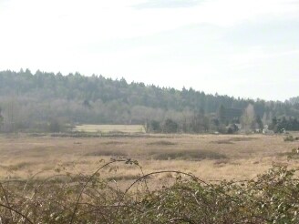
Vacantlandnec
Oregon
EC
1001
B and X Area of moderate flood hazard, usually the area between the limits of the 100-year and 500-year floods.
27.98 AC
2025
Clackamas/Milwaukie
2025
Portland
0232012007
NEARBY LISTINGS FOR SALE OR LEASE
DEMOGRAPHICS near 8560 Se 172Nd Ave
1 mile
3 mile
5 mile
2025 Total Population
2,272
71,496
270,663
2030 Population
2,338
71,562
268,560
Pop Growth 2025-2030
+ 2.90%
+ 0.09%
(0.78%)
Average Age
40
40
40
2025 Total Households
695
23,592
94,644
HH Growth 2025-2030
+ 2.88%
(0.15%)
(1.01%)
Median Household Inc
$114,120
$100,051
$76,409
Avg Household Size
3.10
2.90
2.70
2025 Avg HH Vehicles
3.00
2.00
2.00
Median Home Value
$700,489
$597,291
$475,886
Median Year Built
2001
1992
1983
Nearby Places
Map Layers
Map Styles
 Street
 Aerial
Layers
 Traffic
 Biking
Places
Listings with unknown addresses are not visible on the map
- Restaurants
- Banks
- Shops
- Fitness
- Groceries
PUBLIC TRANSPORTATION
AIRPORT
Portland International
Drive
Walk
Distance
Portland International
25 min
14.3 mi
Freight Ports
Port of Portland
Drive
Walk
Distance
Port of Portland
29 min
17.6 mi
Nearby Properties
Address
Land Use
TOTAL SIZE
Lot Size
Zoning
Address
Land Use
TOTAL SIZE
Lot Size
Zoning
6.92 AC
MCC
Address
Land Use
TOTAL SIZE
Lot Size
Zoning
2,232 SF
15.74 AC
MUC
Address
Land Use
TOTAL SIZE
Lot Size
Zoning
12.06 AC
MCC
Address
Land Use
TOTAL SIZE
Lot Size
Zoning
9 AC
MUE
Address
Land Use
TOTAL SIZE
Lot Size
Zoning
8 AC
MURM1
Address
Land Use
TOTAL SIZE
Lot Size
Zoning
2,089 SF
4.30 AC
MURM2
Address
Land Use
TOTAL SIZE
Lot Size
Zoning
258,564 SF
20.56 AC
LDR7
Address
Land Use
TOTAL SIZE
Lot Size
Zoning
3,342 SF
9.34 AC
MUE
Address
Land Use
TOTAL SIZE
Lot Size
Zoning
238,492 SF
13.10 AC
CMF
Address
Land Use
TOTAL SIZE
Lot Size
Zoning
4.83 AC
MCC
Address
Land Use
TOTAL SIZE
Lot Size
Zoning
5.66 AC
MCC
Address
Land Use
TOTAL SIZE
Lot Size
Zoning
1 AC
MURX
Address
Land Use
TOTAL SIZE
Lot Size
Zoning
5.52 AC
MURM1
Address
Land Use
TOTAL SIZE
Lot Size
Zoning
64,934 SF
9.89 AC
LDR-7
Address
Land Use
TOTAL SIZE
Lot Size
Zoning
199,805 SF
4.96 AC
MDR-24
Address
Land Use
TOTAL SIZE
Lot Size
Zoning
3.15 AC
MURM2
Address
Land Use
TOTAL SIZE
Lot Size
Zoning
1,896 SF
1.96 AC
VO
Address
Land Use
TOTAL SIZE
Lot Size
Zoning
59,786 SF
4.58 AC
LDR-5
Address
Land Use
TOTAL SIZE
Lot Size
Zoning
Address
Land Use
TOTAL SIZE
Lot Size
Zoning
60,530 SF
19.55 AC
LDR
Address
Land Use
TOTAL SIZE
Lot Size
Zoning
Address
Land Use
TOTAL SIZE
Lot Size
Zoning
Address
Land Use
TOTAL SIZE
Lot Size
Zoning
103,090 SF
4.12 AC
CMF
Address
Land Use
TOTAL SIZE
Lot Size
Zoning
86,206 SF
6.66 AC
RM1
Address
Land Use
TOTAL SIZE
Lot Size
Zoning
55,062 SF
2 AC
R5
Address
Land Use
TOTAL SIZE
Lot Size
Zoning
166,296 SF
8.80 AC
RM1
Address
Land Use
TOTAL SIZE
Lot Size
Zoning
121,428 SF
5.81 AC
CMF
Address
Land Use
TOTAL SIZE
Lot Size
Zoning
45,331 SF
5.25 AC
MDR24
Address
Land Use
TOTAL SIZE
Lot Size
Zoning
3,414 SF
6.16 AC
VA
Address
Land Use
TOTAL SIZE
Lot Size
Zoning
2,375 SF
3.32 AC
MUC
The World's #1 Commercial Real Estate Marketplace
Connect with us
© 2026 CoStar Group
The information above has been obtained from sources believed reliable. While we do not doubt its accuracy we have not verified it and make no guarantee, warranty or representation about it. It is your responsibility to independently confirm its accuracy and completeness. Any projections, opinions, assumptions, or estimates used are for example only and do not represent the current or future performance of the property. The value of this transaction to you depends on tax and other factors which should be evaluated by your tax, financial, and legal advisors. You and your advisors should conduct a careful, independent investigation of the property to determine to your satisfaction the suitability of the property for your needs.