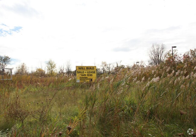
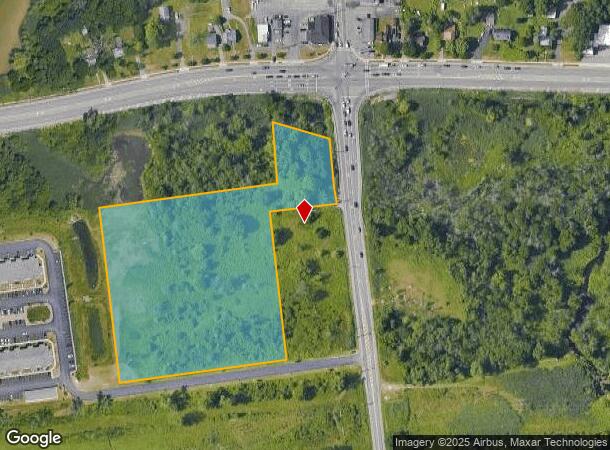
Property Record
8565 Morgan Rd, Clay, NY 13041
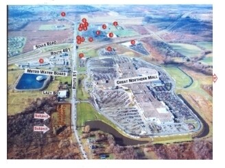
NEARBY LISTINGS FOR SALE OR LEASE
Property Detail
8565 Morgan Rd
Syracuse, NY
DIST 4-MORGAN RD 0550113 44500003020110
312489-055-000-0001-013-001-0000
Onondaga
Commercialacreage
New York
X
13.001
36067C0087F
6.44 AC
2025
NE Outer Onondaga County
2024
Syracuse
011232
DEMOGRAPHICS near 8565 Morgan Rd
1 Mile
3 Mile
5 Mile
2024 Total Population
3,415
23,953
72,835
2029 Population
3,254
23,322
70,968
Pop Growth 2024-2029
(4.71%)
(2.63%)
(2.56%)
Average Age
42
42
42
2024 Total Households
1,311
9,631
29,949
HH Growth 2024-2029
(4.88%)
(2.82%)
(2.73%)
Median Household Inc
$108,363
$83,995
$80,903
Avg Household Size
2.50
2.40
2.40
2024 Avg HH Vehicles
2.00
2.00
2.00
Median Home Value
$214,612
$182,811
$182,895
Median Year Built
1987
1982
1978
Nearby Places
- Restaurants
- Banks
- Shops
- Fitness
- Groceries
PUBLIC TRANSPORTATION
COMMUTER RAIL
Syracuse (Toronto - New York - VIA Rail)
DRIVE
WALK
Distance
Syracuse (Toronto - New York - VIA Rail)
19 min
8.8 mi
AIRPORT
Syracuse Hancock International
DRIVE
WALK
Distance
Syracuse Hancock International
16 min
11.8 mi
Freight Ports
Albany, NY Port
DRIVE
WALK
Distance
Albany, NY Port
180 min
151.8 mi
Nearby Properties
Address
Land Use
TOTAL SIZE
Lot Size
Zoning
Address
Land Use
TOTAL SIZE
Lot Size
Zoning
10,330 SF
241.94 AC
PUD
Address
Land Use
TOTAL SIZE
Lot Size
Zoning
309,390 SF
68.49 AC
05 - COMME
Address
Land Use
TOTAL SIZE
Lot Size
Zoning
6,200 SF
117.28 AC
06 - INDUS
Address
Land Use
TOTAL SIZE
Lot Size
Zoning
Address
Land Use
TOTAL SIZE
Lot Size
Zoning
12,312 SF
40.32 AC
05 - COMME
Address
Land Use
TOTAL SIZE
Lot Size
Zoning
62,496 SF
26.34 AC
04 - FARM
Address
Land Use
TOTAL SIZE
Lot Size
Zoning
4,428 SF
58.31 AC
Address
Land Use
TOTAL SIZE
Lot Size
Zoning
3,776 SF
1.50 AC
MR
Address
Land Use
TOTAL SIZE
Lot Size
Zoning
231.08 AC
R40
Address
Land Use
TOTAL SIZE
Lot Size
Zoning
74,012 SF
58.67 AC
04 - FARM
Address
Land Use
TOTAL SIZE
Lot Size
Zoning
7,350 SF
128.54 AC
02 - SINGL
Address
Land Use
TOTAL SIZE
Lot Size
Zoning
183,715 SF
18.21 AC
05 - COMME
Address
Land Use
TOTAL SIZE
Lot Size
Zoning
75,000 SF
14.90 AC
04
Address
Land Use
TOTAL SIZE
Lot Size
Zoning
28,711 SF
32.84 AC
05 - COMME
Address
Land Use
TOTAL SIZE
Lot Size
Zoning
28,711 SF
32.64 AC
05 - COMME
Address
Land Use
TOTAL SIZE
Lot Size
Zoning
727,525 SF
121.04 AC
05 - COMME
Address
Land Use
TOTAL SIZE
Lot Size
Zoning
151,721 SF
16.70 AC
05 - COMME
Address
Land Use
TOTAL SIZE
Lot Size
Zoning
137,933 SF
14.88 AC
4
Address
Land Use
TOTAL SIZE
Lot Size
Zoning
65.30 AC
R-3
Address
Land Use
TOTAL SIZE
Lot Size
Zoning
125,614 SF
12.17 AC
Address
Land Use
TOTAL SIZE
Lot Size
Zoning
126,105 SF
15.06 AC
05 - COMME
Address
Land Use
TOTAL SIZE
Lot Size
Zoning
12,000 SF
76 AC
04 - FARM
Address
Land Use
TOTAL SIZE
Lot Size
Zoning
135,552 SF
13.87 AC
Address
Land Use
TOTAL SIZE
Lot Size
Zoning
115,660 SF
16.18 AC
05 - COMME
Address
Land Use
TOTAL SIZE
Lot Size
Zoning
39,375 SF
18.02 AC
05 - COMME
Address
Land Use
TOTAL SIZE
Lot Size
Zoning
135,068 SF
48.24 AC
05 - COMME
Address
Land Use
TOTAL SIZE
Lot Size
Zoning
2,160 SF
1.37 AC
C-2
Address
Land Use
TOTAL SIZE
Lot Size
Zoning
2,216 SF
3.39 AC
R-3
Address
Land Use
TOTAL SIZE
Lot Size
Zoning
4,200 SF
1.36 AC
R-3
Address
Land Use
TOTAL SIZE
Lot Size
Zoning
83,963 SF
31.44 AC
07
The World's #1 Commercial Real Estate Marketplace
Connect with us
© 2025 CoStar Group
The information above has been obtained from sources believed reliable. While we do not doubt its accuracy we have not verified it and make no guarantee, warranty or representation about it. It is your responsibility to independently confirm its accuracy and completeness. Any projections, opinions, assumptions, or estimates used are for example only and do not represent the current or future performance of the property. The value of this transaction to you depends on tax and other factors which should be evaluated by your tax, financial, and legal advisors. You and your advisors should conduct a careful, independent investigation of the property to determine to your satisfaction the suitability of the property for your needs.