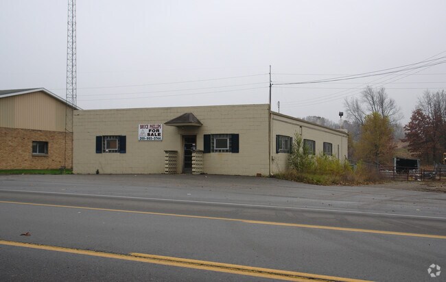
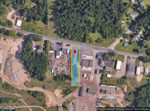
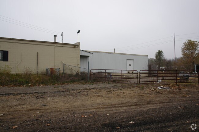
Property Record
8566 Verona Rd, Battle Creek, MI 49014
NEARBY LISTINGS FOR SALE OR LEASE
Property Detail
8566 Verona Rd
Battle Creek, MI
Brownlee Park
10-004-013-01
EMMETT TWP/ T2S R7W, SEC 4: PART NW1/4 NE1/4 COM 273.2 FT E OF N & S 1/4 LINE SD PT BEING ON THE N LINE LOT E, BROWNLEE PARK
Commercialacreage
Calhoun
X
Michigan
26025C0184C
1.04 AC
2024
Battle Crk/W Calhoun Cnty
2025
West Michigan
002100
DEMOGRAPHICS near 8566 Verona Rd
1 Mile
3 Mile
5 Mile
2024 Total Population
1,428
27,746
56,520
2029 Population
1,419
27,511
55,996
Pop Growth 2024-2029
(0.63%)
(0.85%)
(0.93%)
Average Age
41
39
40
2024 Total Households
581
11,251
22,755
HH Growth 2024-2029
(0.52%)
(0.91%)
(0.97%)
Median Household Inc
$58,717
$47,105
$49,966
Avg Household Size
2.40
2.30
2.40
2024 Avg HH Vehicles
2.00
2.00
2.00
Median Home Value
$121,379
$98,799
$113,704
Median Year Built
1960
1955
1956
Nearby Places
Map Layers
Map Styles
 Street
 Aerial
- Restaurants
- Banks
- Shops
- Fitness
- Groceries
PUBLIC TRANSPORTATION
COMMUTER RAIL
Battle Creek (Blue Water - Amtrak, Wolverine - Amtrak)
DRIVE
WALK
Distance
Battle Creek (Blue Water - Amtrak, Wolverine - Amtrak)
7 min
3.7 mi
AIRPORT
Kalamazoo/Battle Creek International
DRIVE
WALK
Distance
Kalamazoo/Battle Creek International
40 min
28.8 mi
Freight Ports
Port of Toledo
DRIVE
WALK
Distance
Port of Toledo
153 min
122.6 mi
Nearby Properties
Address
Land Use
TOTAL SIZE
Lot Size
Zoning
Address
Land Use
TOTAL SIZE
Lot Size
Zoning
1,513,110 SF
108.07 AC
I2
Address
Land Use
TOTAL SIZE
Lot Size
Zoning
337,297 SF
18.85 AC
T4
Address
Land Use
TOTAL SIZE
Lot Size
Zoning
291,206 SF
18.98 AC
T4
Address
Land Use
TOTAL SIZE
Lot Size
Zoning
1,131,895 SF
26.46 AC
I1
Address
Land Use
TOTAL SIZE
Lot Size
Zoning
324,731 SF
69.91 AC
MF
Address
Land Use
TOTAL SIZE
Lot Size
Zoning
174,064 SF
T4
Address
Land Use
TOTAL SIZE
Lot Size
Zoning
52,764 SF
3.52 AC
AG
Address
Land Use
TOTAL SIZE
Lot Size
Zoning
158,786 SF
22.52 AC
HDR
Address
Land Use
TOTAL SIZE
Lot Size
Zoning
129,598 SF
0.62 AC
T5
Address
Land Use
TOTAL SIZE
Lot Size
Zoning
34,452 SF
1.12 AC
T4
Address
Land Use
TOTAL SIZE
Lot Size
Zoning
126,060 SF
15.89 AC
MF
Address
Land Use
TOTAL SIZE
Lot Size
Zoning
49,412 SF
Address
Land Use
TOTAL SIZE
Lot Size
Zoning
52,109 SF
6.46 AC
MFR
Address
Land Use
TOTAL SIZE
Lot Size
Zoning
98,360 SF
0.31 AC
T5
Address
Land Use
TOTAL SIZE
Lot Size
Zoning
82,210 SF
0.29 AC
T5
Address
Land Use
TOTAL SIZE
Lot Size
Zoning
149,939 SF
28.09 AC
I1
Address
Land Use
TOTAL SIZE
Lot Size
Zoning
Address
Land Use
TOTAL SIZE
Lot Size
Zoning
394,832 SF
48.36 AC
I1
Address
Land Use
TOTAL SIZE
Lot Size
Zoning
32,729 SF
3.56 AC
B1
Address
Land Use
TOTAL SIZE
Lot Size
Zoning
60,544 SF
5.96 AC
HDR
Address
Land Use
TOTAL SIZE
Lot Size
Zoning
263,389 SF
13.23 AC
I1
Address
Land Use
TOTAL SIZE
Lot Size
Zoning
141,239 SF
6.90 AC
I1
Address
Land Use
TOTAL SIZE
Lot Size
Zoning
48,192 SF
1.86 AC
T3
Address
Land Use
TOTAL SIZE
Lot Size
Zoning
135,771 SF
8.65 AC
I1
Address
Land Use
TOTAL SIZE
Lot Size
Zoning
78,744 SF
2.57 AC
T4
Address
Land Use
TOTAL SIZE
Lot Size
Zoning
25,200 SF
1.39 AC
MFR
Address
Land Use
TOTAL SIZE
Lot Size
Zoning
31,642 SF
1.38 AC
T4
Address
Land Use
TOTAL SIZE
Lot Size
Zoning
41,795 SF
2.55 AC
MFR
Address
Land Use
TOTAL SIZE
Lot Size
Zoning
14,550 SF
1.10 AC
T3
Address
Land Use
TOTAL SIZE
Lot Size
Zoning
24,036 SF
1.22 AC
T4
The World's #1 Commercial Real Estate Marketplace
Connect with us
© 2025 CoStar Group
The information above has been obtained from sources believed reliable. While we do not doubt its accuracy we have not verified it and make no guarantee, warranty or representation about it. It is your responsibility to independently confirm its accuracy and completeness. Any projections, opinions, assumptions, or estimates used are for example only and do not represent the current or future performance of the property. The value of this transaction to you depends on tax and other factors which should be evaluated by your tax, financial, and legal advisors. You and your advisors should conduct a careful, independent investigation of the property to determine to your satisfaction the suitability of the property for your needs.