Property Record
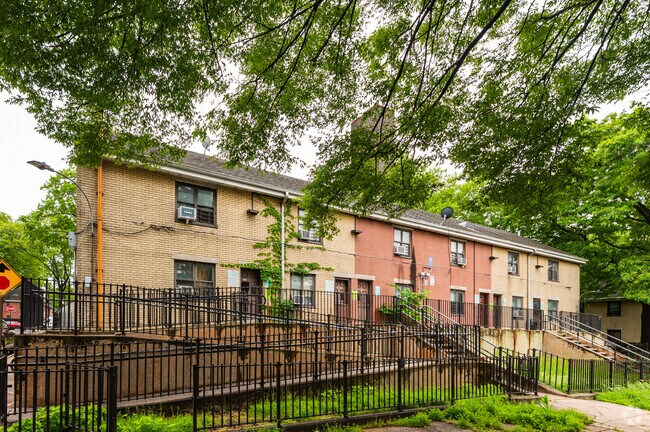
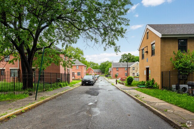
857 Lafayette Ave, Bronx, NY 10472

Property Detail
857 Lafayette Ave
03633-0001
BRONX
Apartment
New York
R6
1
B and X Area of moderate flood hazard, usually the area between the limits of the 100-year and 500-year floods.
11.94 AC
0
Soundview
2025
Westchester/So Connecticut
006800
New York-Jersey City-White Plains, NY-NJ
233,050 SF
NEARBY LISTINGS FOR SALE OR LEASE
DEMOGRAPHICS near 857 Lafayette Ave
1 mile
3 mile
5 mile
2024 Total Population
100,757
793,668
2,297,740
2029 Population
96,280
771,281
2,286,099
Pop Growth 2024-2029
(4.44%)
(2.82%)
(0.51%)
Average Age
38
38
40
2024 Total Households
34,104
271,931
837,715
HH Growth 2024-2029
(4.79%)
(3.36%)
(0.50%)
Median Household Inc
$41,817
$43,067
$53,965
Avg Household Size
2.80
2.70
2.60
2024 Avg HH Vehicles
1.00
.00
.00
Median Home Value
$643,098
$618,807
$619,080
Median Year Built
1956
1956
1953
Nearby Places
Map Layers
Map Styles
 Street
 Aerial
Transit
 Traffic
 Biking
Places
Listings with unknown addresses are not visible on the map
- Restaurants
- Banks
- Shops
- Fitness
- Groceries
PUBLIC TRANSPORTATION
TRANSIT/SUBWAY
Morrison-Sound View Avenues (6 - New York MTA Subway (The Subway))
Drive
Walk
Distance
Morrison-Sound View Avenues (6 - New York MTA Subway (The Subway))
3 min
15 min
0.8 mi
St Lawrence Avenue (6 - New York MTA Subway (The Subway))
Drive
Walk
Distance
St Lawrence Avenue (6 - New York MTA Subway (The Subway))
3 min
17 min
0.9 mi
Elder Avenue (6 - New York MTA Subway (The Subway))
Drive
Walk
Distance
Elder Avenue (6 - New York MTA Subway (The Subway))
4 min
18 min
0.9 mi
COMMUTER RAIL
Tremont Station (Harlem Line - Metro-North Commuter Railroad Company (Metro-North))
Drive
Walk
Distance
Tremont Station (Harlem Line - Metro-North Commuter Railroad Company (Metro-North))
7 min
3.6 mi
Melrose Station (Harlem Line - Metro-North Commuter Railroad Company (Metro-North))
Drive
Walk
Distance
Melrose Station (Harlem Line - Metro-North Commuter Railroad Company (Metro-North))
10 min
3.6 mi
AIRPORT
LaGuardia
Drive
Walk
Distance
LaGuardia
18 min
8.9 mi
John F Kennedy International
Drive
Walk
Distance
John F Kennedy International
26 min
17.4 mi
Newark Liberty International
Drive
Walk
Distance
Newark Liberty International
31 min
25.4 mi
Freight Ports
NY - Red Hook Container Terminal
Drive
Walk
Distance
NY - Red Hook Container Terminal
31 min
17.1 mi
Nearby Properties
Address
Land Use
TOTAL SIZE
Lot Size
Zoning
Address
Land Use
TOTAL SIZE
Lot Size
Zoning
5,519,372 SF
409.21 AC
C8-2
Address
Land Use
TOTAL SIZE
Lot Size
Zoning
550,000 SF
8.75 AC
M1-1
Address
Land Use
TOTAL SIZE
Lot Size
Zoning
1,743,584 SF
77.87 AC
R6
Address
Land Use
TOTAL SIZE
Lot Size
Zoning
1,427,393 SF
39.94 AC
R4
Address
Land Use
TOTAL SIZE
Lot Size
Zoning
1,311,800 SF
9.89 AC
C4-4
Address
Land Use
TOTAL SIZE
Lot Size
Zoning
1,012,000 SF
7.79 AC
R6
Address
Land Use
TOTAL SIZE
Lot Size
Zoning
485,484 SF
39.63 AC
R5
Address
Land Use
TOTAL SIZE
Lot Size
Zoning
667,405 SF
5.51 AC
R6
Address
Land Use
TOTAL SIZE
Lot Size
Zoning
390,750 SF
265 AC
PARK
Address
Land Use
TOTAL SIZE
Lot Size
Zoning
480,769 SF
1.21 AC
R8
Address
Land Use
TOTAL SIZE
Lot Size
Zoning
851,821 SF
7.95 AC
R4
Address
Land Use
TOTAL SIZE
Lot Size
Zoning
426,172 SF
14.30 AC
M3-1
Address
Land Use
TOTAL SIZE
Lot Size
Zoning
491,007 SF
11.85 AC
M3-1
Address
Land Use
TOTAL SIZE
Lot Size
Zoning
566,233 SF
13.25 AC
M3-1
Address
Land Use
TOTAL SIZE
Lot Size
Zoning
291,885 SF
8.86 AC
R8
Address
Land Use
TOTAL SIZE
Lot Size
Zoning
14,681 SF
97 AC
PARK
Address
Land Use
TOTAL SIZE
Lot Size
Zoning
127,000 SF
16.53 AC
M3-1
Address
Land Use
TOTAL SIZE
Lot Size
Zoning
447,145 SF
8.05 AC
M3-1
Address
Land Use
TOTAL SIZE
Lot Size
Zoning
489,326 SF
19.18 AC
C8-1
Address
Land Use
TOTAL SIZE
Lot Size
Zoning
245,002 SF
9.12 AC
C8-3
Address
Land Use
TOTAL SIZE
Lot Size
Zoning
224,037 SF
0.82 AC
C45X
Address
Land Use
TOTAL SIZE
Lot Size
Zoning
238,500 SF
1.13 AC
C4-4
Address
Land Use
TOTAL SIZE
Lot Size
Zoning
361,354 SF
C4-2
Address
Land Use
TOTAL SIZE
Lot Size
Zoning
340,364 SF
4.10 AC
C4-6
Address
Land Use
TOTAL SIZE
Lot Size
Zoning
1,172,005 SF
128.83 AC
M1-1
Address
Land Use
TOTAL SIZE
Lot Size
Zoning
510 SF
68.73 AC
PARK
Address
Land Use
TOTAL SIZE
Lot Size
Zoning
601,260 SF
3.27 AC
R4
Address
Land Use
TOTAL SIZE
Lot Size
Zoning
594,976 SF
1.62 AC
C4-6
Address
Land Use
TOTAL SIZE
Lot Size
Zoning
406,549 SF
3.22 AC
C4-4
Address
Land Use
TOTAL SIZE
Lot Size
Zoning
450,879 SF
9.10 AC
M1-1
The World's #1 Commercial Real Estate Marketplace
Connect with us
© 2026 CoStar Group
The information above has been obtained from sources believed reliable. While we do not doubt its accuracy we have not verified it and make no guarantee, warranty or representation about it. It is your responsibility to independently confirm its accuracy and completeness. Any projections, opinions, assumptions, or estimates used are for example only and do not represent the current or future performance of the property. The value of this transaction to you depends on tax and other factors which should be evaluated by your tax, financial, and legal advisors. You and your advisors should conduct a careful, independent investigation of the property to determine to your satisfaction the suitability of the property for your needs.