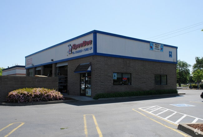
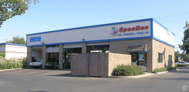
Property Record
8573 Elk Grove Blvd, Elk Grove, CA 95624
NEARBY LISTINGS FOR SALE OR LEASE
Property Detail
8573 Elk Grove Blvd
Sacramento--Roseville--Arden-Arcade, CA
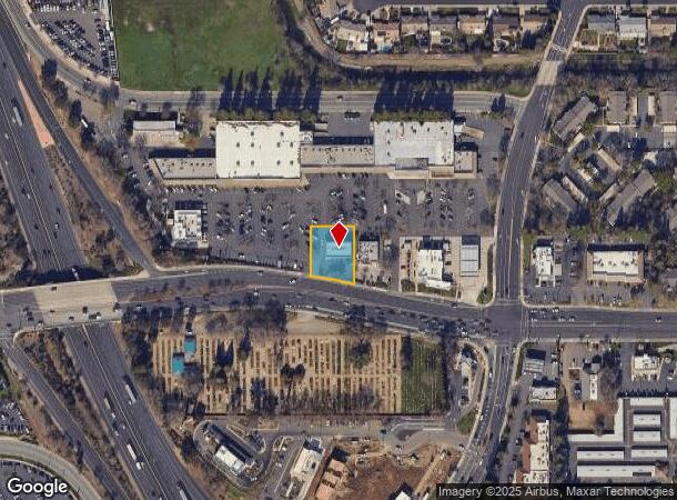
Parcel Map
125-0390-014
PARCEL MAP, LOT 7
Autorepair
Sacramento
AE
California
06067C0317H
7
2024
0.40 AC
2025
Elk Grove
009308
Sacramento
3,895 SF
DEMOGRAPHICS near 8573 Elk Grove Blvd
1 Mile
3 Mile
5 Mile
2024 Total Population
15,702
124,589
258,700
2029 Population
15,728
125,959
260,563
Pop Growth 2024-2029
+ 0.17%
+ 1.10%
+ 0.72%
Average Age
40
39
38
2024 Total Households
5,301
38,464
78,474
HH Growth 2024-2029
+ 0.11%
+ 1.06%
+ 0.68%
Median Household Inc
$102,081
$107,318
$101,529
Avg Household Size
2.90
3.20
3.20
2024 Avg HH Vehicles
2.00
2.00
2.00
Median Home Value
$497,134
$551,987
$494,172
Median Year Built
1985
2000
1997
Nearby Places
Map Layers
Map Styles
 Street
 Aerial
- Restaurants
- Banks
- Shops
- Fitness
- Groceries
PUBLIC TRANSPORTATION
AIRPORT
Sacramento International
DRIVE
WALK
Distance
Sacramento International
34 min
25.6 mi
Freight Ports
Port of Stockton
DRIVE
WALK
Distance
Port of Stockton
49 min
38.4 mi
SALE & LEASE HISTORY
LISTING DATE
SALE/LEASE

Sep 23, 2016
For Sale
Nearby Properties
Address
Land Use
TOTAL SIZE
Lot Size
Zoning
Address
Land Use
TOTAL SIZE
Lot Size
Zoning
43.54 AC
LI
Address
Land Use
TOTAL SIZE
Lot Size
Zoning
268,881 SF
12.25 AC
RD-20
Address
Land Use
TOTAL SIZE
Lot Size
Zoning
7.65 AC
RD-20
Address
Land Use
TOTAL SIZE
Lot Size
Zoning
10.35 AC
SC
Address
Land Use
TOTAL SIZE
Lot Size
Zoning
43.06 AC
LRSPA
Address
Land Use
TOTAL SIZE
Lot Size
Zoning
Address
Land Use
TOTAL SIZE
Lot Size
Zoning
433,006 SF
4.55 AC
R-2B C-2-R
Address
Land Use
TOTAL SIZE
Lot Size
Zoning
221,556 SF
20.10 AC
HI
Address
Land Use
TOTAL SIZE
Lot Size
Zoning
4.98 AC
RD-20
Address
Land Use
TOTAL SIZE
Lot Size
Zoning
102,085 SF
10.26 AC
BP
Address
Land Use
TOTAL SIZE
Lot Size
Zoning
147,920 SF
18.20 AC
SC
Address
Land Use
TOTAL SIZE
Lot Size
Zoning
152,217 SF
17.42 AC
SC
Address
Land Use
TOTAL SIZE
Lot Size
Zoning
9.02 AC
SPASEPA
Address
Land Use
TOTAL SIZE
Lot Size
Zoning
433,006 SF
8.70 AC
R-2B C-2-R
Address
Land Use
TOTAL SIZE
Lot Size
Zoning
64,579 SF
5.41 AC
LRSPA
Address
Land Use
TOTAL SIZE
Lot Size
Zoning
242,577 SF
0.10 AC
RD-20
Address
Land Use
TOTAL SIZE
Lot Size
Zoning
105,511 SF
4.79 AC
BP
Address
Land Use
TOTAL SIZE
Lot Size
Zoning
105,511 SF
6.67 AC
BP
Address
Land Use
TOTAL SIZE
Lot Size
Zoning
111,489 SF
4.96 AC
MP
Address
Land Use
TOTAL SIZE
Lot Size
Zoning
195,101 SF
12.21 AC
BP
Address
Land Use
TOTAL SIZE
Lot Size
Zoning
92,120 SF
6.91 AC
GC
Address
Land Use
TOTAL SIZE
Lot Size
Zoning
76,090 SF
3.32 AC
RD-25
Address
Land Use
TOTAL SIZE
Lot Size
Zoning
148,007 SF
9.09 AC
RD-20
Address
Land Use
TOTAL SIZE
Lot Size
Zoning
108,843 SF
4.14 AC
RD-30
Address
Land Use
TOTAL SIZE
Lot Size
Zoning
185,300 SF
11.63 AC
RD-20
Address
Land Use
TOTAL SIZE
Lot Size
Zoning
3.88 AC
RD-20
Address
Land Use
TOTAL SIZE
Lot Size
Zoning
182,916 SF
10.66 AC
RD-20
Address
Land Use
TOTAL SIZE
Lot Size
Zoning
83,274 SF
9.14 AC
SC
Address
Land Use
TOTAL SIZE
Lot Size
Zoning
221,954 SF
7.71 AC
RD-15
Address
Land Use
TOTAL SIZE
Lot Size
Zoning
433,006 SF
4.13 AC
R-2B
The World's #1 Commercial Real Estate Marketplace
Connect with us
© 2025 CoStar Group
The information above has been obtained from sources believed reliable. While we do not doubt its accuracy we have not verified it and make no guarantee, warranty or representation about it. It is your responsibility to independently confirm its accuracy and completeness. Any projections, opinions, assumptions, or estimates used are for example only and do not represent the current or future performance of the property. The value of this transaction to you depends on tax and other factors which should be evaluated by your tax, financial, and legal advisors. You and your advisors should conduct a careful, independent investigation of the property to determine to your satisfaction the suitability of the property for your needs.