Property Record
8577 Tellers Rd, Chaska, MN 55318
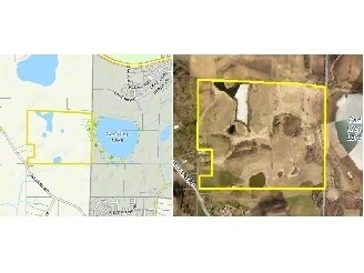

Property Detail
8577 Tellers Rd
Minneapolis-St. Paul-Bloomington, MN-WI
COMM AT A PT 16 CH W & 8.74 CH S OF CENTER OF SECT 15 BEING IN THE S LINE OF R-O-W OF RR &
07.0150910
CARVER
Agriculturalland
Minnesota
A Areas with a 1% annual chance of flooding and a 26% chance of flooding over the life of a 30-year mortgage.
120.40 AC
2025
Carver County Outlying
2025
Minneapolis/St Paul
090801
NEARBY LISTINGS FOR SALE OR LEASE
-
-
View all Chaska listings for sale on LoopNet.com
DEMOGRAPHICS near 8577 Tellers Rd
1 mile
3 mile
5 mile
2025 Total Population
1,983
13,795
47,040
2030 Population
2,055
14,552
48,931
Pop Growth 2025-2030
+ 3.63%
+ 5.49%
+ 4.02%
Average Age
35
39
39
2025 Total Households
559
4,555
16,605
HH Growth 2025-2030
+ 3.94%
+ 5.82%
+ 4.18%
Median Household Inc
$199,166
$191,539
$144,494
Avg Household Size
3.40
2.90
2.80
2025 Avg HH Vehicles
3.00
2.00
2.00
Median Home Value
$680,555
$644,198
$527,275
Median Year Built
2010
2008
2001
Nearby Places
Map Layers
Map Styles
 Street
 Aerial
Transit
 Traffic
 Biking
Places
Listings with unknown addresses are not visible on the map
- Restaurants
- Banks
- Shops
- Fitness
- Groceries
PUBLIC TRANSPORTATION
AIRPORT
Minneapolis-St Paul International/Wold-Chamberlain
Drive
Walk
Distance
Minneapolis-St Paul International/Wold-Chamberlain
42 min
27.7 mi
Freight Ports
Port Milwaukee
Drive
Walk
Distance
Port Milwaukee
410 min
364.8 mi
Nearby Properties
Address
Land Use
TOTAL SIZE
Lot Size
Zoning
Address
Land Use
TOTAL SIZE
Lot Size
Zoning
68.10 AC
Address
Land Use
TOTAL SIZE
Lot Size
Zoning
2.56 AC
Address
Land Use
TOTAL SIZE
Lot Size
Zoning
28,515 SF
9.72 AC
Address
Land Use
TOTAL SIZE
Lot Size
Zoning
Address
Land Use
TOTAL SIZE
Lot Size
Zoning
82,311 SF
2.03 AC
Address
Land Use
TOTAL SIZE
Lot Size
Zoning
4.32 AC
Address
Land Use
TOTAL SIZE
Lot Size
Zoning
2,064 SF
594 AC
Address
Land Use
TOTAL SIZE
Lot Size
Zoning
638.55 AC
Address
Land Use
TOTAL SIZE
Lot Size
Zoning
Address
Land Use
TOTAL SIZE
Lot Size
Zoning
105 SF
219.54 AC
Address
Land Use
TOTAL SIZE
Lot Size
Zoning
208.99 AC
Address
Land Use
TOTAL SIZE
Lot Size
Zoning
20.51 AC
Address
Land Use
TOTAL SIZE
Lot Size
Zoning
6,660 SF
1.49 AC
Address
Land Use
TOTAL SIZE
Lot Size
Zoning
27,060 SF
4.70 AC
Address
Land Use
TOTAL SIZE
Lot Size
Zoning
34.90 AC
Address
Land Use
TOTAL SIZE
Lot Size
Zoning
29,243 SF
1.37 AC
Address
Land Use
TOTAL SIZE
Lot Size
Zoning
2.66 AC
Address
Land Use
TOTAL SIZE
Lot Size
Zoning
183.30 AC
Address
Land Use
TOTAL SIZE
Lot Size
Zoning
7,141 SF
120.06 AC
Address
Land Use
TOTAL SIZE
Lot Size
Zoning
Address
Land Use
TOTAL SIZE
Lot Size
Zoning
8,351 SF
2.07 AC
Address
Land Use
TOTAL SIZE
Lot Size
Zoning
8,208 SF
0.12 AC
Address
Land Use
TOTAL SIZE
Lot Size
Zoning
10,080 SF
2 AC
Address
Land Use
TOTAL SIZE
Lot Size
Zoning
2,880 SF
0.55 AC
Address
Land Use
TOTAL SIZE
Lot Size
Zoning
85.06 AC
Address
Land Use
TOTAL SIZE
Lot Size
Zoning
6,954 SF
45.84 AC
Address
Land Use
TOTAL SIZE
Lot Size
Zoning
4,524 SF
0.86 AC
Address
Land Use
TOTAL SIZE
Lot Size
Zoning
7,200 SF
1.57 AC
The World's #1 Commercial Real Estate Marketplace
Connect with us
© 2026 CoStar Group
The information above has been obtained from sources believed reliable. While we do not doubt its accuracy we have not verified it and make no guarantee, warranty or representation about it. It is your responsibility to independently confirm its accuracy and completeness. Any projections, opinions, assumptions, or estimates used are for example only and do not represent the current or future performance of the property. The value of this transaction to you depends on tax and other factors which should be evaluated by your tax, financial, and legal advisors. You and your advisors should conduct a careful, independent investigation of the property to determine to your satisfaction the suitability of the property for your needs.