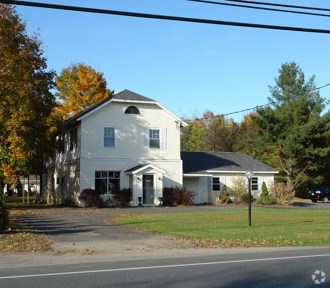
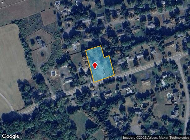
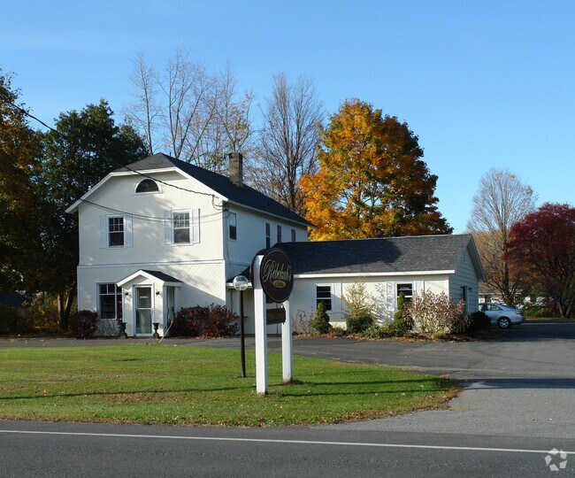
Property Record
86 Broad St, Kinderhook, NY 12106
NEARBY LISTINGS FOR SALE OR LEASE
-
-
View all Kinderhook listings for sale on LoopNet.com
Property Detail
86 Broad St
Hudson, NY
Columbia
104401-053-007-0001-057-000-0000
New York
Commercialofficeresidentialmixeduse
57.000
2025
1.30 AC
2024
Columbia County
000401
Albany/Schenectady/Troy
3,060 SF
DEMOGRAPHICS near 86 Broad St
1 Mile
3 Mile
5 Mile
2024 Total Population
877
4,930
11,608
2029 Population
847
4,794
11,381
Pop Growth 2024-2029
(3.42%)
(2.76%)
(1.96%)
Average Age
48
46
45
2024 Total Households
401
2,035
4,776
HH Growth 2024-2029
(3.24%)
(2.90%)
(2.03%)
Median Household Inc
$77,885
$80,334
$80,697
Avg Household Size
2.20
2.30
2.30
2024 Avg HH Vehicles
2.00
2.00
2.00
Median Home Value
$278,504
$266,854
$267,041
Median Year Built
1949
1963
1967
Nearby Places
- Restaurants
- Banks
- Shops
- Fitness
- Groceries
PUBLIC TRANSPORTATION
AIRPORT
Albany International
DRIVE
WALK
Distance
Albany International
47 min
30.7 mi
Freight Ports
Albany, NY Port
DRIVE
WALK
Distance
Albany, NY Port
35 min
23.8 mi
Nearby Properties
Address
Land Use
TOTAL SIZE
Lot Size
Zoning
Address
Land Use
TOTAL SIZE
Lot Size
Zoning
8,700 SF
98.04 AC
02 - SINGL
Address
Land Use
TOTAL SIZE
Lot Size
Zoning
72,355 SF
15.71 AC
05 - COMME
Address
Land Use
TOTAL SIZE
Lot Size
Zoning
32,010 SF
3.75 AC
05 - COMME
Address
Land Use
TOTAL SIZE
Lot Size
Zoning
4,100 SF
13.90 AC
08 - GOVER
Address
Land Use
TOTAL SIZE
Lot Size
Zoning
20,297 SF
6.60 AC
07 - MIXED
Address
Land Use
TOTAL SIZE
Lot Size
Zoning
1,452 SF
39.10 AC
07 - MIXED
Address
Land Use
TOTAL SIZE
Lot Size
Zoning
4,160 SF
196.57 AC
02 - SINGL
Address
Land Use
TOTAL SIZE
Lot Size
Zoning
26,000 SF
2.28 AC
03 - MULTI
Address
Land Use
TOTAL SIZE
Lot Size
Zoning
12,306 SF
2.60 AC
07 - MIXED
Address
Land Use
TOTAL SIZE
Lot Size
Zoning
1,200 SF
50.48 AC
07 - MIXED
Address
Land Use
TOTAL SIZE
Lot Size
Zoning
9,460 SF
155 AC
07 - MIXED
Address
Land Use
TOTAL SIZE
Lot Size
Zoning
9,110 SF
2.40 AC
07 - MIXED
Address
Land Use
TOTAL SIZE
Lot Size
Zoning
10,775 SF
3.50 AC
05 - COMME
Address
Land Use
TOTAL SIZE
Lot Size
Zoning
6,152 SF
66.68 AC
02 - SINGL
Address
Land Use
TOTAL SIZE
Lot Size
Zoning
46,650 SF
1.40 AC
05 - COMME
Address
Land Use
TOTAL SIZE
Lot Size
Zoning
Address
Land Use
TOTAL SIZE
Lot Size
Zoning
Address
Land Use
TOTAL SIZE
Lot Size
Zoning
5,216 SF
39.30 AC
02 - SINGL
Address
Land Use
TOTAL SIZE
Lot Size
Zoning
21,996 SF
4.30 AC
07 - MIXED
Address
Land Use
TOTAL SIZE
Lot Size
Zoning
25,196 SF
21.70 AC
07 - MIXED
Address
Land Use
TOTAL SIZE
Lot Size
Zoning
8,112 SF
60 AC
05 - COMME
Address
Land Use
TOTAL SIZE
Lot Size
Zoning
1,008 SF
10.50 AC
05 - COMME
Address
Land Use
TOTAL SIZE
Lot Size
Zoning
38 AC
07 - MIXED
Address
Land Use
TOTAL SIZE
Lot Size
Zoning
5,896 SF
6.90 AC
07 - MIXED
Address
Land Use
TOTAL SIZE
Lot Size
Zoning
Address
Land Use
TOTAL SIZE
Lot Size
Zoning
Address
Land Use
TOTAL SIZE
Lot Size
Zoning
4,000 SF
91.10 AC
RA1
Address
Land Use
TOTAL SIZE
Lot Size
Zoning
6,840 SF
8.34 AC
05 - COMME
Address
Land Use
TOTAL SIZE
Lot Size
Zoning
Address
Land Use
TOTAL SIZE
Lot Size
Zoning
The World's #1 Commercial Real Estate Marketplace
Connect with us
© 2025 CoStar Group
The information above has been obtained from sources believed reliable. While we do not doubt its accuracy we have not verified it and make no guarantee, warranty or representation about it. It is your responsibility to independently confirm its accuracy and completeness. Any projections, opinions, assumptions, or estimates used are for example only and do not represent the current or future performance of the property. The value of this transaction to you depends on tax and other factors which should be evaluated by your tax, financial, and legal advisors. You and your advisors should conduct a careful, independent investigation of the property to determine to your satisfaction the suitability of the property for your needs.