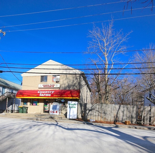
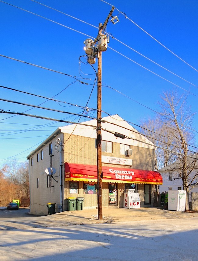
Property Record
86 Mapleville Main St, Mapleville, RI 02839

Property Detail
86 Mapleville Main St
BURR-000214-000000-000067
Providence
Commercialofficeresidentialmixeduse
Rhode Island
R20
67
B and X Area of moderate flood hazard, usually the area between the limits of the 100-year and 500-year floods.
0.15 AC
2025
Burrillville/Glocester
2025
Providence
013002
Providence-Warwick, RI-MA
2,944 SF
NEARBY LISTINGS FOR SALE OR LEASE
DEMOGRAPHICS near 86 Mapleville Main St
1 mile
3 mile
5 mile
2025 Total Population
2,298
12,432
28,601
2030 Population
2,410
13,015
29,969
Pop Growth 2025-2030
+ 4.87%
+ 4.69%
+ 4.78%
Average Age
44
43
43
2025 Total Households
896
4,890
10,956
HH Growth 2025-2030
+ 4.80%
+ 4.70%
+ 4.81%
Median Household Inc
$113,121
$106,789
$109,646
Avg Household Size
2.60
2.50
2.50
2025 Avg HH Vehicles
2.00
2.00
2.00
Median Home Value
$375,402
$411,511
$433,032
Median Year Built
1974
1970
1972
Nearby Places
Map Layers
Map Styles
 Street
 Aerial
Layers
 Traffic
 Biking
Places
Listings with unknown addresses are not visible on the map
- Restaurants
- Banks
- Shops
- Fitness
- Groceries
PUBLIC TRANSPORTATION
AIRPORT
Rhode Island Tf Green International
Drive
Walk
Distance
Rhode Island Tf Green International
43 min
26.0 mi
Worcester Regional
Drive
Walk
Distance
Worcester Regional
51 min
33.5 mi
Freight Ports
Port of Davisville, RI
Drive
Walk
Distance
Port of Davisville, RI
53 min
35.3 mi
SALE & LEASE HISTORY
LISTING DATE
SALE/LEASE

Jul 09, 2021
For Sale
Dec 28, 2016
For Sale
Nearby Properties
Address
Land Use
TOTAL SIZE
Lot Size
Zoning
Address
Land Use
TOTAL SIZE
Lot Size
Zoning
64.77 AC
GI
Address
Land Use
TOTAL SIZE
Lot Size
Zoning
10.43 AC
R20
Address
Land Use
TOTAL SIZE
Lot Size
Zoning
192.38 AC
R20
Address
Land Use
TOTAL SIZE
Lot Size
Zoning
28.39 AC
F5
Address
Land Use
TOTAL SIZE
Lot Size
Zoning
85,200 SF
3.86 AC
VC
Address
Land Use
TOTAL SIZE
Lot Size
Zoning
42,504 SF
10.35 AC
R40
Address
Land Use
TOTAL SIZE
Lot Size
Zoning
151,584 SF
7.61 AC
GI
Address
Land Use
TOTAL SIZE
Lot Size
Zoning
173.57 AC
20
Address
Land Use
TOTAL SIZE
Lot Size
Zoning
66,069 SF
2.28 AC
VCVP
Address
Land Use
TOTAL SIZE
Lot Size
Zoning
44.50 AC
F5
Address
Land Use
TOTAL SIZE
Lot Size
Zoning
23,937 SF
2.34 AC
VCVP
Address
Land Use
TOTAL SIZE
Lot Size
Zoning
5,011 SF
6.98 AC
R12
Address
Land Use
TOTAL SIZE
Lot Size
Zoning
48,902 SF
4.35 AC
VCVP
Address
Land Use
TOTAL SIZE
Lot Size
Zoning
44.16 AC
GI
Address
Land Use
TOTAL SIZE
Lot Size
Zoning
43,999 SF
7.79 AC
GI
Address
Land Use
TOTAL SIZE
Lot Size
Zoning
1,293.70 AC
OS
Address
Land Use
TOTAL SIZE
Lot Size
Zoning
14,239 SF
186.15 AC
R40
Address
Land Use
TOTAL SIZE
Lot Size
Zoning
41,420 SF
2.90 AC
R12
Address
Land Use
TOTAL SIZE
Lot Size
Zoning
40,110 SF
6.49 AC
VC
Address
Land Use
TOTAL SIZE
Lot Size
Zoning
29,668 SF
1.18 AC
GI
Address
Land Use
TOTAL SIZE
Lot Size
Zoning
52,200 SF
3.44 AC
GI
Address
Land Use
TOTAL SIZE
Lot Size
Zoning
6.93 AC
GC
Address
Land Use
TOTAL SIZE
Lot Size
Zoning
0.97 AC
R12
Address
Land Use
TOTAL SIZE
Lot Size
Zoning
40,767 SF
32.40 AC
R40
Address
Land Use
TOTAL SIZE
Lot Size
Zoning
68.30 AC
GI
Address
Land Use
TOTAL SIZE
Lot Size
Zoning
8.76 AC
80
Address
Land Use
TOTAL SIZE
Lot Size
Zoning
8.24 AC
F5
Address
Land Use
TOTAL SIZE
Lot Size
Zoning
10.22 AC
1
Address
Land Use
TOTAL SIZE
Lot Size
Zoning
26,354 SF
6.89 AC
VC
Address
Land Use
TOTAL SIZE
Lot Size
Zoning
31,659 SF
21.32 AC
GI
The World's #1 Commercial Real Estate Marketplace
Connect with us
© 2026 CoStar Group
The information above has been obtained from sources believed reliable. While we do not doubt its accuracy we have not verified it and make no guarantee, warranty or representation about it. It is your responsibility to independently confirm its accuracy and completeness. Any projections, opinions, assumptions, or estimates used are for example only and do not represent the current or future performance of the property. The value of this transaction to you depends on tax and other factors which should be evaluated by your tax, financial, and legal advisors. You and your advisors should conduct a careful, independent investigation of the property to determine to your satisfaction the suitability of the property for your needs.