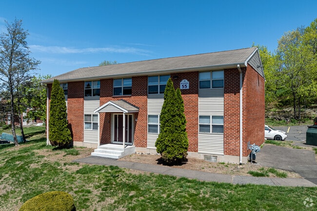
Property Record
86 Stonefield Dr, Waterbury, CT 06705
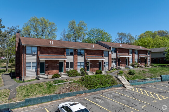
NEARBY LISTINGS FOR SALE OR LEASE
Property Detail
86 Stonefield Dr
WATE-000447-000141-000031
New Haven
Apartmenthouse100plusunits
Connecticut
X
31
09009C0136H
8.80 AC
2024
Waterbury
2025
Westchester/So Connecticut
352800
New Haven-Milford, CT
DEMOGRAPHICS near 86 Stonefield Dr
1 Mile
3 Mile
5 Mile
2024 Total Population
9,178
66,290
159,511
2029 Population
9,133
66,044
158,821
Pop Growth 2024-2029
(0.49%)
(0.37%)
(0.43%)
Average Age
40
39
39
2024 Total Households
3,788
25,717
61,603
HH Growth 2024-2029
(0.53%)
(0.38%)
(0.46%)
Median Household Inc
$69,309
$53,478
$61,634
Avg Household Size
2.30
2.50
2.50
2024 Avg HH Vehicles
1.00
1.00
2.00
Median Home Value
$183,480
$183,824
$200,491
Median Year Built
1969
1959
1962
Nearby Places
Map Layers
Map Styles
 Street
 Aerial
- Restaurants
- Banks
- Shops
- Fitness
- Groceries
PUBLIC TRANSPORTATION
COMMUTER RAIL
Waterbury Station (New Haven Line - Metro-North Commuter Railroad Company (Metro-North))
DRIVE
WALK
Distance
Waterbury Station (New Haven Line - Metro-North Commuter Railroad Company (Metro-North))
8 min
3.8 mi
Naugatuck Station (New Haven Line - Metro-North Commuter Railroad Company (Metro-North))
DRIVE
WALK
Distance
Naugatuck Station (New Haven Line - Metro-North Commuter Railroad Company (Metro-North))
11 min
6.4 mi
AIRPORT
Tweed/New Haven
DRIVE
WALK
Distance
Tweed/New Haven
41 min
26.1 mi
Freight Ports
Port of New Haven
DRIVE
WALK
Distance
Port of New Haven
36 min
21.1 mi
Nearby Properties
Address
Land Use
TOTAL SIZE
Lot Size
Zoning
Address
Land Use
TOTAL SIZE
Lot Size
Zoning
77.50 AC
RS
Address
Land Use
TOTAL SIZE
Lot Size
Zoning
195,000 SF
1.41 AC
CBD
Address
Land Use
TOTAL SIZE
Lot Size
Zoning
29.92 AC
IG
Address
Land Use
TOTAL SIZE
Lot Size
Zoning
88,350 SF
9.50 AC
RS
Address
Land Use
TOTAL SIZE
Lot Size
Zoning
118,884 SF
13.40 AC
RL
Address
Land Use
TOTAL SIZE
Lot Size
Zoning
103,254 SF
2.03 AC
CBD
Address
Land Use
TOTAL SIZE
Lot Size
Zoning
97,386 SF
53.20 AC
RS
Address
Land Use
TOTAL SIZE
Lot Size
Zoning
44.31 AC
CA
Address
Land Use
TOTAL SIZE
Lot Size
Zoning
45,605 SF
2.48 AC
RH
Address
Land Use
TOTAL SIZE
Lot Size
Zoning
95,000 SF
9.30 AC
RM
Address
Land Use
TOTAL SIZE
Lot Size
Zoning
5.13 AC
RM
Address
Land Use
TOTAL SIZE
Lot Size
Zoning
19.24 AC
CA
Address
Land Use
TOTAL SIZE
Lot Size
Zoning
35,860 SF
1.29 AC
CBD
Address
Land Use
TOTAL SIZE
Lot Size
Zoning
12.49 AC
CA
Address
Land Use
TOTAL SIZE
Lot Size
Zoning
31.75 AC
CA
Address
Land Use
TOTAL SIZE
Lot Size
Zoning
18.01 AC
CA
Address
Land Use
TOTAL SIZE
Lot Size
Zoning
10.51 AC
RL
Address
Land Use
TOTAL SIZE
Lot Size
Zoning
91,324 SF
22.27 AC
RM
Address
Land Use
TOTAL SIZE
Lot Size
Zoning
25,474 SF
20.35 AC
RM
Address
Land Use
TOTAL SIZE
Lot Size
Zoning
25,844 SF
22.20 AC
R-80
Address
Land Use
TOTAL SIZE
Lot Size
Zoning
15.39 AC
RM
Address
Land Use
TOTAL SIZE
Lot Size
Zoning
167,266 SF
1.85 AC
CBD
Address
Land Use
TOTAL SIZE
Lot Size
Zoning
1.30 AC
CBD
Address
Land Use
TOTAL SIZE
Lot Size
Zoning
152,704 SF
17.09 AC
CA
Address
Land Use
TOTAL SIZE
Lot Size
Zoning
1.02 AC
CBD
Address
Land Use
TOTAL SIZE
Lot Size
Zoning
81,501 SF
19 AC
R-30
Address
Land Use
TOTAL SIZE
Lot Size
Zoning
5.10 AC
RM
Address
Land Use
TOTAL SIZE
Lot Size
Zoning
95,030 SF
14.30 AC
RA-1
Address
Land Use
TOTAL SIZE
Lot Size
Zoning
115,996 SF
19.57 AC
CA
Address
Land Use
TOTAL SIZE
Lot Size
Zoning
336,560 SF
0.85 AC
CBD
The World's #1 Commercial Real Estate Marketplace
Connect with us
© 2025 CoStar Group
The information above has been obtained from sources believed reliable. While we do not doubt its accuracy we have not verified it and make no guarantee, warranty or representation about it. It is your responsibility to independently confirm its accuracy and completeness. Any projections, opinions, assumptions, or estimates used are for example only and do not represent the current or future performance of the property. The value of this transaction to you depends on tax and other factors which should be evaluated by your tax, financial, and legal advisors. You and your advisors should conduct a careful, independent investigation of the property to determine to your satisfaction the suitability of the property for your needs.