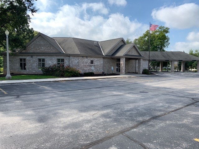
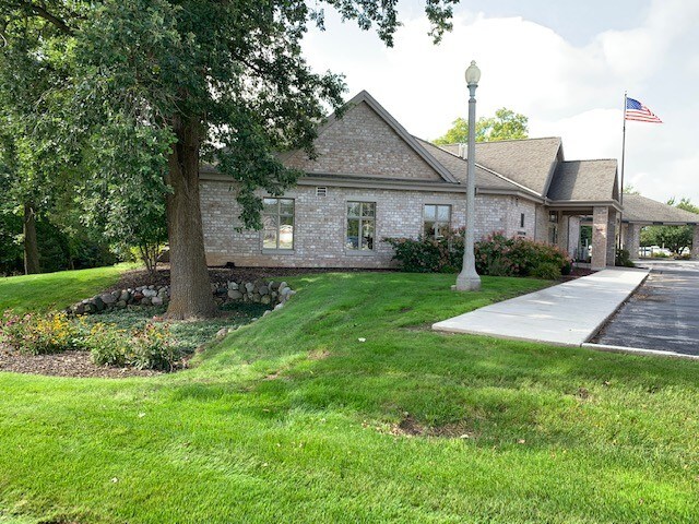
Property Record
860 N Rapids Rd, Manitowoc, WI 54220

Property Detail
860 N Rapids Rd
052-823-104-040.00
TR 1.1.1 OF CSM V26 P99 & THAT PART OF TR 3.1 OF CSM V24 P321 WHICH IS NOT PART OF TR 3.1.1 OF CSM V26 P99 LOCATED IN THE SE1/4 OF THE NE 1/4 OF SEC 23-19-23
Commercialnec
Manitowoc
B and X Area of moderate flood hazard, usually the area between the limits of the 100-year and 500-year floods.
Wisconsin
2025
3.57 AC
2025
Wisconsin South Area
000300
Other Market Areas
22,454 SF
Manitowoc, WI
NEARBY LISTINGS FOR SALE OR LEASE
DEMOGRAPHICS near 860 N Rapids Rd
1 mile
3 mile
5 mile
2025 Total Population
3,821
32,093
38,963
2030 Population
3,806
31,982
38,883
Pop Growth 2025-2030
(0.39%)
(0.35%)
(0.21%)
Average Age
46
43
44
2025 Total Households
1,609
13,971
17,041
HH Growth 2025-2030
(0.37%)
(0.36%)
(0.21%)
Median Household Inc
$82,106
$60,402
$62,855
Avg Household Size
2.30
2.20
2.20
2025 Avg HH Vehicles
2.00
2.00
2.00
Median Home Value
$228,892
$172,397
$179,894
Median Year Built
1976
1957
1961
Nearby Places
Map Layers
Map Styles
 Street
 Aerial
Layers
 Traffic
 Biking
Places
Listings with unknown addresses are not visible on the map
- Restaurants
- Banks
- Shops
- Fitness
- Groceries
SALE & LEASE HISTORY
LISTING DATE
SALE/LEASE

Oct 29, 2018
For Lease
Oct 22, 2018
For Lease
Mar 19, 2018
For Sale
Jan 31, 2019
For Lease
Nearby Properties
Address
Land Use
TOTAL SIZE
Lot Size
Zoning
Address
Land Use
TOTAL SIZE
Lot Size
Zoning
159,900 SF
35.31 AC
Address
Land Use
TOTAL SIZE
Lot Size
Zoning
36.16 AC
Address
Land Use
TOTAL SIZE
Lot Size
Zoning
74,004 SF
12.64 AC
Address
Land Use
TOTAL SIZE
Lot Size
Zoning
140,000 SF
5.63 AC
Address
Land Use
TOTAL SIZE
Lot Size
Zoning
45,901 SF
9.26 AC
Address
Land Use
TOTAL SIZE
Lot Size
Zoning
49.62 AC
Address
Land Use
TOTAL SIZE
Lot Size
Zoning
176,600 SF
18.79 AC
Address
Land Use
TOTAL SIZE
Lot Size
Zoning
12.50 AC
Address
Land Use
TOTAL SIZE
Lot Size
Zoning
15,775 SF
1.64 AC
Address
Land Use
TOTAL SIZE
Lot Size
Zoning
202,432 SF
20.27 AC
Address
Land Use
TOTAL SIZE
Lot Size
Zoning
66,328 SF
6.09 AC
Address
Land Use
TOTAL SIZE
Lot Size
Zoning
160,600 SF
20.73 AC
Address
Land Use
TOTAL SIZE
Lot Size
Zoning
10.25 AC
Address
Land Use
TOTAL SIZE
Lot Size
Zoning
108,212 SF
12.56 AC
Address
Land Use
TOTAL SIZE
Lot Size
Zoning
15.62 AC
Address
Land Use
TOTAL SIZE
Lot Size
Zoning
21.54 AC
Address
Land Use
TOTAL SIZE
Lot Size
Zoning
21.54 AC
Address
Land Use
TOTAL SIZE
Lot Size
Zoning
29.89 AC
Address
Land Use
TOTAL SIZE
Lot Size
Zoning
150,045 SF
10.42 AC
Address
Land Use
TOTAL SIZE
Lot Size
Zoning
677,161 SF
9.15 AC
Address
Land Use
TOTAL SIZE
Lot Size
Zoning
76,362 SF
7.83 AC
Address
Land Use
TOTAL SIZE
Lot Size
Zoning
187,990 SF
12.45 AC
Address
Land Use
TOTAL SIZE
Lot Size
Zoning
22.60 AC
Address
Land Use
TOTAL SIZE
Lot Size
Zoning
17.41 AC
Address
Land Use
TOTAL SIZE
Lot Size
Zoning
7.08 AC
Address
Land Use
TOTAL SIZE
Lot Size
Zoning
19.50 AC
Address
Land Use
TOTAL SIZE
Lot Size
Zoning
89,924 SF
7.11 AC
Address
Land Use
TOTAL SIZE
Lot Size
Zoning
48,828 SF
0.65 AC
Address
Land Use
TOTAL SIZE
Lot Size
Zoning
12,845 SF
11 AC
Address
Land Use
TOTAL SIZE
Lot Size
Zoning
64,206 SF
3.76 AC
The World's #1 Commercial Real Estate Marketplace
Connect with us
© 2026 CoStar Group
The information above has been obtained from sources believed reliable. While we do not doubt its accuracy we have not verified it and make no guarantee, warranty or representation about it. It is your responsibility to independently confirm its accuracy and completeness. Any projections, opinions, assumptions, or estimates used are for example only and do not represent the current or future performance of the property. The value of this transaction to you depends on tax and other factors which should be evaluated by your tax, financial, and legal advisors. You and your advisors should conduct a careful, independent investigation of the property to determine to your satisfaction the suitability of the property for your needs.