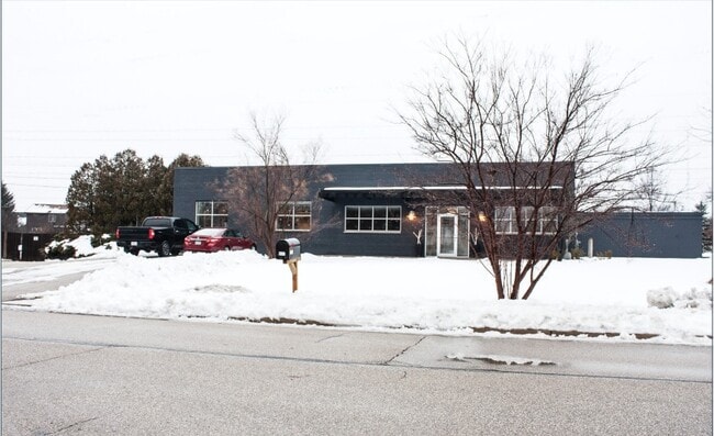
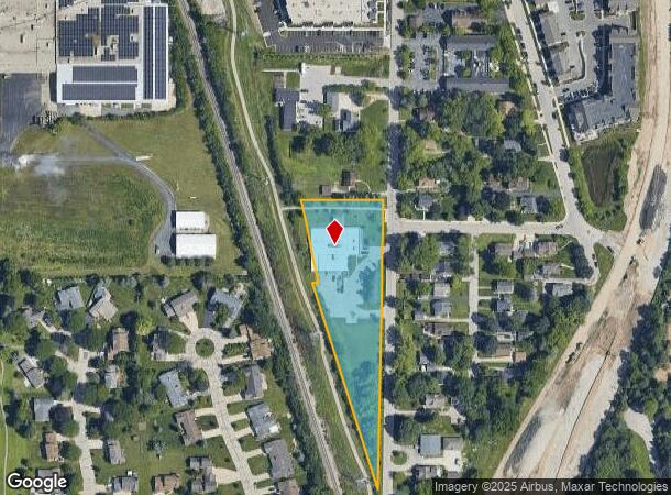
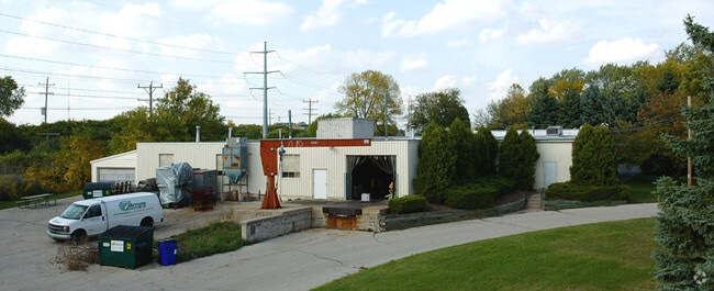
Property Record
8601 N 43Rd St, Milwaukee, WI 53209
NEARBY LISTINGS FOR SALE OR LEASE
Property Detail
8601 N 43Rd St
047-9984-001
TH PT OF E HALF OF NE 11 8 21 LYING SLY OF A LI 1116.61 FT S OF NE COR OF SD QUAR & NELY OF WEPCO ROW EXC THE ELY 33 FT FOR STR
Commercialnec
Milwaukee
X
Wisconsin
55089C0265G
2.03 AC
2024
Milwaukee NW
2024
Milwaukee/Madison
050103
Milwaukee-Waukesha-West Allis, WI
DEMOGRAPHICS near 8601 N 43Rd St
1 Mile
3 Mile
5 Mile
2024 Total Population
6,145
48,340
158,888
2029 Population
5,993
47,608
157,547
Pop Growth 2024-2029
(2.47%)
(1.51%)
(0.84%)
Average Age
43
42
39
2024 Total Households
2,689
20,504
62,731
HH Growth 2024-2029
(2.60%)
(1.61%)
(0.90%)
Median Household Inc
$73,499
$67,530
$61,251
Avg Household Size
2.20
2.30
2.50
2024 Avg HH Vehicles
2.00
2.00
2.00
Median Home Value
$204,862
$242,400
$236,691
Median Year Built
1964
1970
1963
Nearby Places
Map Layers
Map Styles
 Street
 Aerial
- Restaurants
- Banks
- Shops
- Fitness
- Groceries
PUBLIC TRANSPORTATION
AIRPORT
General Mitchell International
DRIVE
WALK
Distance
General Mitchell International
31 min
18.6 mi
Freight Ports
Port Milwaukee
DRIVE
WALK
Distance
Port Milwaukee
24 min
14.5 mi
SALE & LEASE HISTORY
LISTING DATE
SALE/LEASE

Sep 24, 2016
For Sale
Jan 26, 2024
For Sale
Nearby Properties
Address
Land Use
TOTAL SIZE
Lot Size
Zoning
Address
Land Use
TOTAL SIZE
Lot Size
Zoning
19.64 AC
Address
Land Use
TOTAL SIZE
Lot Size
Zoning
Address
Land Use
TOTAL SIZE
Lot Size
Zoning
Address
Land Use
TOTAL SIZE
Lot Size
Zoning
145,218 SF
10.23 AC
Address
Land Use
TOTAL SIZE
Lot Size
Zoning
72,824 SF
11.57 AC
Address
Land Use
TOTAL SIZE
Lot Size
Zoning
391,696 SF
36.33 AC
PD
Address
Land Use
TOTAL SIZE
Lot Size
Zoning
47.49 AC
Address
Land Use
TOTAL SIZE
Lot Size
Zoning
21.58 AC
RESIDENTIA
Address
Land Use
TOTAL SIZE
Lot Size
Zoning
Address
Land Use
TOTAL SIZE
Lot Size
Zoning
Address
Land Use
TOTAL SIZE
Lot Size
Zoning
35.05 AC
Address
Land Use
TOTAL SIZE
Lot Size
Zoning
298,666 SF
5.09 AC
PD
Address
Land Use
TOTAL SIZE
Lot Size
Zoning
Address
Land Use
TOTAL SIZE
Lot Size
Zoning
104,365 SF
9.85 AC
PD
Address
Land Use
TOTAL SIZE
Lot Size
Zoning
4.70 AC
Address
Land Use
TOTAL SIZE
Lot Size
Zoning
12.70 AC
RESIDENTIA
Address
Land Use
TOTAL SIZE
Lot Size
Zoning
4.26 AC
Address
Land Use
TOTAL SIZE
Lot Size
Zoning
25.77 AC
Address
Land Use
TOTAL SIZE
Lot Size
Zoning
Address
Land Use
TOTAL SIZE
Lot Size
Zoning
Address
Land Use
TOTAL SIZE
Lot Size
Zoning
10.98 AC
Address
Land Use
TOTAL SIZE
Lot Size
Zoning
297,894 SF
19.67 AC
IL1
Address
Land Use
TOTAL SIZE
Lot Size
Zoning
333,971 SF
16.93 AC
IL1
Address
Land Use
TOTAL SIZE
Lot Size
Zoning
166,245 SF
55 AC
PD
Address
Land Use
TOTAL SIZE
Lot Size
Zoning
173,090 SF
15.83 AC
RB1
Address
Land Use
TOTAL SIZE
Lot Size
Zoning
Address
Land Use
TOTAL SIZE
Lot Size
Zoning
116,862 SF
14.39 AC
RM1
Address
Land Use
TOTAL SIZE
Lot Size
Zoning
23.38 AC
RS6
Address
Land Use
TOTAL SIZE
Lot Size
Zoning
13.08 AC
Address
Land Use
TOTAL SIZE
Lot Size
Zoning
49.03 AC
PK
The World's #1 Commercial Real Estate Marketplace
Connect with us
© 2025 CoStar Group
The information above has been obtained from sources believed reliable. While we do not doubt its accuracy we have not verified it and make no guarantee, warranty or representation about it. It is your responsibility to independently confirm its accuracy and completeness. Any projections, opinions, assumptions, or estimates used are for example only and do not represent the current or future performance of the property. The value of this transaction to you depends on tax and other factors which should be evaluated by your tax, financial, and legal advisors. You and your advisors should conduct a careful, independent investigation of the property to determine to your satisfaction the suitability of the property for your needs.