Property Record
8601 Road 33 1/2, Madera, CA 93636

Save to a Folder
{{folder.Name}}
{{folder.ListingIds.length}} Properties
{{folder.ListingIds.length}} Property
Create a New Folder
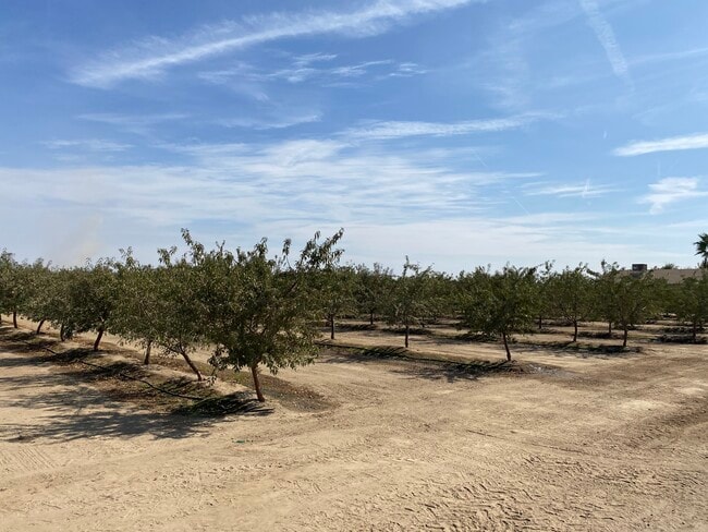
Property Detail
8601 Road 33 1/2
048-100-027
SEC 19 T12S R19E
Orchard
MADERA
ARE-20
California
B and X Area of moderate flood hazard, usually the area between the limits of the 100-year and 500-year floods.
18.28 AC
2025
Outlying Madera County
2026
Fresno
001100
Fresno, CA
NEARBY LISTINGS FOR SALE OR LEASE
-
-
View all Madera listings for sale on LoopNet.com
DEMOGRAPHICS near 8601 Road 33 1/2
1 mile
3 mile
5 mile
2025 Total Population
108
4,118
40,680
2030 Population
110
4,160
41,337
Pop Growth 2025-2030
+ 1.85%
+ 1.02%
+ 1.62%
Average Age
37
38
38
2025 Total Households
32
1,321
12,999
HH Growth 2025-2030
+ 3.13%
+ 0.98%
+ 1.56%
Median Household Inc
$95,833
$97,106
$98,446
Avg Household Size
3.20
3.10
3.10
2025 Avg HH Vehicles
2.00
2.00
2.00
Median Home Value
$899,999
$469,804
$455,196
Median Year Built
1970
1997
1997
Nearby Places
Map Layers
Map Styles
 Street
 Aerial
Layers
 Traffic
 Biking
Places
Listings with unknown addresses are not visible on the map
- Restaurants
- Banks
- Shops
- Fitness
- Groceries
PUBLIC TRANSPORTATION
AIRPORT
Fresno Yosemite International
Drive
Walk
Distance
Fresno Yosemite International
37 min
20.7 mi
Freight Ports
Port of Stockton
Drive
Walk
Distance
Port of Stockton
144 min
115.4 mi
SALE & LEASE HISTORY
LISTING DATE
SALE/LEASE

Dec 07, 2020
For Sale
Nearby Properties
Address
Land Use
TOTAL SIZE
Lot Size
Zoning
Address
Land Use
TOTAL SIZE
Lot Size
Zoning
83,800 SF
4.04 AC
R2
Address
Land Use
TOTAL SIZE
Lot Size
Zoning
6.35 AC
Address
Land Use
TOTAL SIZE
Lot Size
Zoning
49,144 SF
1.63 AC
CM
Address
Land Use
TOTAL SIZE
Lot Size
Zoning
55,237 SF
1.46 AC
CM
Address
Land Use
TOTAL SIZE
Lot Size
Zoning
13,228 SF
1.86 AC
CR
Address
Land Use
TOTAL SIZE
Lot Size
Zoning
1,150 SF
275.51 AC
ARE-40
Address
Land Use
TOTAL SIZE
Lot Size
Zoning
7,757 SF
1.65 AC
CR
Address
Land Use
TOTAL SIZE
Lot Size
Zoning
3,088 SF
1.39 AC
CR
Address
Land Use
TOTAL SIZE
Lot Size
Zoning
1,776 SF
120.49 AC
ARE-80
Address
Land Use
TOTAL SIZE
Lot Size
Zoning
960 SF
616.95 AC
ARE-40
Address
Land Use
TOTAL SIZE
Lot Size
Zoning
137.53 AC
ARE-20
Address
Land Use
TOTAL SIZE
Lot Size
Zoning
1,265 SF
143.46 AC
ARV-20
Address
Land Use
TOTAL SIZE
Lot Size
Zoning
2,574 SF
282.60 AC
ARE-40
Address
Land Use
TOTAL SIZE
Lot Size
Zoning
4,300 SF
1.37 AC
CR
Address
Land Use
TOTAL SIZE
Lot Size
Zoning
6,500 SF
1.15 AC
CR
Address
Land Use
TOTAL SIZE
Lot Size
Zoning
82.14 AC
ARE-20
Address
Land Use
TOTAL SIZE
Lot Size
Zoning
2,589 SF
77.53 AC
ARE-40
Address
Land Use
TOTAL SIZE
Lot Size
Zoning
3,436 SF
0.91 AC
CG
Address
Land Use
TOTAL SIZE
Lot Size
Zoning
2,241 SF
334.63 AC
ARE-40
Address
Land Use
TOTAL SIZE
Lot Size
Zoning
3,807 SF
0.95 AC
C3
Address
Land Use
TOTAL SIZE
Lot Size
Zoning
1.54 AC
Address
Land Use
TOTAL SIZE
Lot Size
Zoning
3,472 SF
71.67 AC
ARE-20
Address
Land Use
TOTAL SIZE
Lot Size
Zoning
2,530 SF
0.72 AC
Address
Land Use
TOTAL SIZE
Lot Size
Zoning
672 SF
81.85 AC
ARE-40
Address
Land Use
TOTAL SIZE
Lot Size
Zoning
3,830 SF
155.61 AC
ARE-40
Address
Land Use
TOTAL SIZE
Lot Size
Zoning
39.30 AC
ARE-40
The World's #1 Commercial Real Estate Marketplace
Connect with us
© 2026 CoStar Group
The information above has been obtained from sources believed reliable. While we do not doubt its accuracy we have not verified it and make no guarantee, warranty or representation about it. It is your responsibility to independently confirm its accuracy and completeness. Any projections, opinions, assumptions, or estimates used are for example only and do not represent the current or future performance of the property. The value of this transaction to you depends on tax and other factors which should be evaluated by your tax, financial, and legal advisors. You and your advisors should conduct a careful, independent investigation of the property to determine to your satisfaction the suitability of the property for your needs.