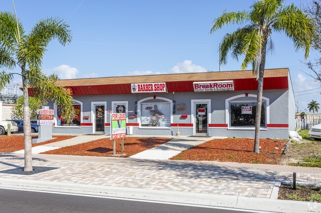
Property Record
861 Se 47Th Ter, Cape Coral, FL 33904
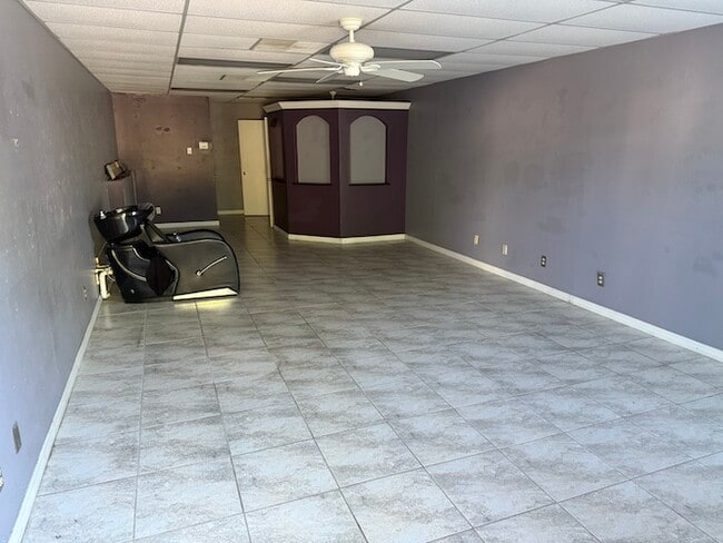
Current Lease Availabilities
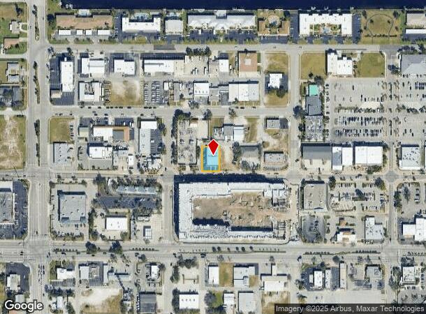
NEARBY LISTINGS FOR SALE OR LEASE
Property Detail
861 Se 47Th Ter
Cape Coral-Fort Myers, FL
Cape Coral
07-45-24-C4-00354.0090
CAPE CORAL UNIT 8 BLK 354 PB 13 PG 4 LOTS 9 THRU 11
Regionalshoppingcenterormallwithanchorstore
Lee
AE
Florida
12071C0404G
9-11
2024
0.24 AC
2025
Cape Coral
010602
Southwest Florida
5,641 SF
DEMOGRAPHICS near 861 Se 47Th Ter
1 Mile
3 Mile
5 Mile
2024 Total Population
10,410
63,101
185,983
2029 Population
12,456
75,068
220,921
Pop Growth 2024-2029
+ 19.65%
+ 18.96%
+ 18.79%
Average Age
50
50
49
2024 Total Households
5,205
29,068
83,854
HH Growth 2024-2029
+ 19.21%
+ 18.66%
+ 18.49%
Median Household Inc
$48,021
$63,954
$62,510
Avg Household Size
1.90
2.10
2.10
2024 Avg HH Vehicles
1.00
2.00
2.00
Median Home Value
$299,782
$325,867
$291,429
Median Year Built
1979
1986
1989
Nearby Places
- Restaurants
- Banks
- Shops
- Fitness
- Groceries
PUBLIC TRANSPORTATION
AIRPORT
Southwest Florida International
DRIVE
WALK
Distance
Southwest Florida International
27 min
14.2 mi
Punta Gorda
DRIVE
WALK
Distance
Punta Gorda
49 min
29.8 mi
Nearby Properties
Address
Land Use
TOTAL SIZE
Lot Size
Zoning
Address
Land Use
TOTAL SIZE
Lot Size
Zoning
423,044 SF
37.11 AC
C-1
Address
Land Use
TOTAL SIZE
Lot Size
Zoning
144,607 SF
20 AC
INS
Address
Land Use
TOTAL SIZE
Lot Size
Zoning
99,749 SF
11.49 AC
WSHP
Address
Land Use
TOTAL SIZE
Lot Size
Zoning
113,239 SF
12.62 AC
R1-D
Address
Land Use
TOTAL SIZE
Lot Size
Zoning
26,337 SF
11.54 AC
C-1
Address
Land Use
TOTAL SIZE
Lot Size
Zoning
47,660 SF
3.52 AC
C1-D
Address
Land Use
TOTAL SIZE
Lot Size
Zoning
121,182 SF
9.91 AC
C-1A
Address
Land Use
TOTAL SIZE
Lot Size
Zoning
52,003 SF
6.66 AC
WSHP
Address
Land Use
TOTAL SIZE
Lot Size
Zoning
69,261 SF
8.44 AC
WSHP
Address
Land Use
TOTAL SIZE
Lot Size
Zoning
81,988 SF
7.97 AC
C-1A
Address
Land Use
TOTAL SIZE
Lot Size
Zoning
74,368 SF
2.32 AC
SC
Address
Land Use
TOTAL SIZE
Lot Size
Zoning
86,497 SF
6.20 AC
SC
Address
Land Use
TOTAL SIZE
Lot Size
Zoning
45,809 SF
1.75 AC
SC
Address
Land Use
TOTAL SIZE
Lot Size
Zoning
82,526 SF
113.48 AC
PUD
Address
Land Use
TOTAL SIZE
Lot Size
Zoning
51,688 SF
3.60 AC
C-1
Address
Land Use
TOTAL SIZE
Lot Size
Zoning
67,396 SF
2.02 AC
SC
Address
Land Use
TOTAL SIZE
Lot Size
Zoning
76,025 SF
2.25 AC
MPD
Address
Land Use
TOTAL SIZE
Lot Size
Zoning
39,441 SF
3.05 AC
C-1
Address
Land Use
TOTAL SIZE
Lot Size
Zoning
46,386 SF
3.43 AC
C-1
Address
Land Use
TOTAL SIZE
Lot Size
Zoning
54,257 SF
3.34 AC
R-3
Address
Land Use
TOTAL SIZE
Lot Size
Zoning
23,799 SF
2.27 AC
RS-1
Address
Land Use
TOTAL SIZE
Lot Size
Zoning
97,049 SF
1.05 AC
C-1
Address
Land Use
TOTAL SIZE
Lot Size
Zoning
42,794 SF
10.80 AC
RD-D
Address
Land Use
TOTAL SIZE
Lot Size
Zoning
64,922 SF
2.98 AC
SC
Address
Land Use
TOTAL SIZE
Lot Size
Zoning
32,964 SF
2.77 AC
C
Address
Land Use
TOTAL SIZE
Lot Size
Zoning
13,166 SF
1.74 AC
C
Address
Land Use
TOTAL SIZE
Lot Size
Zoning
118,605 SF
13.59 AC
CPD
Address
Land Use
TOTAL SIZE
Lot Size
Zoning
49,443 SF
4.65 AC
C-1
Address
Land Use
TOTAL SIZE
Lot Size
Zoning
48,105 SF
1.61 AC
R3-D
Address
Land Use
TOTAL SIZE
Lot Size
Zoning
640 SF
10.54 AC
R1AW
The World's #1 Commercial Real Estate Marketplace
Connect with us
© 2025 CoStar Group
The information above has been obtained from sources believed reliable. While we do not doubt its accuracy we have not verified it and make no guarantee, warranty or representation about it. It is your responsibility to independently confirm its accuracy and completeness. Any projections, opinions, assumptions, or estimates used are for example only and do not represent the current or future performance of the property. The value of this transaction to you depends on tax and other factors which should be evaluated by your tax, financial, and legal advisors. You and your advisors should conduct a careful, independent investigation of the property to determine to your satisfaction the suitability of the property for your needs.