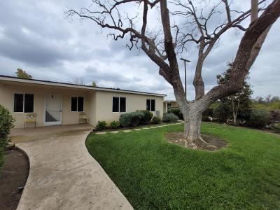
Property Record
8614 Stockton Rd, Moorpark, CA 93021


Property Detail
8614 Stockton Rd
503-0-040-175
TRACT 89
Orchard
VENTURA
AE-40
California
A Areas with a 1% annual chance of flooding and a 26% chance of flooding over the life of a 30-year mortgage.
40.50 AC
2024
Moorpark/Simi Valley
2025
Los Angeles
009300
Oxnard-Thousand Oaks-Ventura, CA
1,212 SF
NEARBY LISTINGS FOR SALE OR LEASE
DEMOGRAPHICS near 8614 Stockton Rd
1 mile
3 mile
5 mile
2025 Total Population
158
5,002
43,321
2030 Population
150
4,877
42,700
Pop Growth 2025-2030
(5.06%)
(2.50%)
(1.43%)
Average Age
41
42
42
2025 Total Households
44
1,513
14,191
HH Growth 2025-2030
(4.55%)
(2.71%)
(1.57%)
Median Household Inc
$175,000
$167,520
$150,976
Avg Household Size
3.20
3.10
3.00
2025 Avg HH Vehicles
3.00
3.00
2.00
Median Home Value
$1,102,273
$1,042,405
$943,314
Median Year Built
1974
1985
1984
Nearby Places
Map Layers
Map Styles
 Street
 Aerial
Layers
 Traffic
 Biking
Places
Listings with unknown addresses are not visible on the map
- Restaurants
- Banks
- Shops
- Fitness
- Groceries
PUBLIC TRANSPORTATION
COMMUTER RAIL
Moorpark (Ventura County Line - Southern California Regional Rail Authority (Metrolink))
Drive
Walk
Distance
Moorpark (Ventura County Line - Southern California Regional Rail Authority (Metrolink))
15 min
7.4 mi
Camarillo (Ventura County Line - Southern California Regional Rail Authority (Metrolink))
Drive
Walk
Distance
Camarillo (Ventura County Line - Southern California Regional Rail Authority (Metrolink))
17 min
8.6 mi
Freight Ports
The Port of Hueneme
Drive
Walk
Distance
The Port of Hueneme
37 min
20.5 mi
SALE & LEASE HISTORY
LISTING DATE
SALE/LEASE

Apr 24, 2021
For Sale
Nearby Properties
Address
Land Use
TOTAL SIZE
Lot Size
Zoning
Address
Land Use
TOTAL SIZE
Lot Size
Zoning
Address
Land Use
TOTAL SIZE
Lot Size
Zoning
52,547 SF
10.83 AC
Address
Land Use
TOTAL SIZE
Lot Size
Zoning
30 AC
AE
Address
Land Use
TOTAL SIZE
Lot Size
Zoning
586.22 AC
AEO-S-
Address
Land Use
TOTAL SIZE
Lot Size
Zoning
134.97 AC
A-E
Address
Land Use
TOTAL SIZE
Lot Size
Zoning
112,817 SF
3.07 AC
M2
Address
Land Use
TOTAL SIZE
Lot Size
Zoning
6.46 AC
Address
Land Use
TOTAL SIZE
Lot Size
Zoning
728 SF
32.05 AC
AE
Address
Land Use
TOTAL SIZE
Lot Size
Zoning
183.96 AC
AE
Address
Land Use
TOTAL SIZE
Lot Size
Zoning
66.90 AC
Address
Land Use
TOTAL SIZE
Lot Size
Zoning
497.22 AC
AEO-S-
Address
Land Use
TOTAL SIZE
Lot Size
Zoning
110.24 AC
AEO-S-
Address
Land Use
TOTAL SIZE
Lot Size
Zoning
990 SF
167.06 AC
AE
Address
Land Use
TOTAL SIZE
Lot Size
Zoning
5.23 AC
Address
Land Use
TOTAL SIZE
Lot Size
Zoning
19.52 AC
AE
Address
Land Use
TOTAL SIZE
Lot Size
Zoning
87.29 AC
AE
Address
Land Use
TOTAL SIZE
Lot Size
Zoning
222.29 AC
OS20AC
Address
Land Use
TOTAL SIZE
Lot Size
Zoning
30,897 SF
2.02 AC
M2
Address
Land Use
TOTAL SIZE
Lot Size
Zoning
13,146 SF
20.75 AC
AE
Address
Land Use
TOTAL SIZE
Lot Size
Zoning
17,500 SF
20 AC
AE
Address
Land Use
TOTAL SIZE
Lot Size
Zoning
57,564 SF
2.83 AC
M2
Address
Land Use
TOTAL SIZE
Lot Size
Zoning
7,413 SF
18.73 AC
AE-40
Address
Land Use
TOTAL SIZE
Lot Size
Zoning
1,145 SF
235.11 AC
AE
Address
Land Use
TOTAL SIZE
Lot Size
Zoning
63.47 AC
AE
Address
Land Use
TOTAL SIZE
Lot Size
Zoning
1,870 SF
165.39 AC
OS160AC
Address
Land Use
TOTAL SIZE
Lot Size
Zoning
4,430 SF
44 SF
AE
Address
Land Use
TOTAL SIZE
Lot Size
Zoning
63 AC
AE
Address
Land Use
TOTAL SIZE
Lot Size
Zoning
9,328 SF
20.85 AC
AE-40
Address
Land Use
TOTAL SIZE
Lot Size
Zoning
39.86 AC
AE
The World's #1 Commercial Real Estate Marketplace
Connect with us
© 2026 CoStar Group
The information above has been obtained from sources believed reliable. While we do not doubt its accuracy we have not verified it and make no guarantee, warranty or representation about it. It is your responsibility to independently confirm its accuracy and completeness. Any projections, opinions, assumptions, or estimates used are for example only and do not represent the current or future performance of the property. The value of this transaction to you depends on tax and other factors which should be evaluated by your tax, financial, and legal advisors. You and your advisors should conduct a careful, independent investigation of the property to determine to your satisfaction the suitability of the property for your needs.