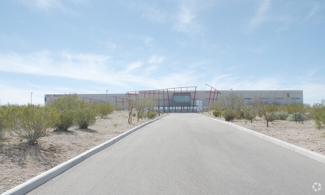
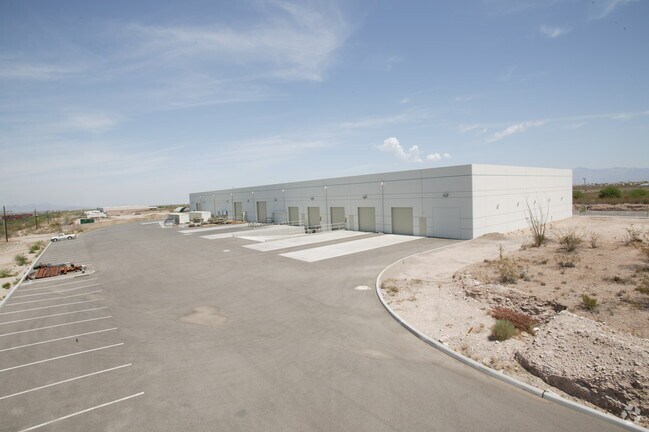
Property Record
8620 E Old Vail Rd, Tucson, AZ 85747

Property Detail
8620 E Old Vail Rd
141-11-031A
SUNBELT INDUSTRIAL CENTER S428 OF LOT 8
Industrialgeneral
Pima
I2
Arizona
B and X Area of moderate flood hazard, usually the area between the limits of the 100-year and 500-year floods.
8
2025
6.88 AC
2026
Southeast Tucson
004073
Tucson
53,820 SF
Tucson, AZ
NEARBY LISTINGS FOR SALE OR LEASE
DEMOGRAPHICS near 8620 E Old Vail Rd
1 mile
3 mile
5 mile
2025 Total Population
2,990
25,642
51,956
2030 Population
3,094
26,423
53,667
Pop Growth 2025-2030
+ 3.48%
+ 3.05%
+ 3.29%
Average Age
36
39
38
2025 Total Households
1,039
9,184
18,427
HH Growth 2025-2030
+ 3.37%
+ 2.91%
+ 3.30%
Median Household Inc
$95,020
$98,778
$93,452
Avg Household Size
2.80
2.70
2.80
2025 Avg HH Vehicles
2.00
2.00
2.00
Median Home Value
$346,681
$331,051
$330,627
Median Year Built
1996
1999
2001
Nearby Places
Map Layers
Map Styles
 Street
 Aerial
Layers
 Traffic
 Biking
Places
Listings with unknown addresses are not visible on the map
- Restaurants
- Banks
- Shops
- Fitness
- Groceries
PUBLIC TRANSPORTATION
AIRPORT
Tucson International
Drive
Walk
Distance
Tucson International
19 min
10.5 mi
Freight Ports
Port of San Diego
Drive
Walk
Distance
Port of San Diego
453 min
424.6 mi
SALE & LEASE HISTORY
LISTING DATE
SALE/LEASE

Sep 24, 2016
For Lease
Nearby Properties
Address
Land Use
TOTAL SIZE
Lot Size
Zoning
Address
Land Use
TOTAL SIZE
Lot Size
Zoning
489,276 SF
85 AC
I2
Address
Land Use
TOTAL SIZE
Lot Size
Zoning
67,635 SF
107.18 AC
TH
Address
Land Use
TOTAL SIZE
Lot Size
Zoning
855,278 SF
79.48 AC
SP
Address
Land Use
TOTAL SIZE
Lot Size
Zoning
1,698,495 SF
751.94 AC
Address
Land Use
TOTAL SIZE
Lot Size
Zoning
39,726 SF
15.74 AC
Address
Land Use
TOTAL SIZE
Lot Size
Zoning
340,031 SF
17.14 AC
Address
Land Use
TOTAL SIZE
Lot Size
Zoning
44,323 SF
17.35 AC
Address
Land Use
TOTAL SIZE
Lot Size
Zoning
340,031 SF
17.15 AC
Address
Land Use
TOTAL SIZE
Lot Size
Zoning
268,728 SF
20.57 AC
Address
Land Use
TOTAL SIZE
Lot Size
Zoning
971,480 SF
97.71 AC
I1
Address
Land Use
TOTAL SIZE
Lot Size
Zoning
133,992 SF
43.35 AC
RX1
Address
Land Use
TOTAL SIZE
Lot Size
Zoning
230,133 SF
20.01 AC
Address
Land Use
TOTAL SIZE
Lot Size
Zoning
238,303 SF
18.38 AC
Address
Land Use
TOTAL SIZE
Lot Size
Zoning
23,840 SF
8.39 AC
I2
Address
Land Use
TOTAL SIZE
Lot Size
Zoning
109,650 SF
10.29 AC
Address
Land Use
TOTAL SIZE
Lot Size
Zoning
10,455 SF
5 AC
O3
Address
Land Use
TOTAL SIZE
Lot Size
Zoning
78,166 SF
23.16 AC
RX1
Address
Land Use
TOTAL SIZE
Lot Size
Zoning
75,179 SF
32.65 AC
Address
Land Use
TOTAL SIZE
Lot Size
Zoning
14,427 SF
13.43 AC
I2
Address
Land Use
TOTAL SIZE
Lot Size
Zoning
73,280 SF
10 AC
RX1
Address
Land Use
TOTAL SIZE
Lot Size
Zoning
45.88 AC
Address
Land Use
TOTAL SIZE
Lot Size
Zoning
165,602 SF
24.79 AC
Address
Land Use
TOTAL SIZE
Lot Size
Zoning
62,451 SF
10 AC
RX1
Address
Land Use
TOTAL SIZE
Lot Size
Zoning
103,074 SF
13.84 AC
Address
Land Use
TOTAL SIZE
Lot Size
Zoning
62,087 SF
3.43 AC
Address
Land Use
TOTAL SIZE
Lot Size
Zoning
91,519 SF
11.03 AC
Address
Land Use
TOTAL SIZE
Lot Size
Zoning
355.61 AC
GR1
Address
Land Use
TOTAL SIZE
Lot Size
Zoning
56,316 SF
5.15 AC
Address
Land Use
TOTAL SIZE
Lot Size
Zoning
844,800 SF
49.72 AC
The World's #1 Commercial Real Estate Marketplace
Connect with us
© 2026 CoStar Group
The information above has been obtained from sources believed reliable. While we do not doubt its accuracy we have not verified it and make no guarantee, warranty or representation about it. It is your responsibility to independently confirm its accuracy and completeness. Any projections, opinions, assumptions, or estimates used are for example only and do not represent the current or future performance of the property. The value of this transaction to you depends on tax and other factors which should be evaluated by your tax, financial, and legal advisors. You and your advisors should conduct a careful, independent investigation of the property to determine to your satisfaction the suitability of the property for your needs.