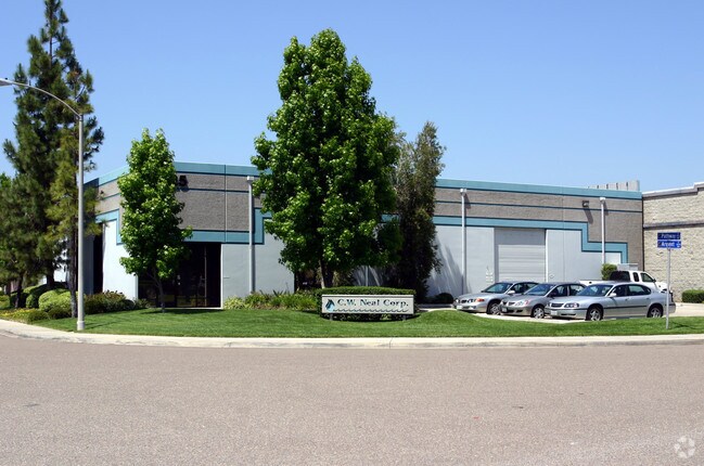
Property Record
8625 Argent St, Santee, CA 92071


Property Detail
8625 Argent St
384-311-18
LOT 18 TR 010619
Warehouse
San Diego
IG
California
B and X Area of moderate flood hazard, usually the area between the limits of the 100-year and 500-year floods.
18
2024
0.52 AC
2025
Santee
016616
San Diego
7,128 SF
San Diego-Chula Vista-Carlsbad, CA
NEARBY LISTINGS FOR SALE OR LEASE
DEMOGRAPHICS near 8625 Argent St
1 mile
3 mile
5 mile
2025 Total Population
10,229
115,995
290,257
2030 Population
10,152
115,609
290,092
Pop Growth 2025-2030
(0.75%)
(0.33%)
(0.06%)
Average Age
40
40
40
2025 Total Households
3,710
41,210
103,507
HH Growth 2025-2030
(0.84%)
(0.46%)
(0.18%)
Median Household Inc
$90,820
$101,676
$92,353
Avg Household Size
2.60
2.70
2.70
2025 Avg HH Vehicles
2.00
2.00
2.00
Median Home Value
$763,807
$725,686
$741,697
Median Year Built
1979
1975
1974
Nearby Places
Map Layers
Map Styles
 Street
 Aerial
Transit
 Traffic
 Biking
Places
Listings with unknown addresses are not visible on the map
- Restaurants
- Banks
- Shops
- Fitness
- Groceries
PUBLIC TRANSPORTATION
TRANSIT/SUBWAY
Gillespie Field (Green Line - San Diego Metropolitan Transit System Trolley (San Diego Trolley), Orange Line - San Diego Metropolitan Transit System Trolley (San Diego Trolley))
Drive
Walk
Distance
Gillespie Field (Green Line - San Diego Metropolitan Transit System Trolley (San Diego Trolley), Orange Line - San Diego Metropolitan Transit System Trolley (San Diego Trolley))
2 min
15 min
0.7 mi
AIRPORT
San Diego International
Drive
Walk
Distance
San Diego International
27 min
20.5 mi
Freight Ports
Port of San Diego
Drive
Walk
Distance
Port of San Diego
25 min
17.8 mi
Nearby Properties
Address
Land Use
TOTAL SIZE
Lot Size
Zoning
Address
Land Use
TOTAL SIZE
Lot Size
Zoning
6.84 AC
M
Address
Land Use
TOTAL SIZE
Lot Size
Zoning
8.24 AC
RU
Address
Land Use
TOTAL SIZE
Lot Size
Zoning
7.46 AC
RM-2200
Address
Land Use
TOTAL SIZE
Lot Size
Zoning
6.82 AC
TC
Address
Land Use
TOTAL SIZE
Lot Size
Zoning
5.90 AC
RM-2200
Address
Land Use
TOTAL SIZE
Lot Size
Zoning
39.17 AC
C-R
Address
Land Use
TOTAL SIZE
Lot Size
Zoning
8.82 AC
RM-2200
Address
Land Use
TOTAL SIZE
Lot Size
Zoning
13.48 AC
CC-1-3
Address
Land Use
TOTAL SIZE
Lot Size
Zoning
9.38 AC
RU
Address
Land Use
TOTAL SIZE
Lot Size
Zoning
85,848 SF
5.03 AC
GC
Address
Land Use
TOTAL SIZE
Lot Size
Zoning
83,198 SF
5 AC
RM-2200
Address
Land Use
TOTAL SIZE
Lot Size
Zoning
6.72 AC
RM-3-7
Address
Land Use
TOTAL SIZE
Lot Size
Zoning
10.23 AC
R22
Address
Land Use
TOTAL SIZE
Lot Size
Zoning
3.69 AC
R22
Address
Land Use
TOTAL SIZE
Lot Size
Zoning
5.45 AC
R14
Address
Land Use
TOTAL SIZE
Lot Size
Zoning
475.50 AC
IH-2-1
Address
Land Use
TOTAL SIZE
Lot Size
Zoning
3.80 AC
NC/R14
Address
Land Use
TOTAL SIZE
Lot Size
Zoning
4.75 AC
C-6
Address
Land Use
TOTAL SIZE
Lot Size
Zoning
4.69 AC
RU
Address
Land Use
TOTAL SIZE
Lot Size
Zoning
95,024 SF
2.89 AC
RM-2200
Address
Land Use
TOTAL SIZE
Lot Size
Zoning
3.33 AC
R22
Address
Land Use
TOTAL SIZE
Lot Size
Zoning
16.33 AC
C-R
Address
Land Use
TOTAL SIZE
Lot Size
Zoning
1.89 AC
C-R
Address
Land Use
TOTAL SIZE
Lot Size
Zoning
10.79 AC
TC
Address
Land Use
TOTAL SIZE
Lot Size
Zoning
86,578 SF
4.26 AC
M
Address
Land Use
TOTAL SIZE
Lot Size
Zoning
8.81 AC
C-R
Address
Land Use
TOTAL SIZE
Lot Size
Zoning
42.49 AC
R2
Address
Land Use
TOTAL SIZE
Lot Size
Zoning
97,096 SF
2.74 AC
R3
Address
Land Use
TOTAL SIZE
Lot Size
Zoning
4.76 AC
RM-1450
Address
Land Use
TOTAL SIZE
Lot Size
Zoning
74,882 SF
3.45 AC
RU
The World's #1 Commercial Real Estate Marketplace
Connect with us
© 2026 CoStar Group
The information above has been obtained from sources believed reliable. While we do not doubt its accuracy we have not verified it and make no guarantee, warranty or representation about it. It is your responsibility to independently confirm its accuracy and completeness. Any projections, opinions, assumptions, or estimates used are for example only and do not represent the current or future performance of the property. The value of this transaction to you depends on tax and other factors which should be evaluated by your tax, financial, and legal advisors. You and your advisors should conduct a careful, independent investigation of the property to determine to your satisfaction the suitability of the property for your needs.