Property Record
8625 E Utopia Pkwy, Raytown, MO 64138


NEARBY LISTINGS FOR SALE OR LEASE
-
-
View all Raytown listings for sale on LoopNet.com
Property Detail
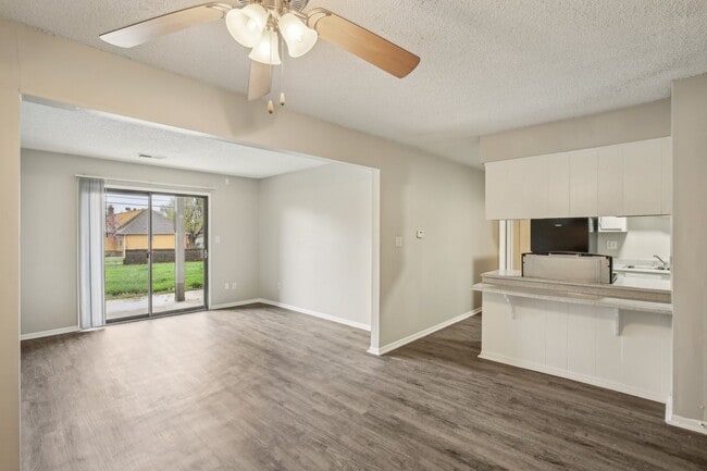
8625 E Utopia Pkwy
Kansas City, MO-KS
Lane At 87Th Street Apts
50-220-17-42-00-0-00-000
UTOPIA---ALL LOT 18 & LANE AT 87TH STREETS APT TRACT A & PT W NW ALL DAF: BEG SW SD LOT 18 UTOPIA TH N 02 DEG 04 MIN 47 SEC E 260.97 TH N 86 DEG 04 MIN 42 SEC W 125 TH N 02 D
Governmentalpublicusegeneral
Jackson
X
Missouri
29095C0403G
18
2024
2.61 AC
2025
Raytown
012804
Kansas City
47,958 SF
DEMOGRAPHICS near 8625 E Utopia Pkwy
1 mile
3 mile
5 mile
2024 Total Population
10,042
46,222
122,968
2029 Population
9,918
45,929
123,077
Pop Growth 2024-2029
(1.23%)
(0.63%)
+ 0.09%
Average Age
40
39
39
2024 Total Households
3,853
18,965
49,763
HH Growth 2024-2029
(1.48%)
(0.71%)
0.00%
Median Household Inc
$59,664
$55,770
$57,046
Avg Household Size
2.50
2.30
2.40
2024 Avg HH Vehicles
2.00
2.00
2.00
Median Home Value
$145,992
$151,087
$159,143
Median Year Built
1965
1966
1966
Nearby Places
Map Layers
Map Styles
 Street
 Aerial
Transit
 Traffic
 Biking
Places
Listings with unknown addresses are not visible on the map
- Restaurants
- Banks
- Shops
- Fitness
- Groceries
PUBLIC TRANSPORTATION
COMMUTER RAIL
Lee's Summit Amtrak (Lincoln Service Missouri River Runner - Amtrak, Missouri River Runner - Amtrak)
Drive
Walk
Distance
Lee's Summit Amtrak (Lincoln Service Missouri River Runner - Amtrak, Missouri River Runner - Amtrak)
14 min
9.1 mi
AIRPORT
Kansas City International
Drive
Walk
Distance
Kansas City International
47 min
33.3 mi
Freight Ports
Tulsa Port Of Catoosa
Drive
Walk
Distance
Tulsa Port Of Catoosa
263 min
233.8 mi
Nearby Properties
Address
Land Use
TOTAL SIZE
Lot Size
Zoning
Address
Land Use
TOTAL SIZE
Lot Size
Zoning
268,537 SF
54.27 AC
Address
Land Use
TOTAL SIZE
Lot Size
Zoning
110,478 SF
11.81 AC
Address
Land Use
TOTAL SIZE
Lot Size
Zoning
246,115 SF
Address
Land Use
TOTAL SIZE
Lot Size
Zoning
485,352 SF
Address
Land Use
TOTAL SIZE
Lot Size
Zoning
175,318 SF
26.37 AC
Address
Land Use
TOTAL SIZE
Lot Size
Zoning
147,018 SF
16.01 AC
Address
Land Use
TOTAL SIZE
Lot Size
Zoning
61,903 SF
54.40 AC
Address
Land Use
TOTAL SIZE
Lot Size
Zoning
69,771 SF
83.01 AC
Address
Land Use
TOTAL SIZE
Lot Size
Zoning
168,184 SF
18.63 AC
Address
Land Use
TOTAL SIZE
Lot Size
Zoning
33,096 SF
Address
Land Use
TOTAL SIZE
Lot Size
Zoning
138,954 SF
18.66 AC
Address
Land Use
TOTAL SIZE
Lot Size
Zoning
173,321 SF
40 AC
Address
Land Use
TOTAL SIZE
Lot Size
Zoning
74,139 SF
16.04 AC
Address
Land Use
TOTAL SIZE
Lot Size
Zoning
42,417 SF
21.81 AC
Address
Land Use
TOTAL SIZE
Lot Size
Zoning
62,466 SF
Address
Land Use
TOTAL SIZE
Lot Size
Zoning
161,823 SF
Address
Land Use
TOTAL SIZE
Lot Size
Zoning
Address
Land Use
TOTAL SIZE
Lot Size
Zoning
57,442 SF
59.91 AC
Address
Land Use
TOTAL SIZE
Lot Size
Zoning
Address
Land Use
TOTAL SIZE
Lot Size
Zoning
Address
Land Use
TOTAL SIZE
Lot Size
Zoning
33,541 SF
21.83 AC
Address
Land Use
TOTAL SIZE
Lot Size
Zoning
73,434 SF
10.35 AC
Address
Land Use
TOTAL SIZE
Lot Size
Zoning
152,610 SF
17.51 AC
CP3
Address
Land Use
TOTAL SIZE
Lot Size
Zoning
74,396 SF
12.32 AC
Address
Land Use
TOTAL SIZE
Lot Size
Zoning
47,537 SF
15.70 AC
Address
Land Use
TOTAL SIZE
Lot Size
Zoning
36,546 SF
23.46 AC
Address
Land Use
TOTAL SIZE
Lot Size
Zoning
214,084 SF
17.25 AC
Address
Land Use
TOTAL SIZE
Lot Size
Zoning
48,474 SF
Address
Land Use
TOTAL SIZE
Lot Size
Zoning
85,700 SF
21.88 AC
Address
Land Use
TOTAL SIZE
Lot Size
Zoning
43,200 SF
4.37 AC
The World's #1 Commercial Real Estate Marketplace
Connect with us
© 2026 CoStar Group
The information above has been obtained from sources believed reliable. While we do not doubt its accuracy we have not verified it and make no guarantee, warranty or representation about it. It is your responsibility to independently confirm its accuracy and completeness. Any projections, opinions, assumptions, or estimates used are for example only and do not represent the current or future performance of the property. The value of this transaction to you depends on tax and other factors which should be evaluated by your tax, financial, and legal advisors. You and your advisors should conduct a careful, independent investigation of the property to determine to your satisfaction the suitability of the property for your needs.