Property Record
8630 S Eastern Ave, Henderson, NV 89074


Property Detail
8630 S Eastern Ave
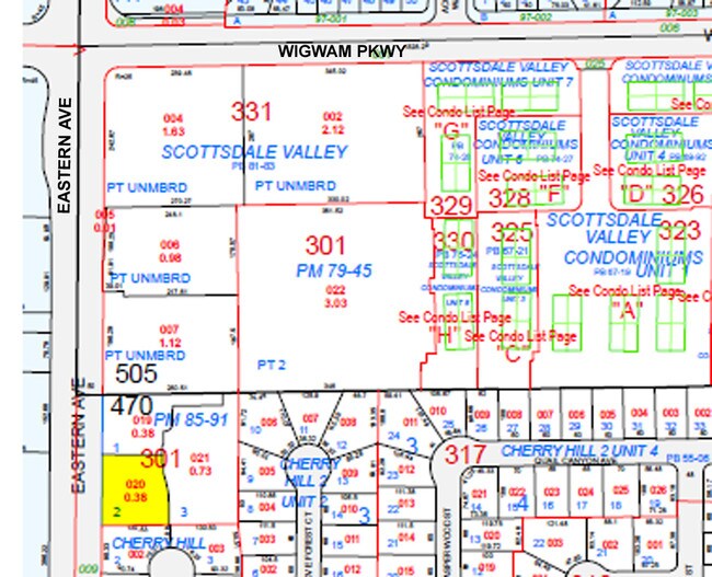
177-13-301-020
PARCEL MAP FILE 85 PAGE 91 LOT 2
Commercialnec
CLARK
CP
Nevada
B and X Area of moderate flood hazard, usually the area between the limits of the 100-year and 500-year floods.
2
0
0.38 AC
2026
South Las Vegas
005318
Las Vegas
5,535 SF
Las Vegas-Henderson-North Las Vegas, NV
NEARBY LISTINGS FOR SALE OR LEASE
DEMOGRAPHICS near 8630 S Eastern Ave
1 mile
3 mile
5 mile
2024 Total Population
18,167
164,748
343,458
2029 Population
18,971
171,974
360,429
Pop Growth 2024-2029
+ 4.43%
+ 4.39%
+ 4.94%
Average Age
43
42
41
2024 Total Households
7,369
66,810
138,434
HH Growth 2024-2029
+ 4.38%
+ 4.45%
+ 4.95%
Median Household Inc
$88,797
$86,474
$84,698
Avg Household Size
2.40
2.40
2.40
2024 Avg HH Vehicles
2.00
2.00
2.00
Median Home Value
$458,681
$470,839
$477,470
Median Year Built
1994
1996
1997
Nearby Places
Map Layers
Map Styles
 Street
 Aerial
Transit
 Traffic
 Biking
Places
Listings with unknown addresses are not visible on the map
- Restaurants
- Banks
- Shops
- Fitness
- Groceries
PUBLIC TRANSPORTATION
AIRPORT
Harry Reid International
Drive
Walk
Distance
Harry Reid International
9 min
5.1 mi
Boulder City Municipal
Drive
Walk
Distance
Boulder City Municipal
27 min
18.9 mi
Nearby Properties
Address
Land Use
TOTAL SIZE
Lot Size
Zoning
Address
Land Use
TOTAL SIZE
Lot Size
Zoning
630,906 SF
39.87 AC
CT
Address
Land Use
TOTAL SIZE
Lot Size
Zoning
9,314 SF
23.10 AC
PS
Address
Land Use
TOTAL SIZE
Lot Size
Zoning
1,365 SF
22.68 AC
Address
Land Use
TOTAL SIZE
Lot Size
Zoning
7,177 SF
15.88 AC
Address
Land Use
TOTAL SIZE
Lot Size
Zoning
3,528 SF
18.15 AC
RH36
Address
Land Use
TOTAL SIZE
Lot Size
Zoning
4,312 SF
19.42 AC
C:R-4
Address
Land Use
TOTAL SIZE
Lot Size
Zoning
36.85 AC
PS
Address
Land Use
TOTAL SIZE
Lot Size
Zoning
438,778 SF
19.30 AC
C:R-4
Address
Land Use
TOTAL SIZE
Lot Size
Zoning
3,990 SF
24.88 AC
RM16
Address
Land Use
TOTAL SIZE
Lot Size
Zoning
4,405 SF
19.79 AC
Address
Land Use
TOTAL SIZE
Lot Size
Zoning
18.08 AC
RE
Address
Land Use
TOTAL SIZE
Lot Size
Zoning
4,444 SF
18.11 AC
Address
Land Use
TOTAL SIZE
Lot Size
Zoning
220,694 SF
44.74 AC
Address
Land Use
TOTAL SIZE
Lot Size
Zoning
399,206 SF
22.06 AC
MD
Address
Land Use
TOTAL SIZE
Lot Size
Zoning
402,610 SF
15.51 AC
R3
Address
Land Use
TOTAL SIZE
Lot Size
Zoning
22,009 SF
11.53 AC
Address
Land Use
TOTAL SIZE
Lot Size
Zoning
324 SF
7.01 AC
C2
Address
Land Use
TOTAL SIZE
Lot Size
Zoning
371,958 SF
22.85 AC
RM16
Address
Land Use
TOTAL SIZE
Lot Size
Zoning
9,164 SF
22.81 AC
R3
Address
Land Use
TOTAL SIZE
Lot Size
Zoning
4,444 SF
15.48 AC
H:RH-24
Address
Land Use
TOTAL SIZE
Lot Size
Zoning
213,957 SF
19.68 AC
Address
Land Use
TOTAL SIZE
Lot Size
Zoning
148.64 AC
PF
Address
Land Use
TOTAL SIZE
Lot Size
Zoning
3,850 SF
6.09 AC
R3
Address
Land Use
TOTAL SIZE
Lot Size
Zoning
61,157 SF
2.54 AC
Address
Land Use
TOTAL SIZE
Lot Size
Zoning
59,421 SF
14 AC
Address
Land Use
TOTAL SIZE
Lot Size
Zoning
9,196 SF
17.77 AC
R3
Address
Land Use
TOTAL SIZE
Lot Size
Zoning
18.75 AC
PF
Address
Land Use
TOTAL SIZE
Lot Size
Zoning
341,744 SF
21.82 AC
RM16
Address
Land Use
TOTAL SIZE
Lot Size
Zoning
4,330 SF
21.45 AC
RM16
Address
Land Use
TOTAL SIZE
Lot Size
Zoning
20 AC
RE
The World's #1 Commercial Real Estate Marketplace
Connect with us
© 2026 CoStar Group
The information above has been obtained from sources believed reliable. While we do not doubt its accuracy we have not verified it and make no guarantee, warranty or representation about it. It is your responsibility to independently confirm its accuracy and completeness. Any projections, opinions, assumptions, or estimates used are for example only and do not represent the current or future performance of the property. The value of this transaction to you depends on tax and other factors which should be evaluated by your tax, financial, and legal advisors. You and your advisors should conduct a careful, independent investigation of the property to determine to your satisfaction the suitability of the property for your needs.