Property Record
8639 Beechmont Ave, Cincinnati, OH 45255
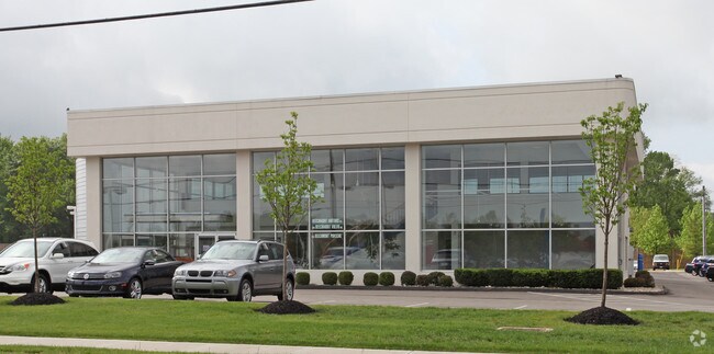


Property Detail
8639 Beechmont Ave
Cincinnati, OH-KY-IN
BEECHMONT AVE 5.8831 ACS MS 637
500-0040-0016
Hamilton
Vehiclerentalsvehiclesales
Ohio
B and X Area of moderate flood hazard, usually the area between the limits of the 100-year and 500-year floods.
5.88 AC
2025
Eastgate/Anderson Twp
2025
Cincinnati/Dayton
025103
NEARBY LISTINGS FOR SALE OR LEASE
DEMOGRAPHICS near 8639 Beechmont Ave
1 mile
3 mile
5 mile
2025 Total Population
10,313
54,070
118,510
2030 Population
10,374
54,620
119,995
Pop Growth 2025-2030
+ 0.59%
+ 1.02%
+ 1.25%
Average Age
42
41
41
2025 Total Households
4,441
21,882
48,622
HH Growth 2025-2030
+ 0.99%
+ 1.28%
+ 1.48%
Median Household Inc
$85,599
$87,480
$85,711
Avg Household Size
2.30
2.40
2.40
2025 Avg HH Vehicles
2.00
2.00
2.00
Median Home Value
$274,222
$305,976
$294,110
Median Year Built
1981
1979
1979
Nearby Places
Map Layers
Map Styles
 Street
 Aerial
Layers
 Traffic
 Biking
Places
Listings with unknown addresses are not visible on the map
- Restaurants
- Banks
- Shops
- Fitness
- Groceries
PUBLIC TRANSPORTATION
AIRPORT
Cincinnati/Northern Kentucky International
Drive
Walk
Distance
Cincinnati/Northern Kentucky International
38 min
24.1 mi
Nearby Properties
Address
Land Use
TOTAL SIZE
Lot Size
Zoning
Address
Land Use
TOTAL SIZE
Lot Size
Zoning
26.42 AC
Address
Land Use
TOTAL SIZE
Lot Size
Zoning
50,382 SF
33.05 AC
Address
Land Use
TOTAL SIZE
Lot Size
Zoning
3.87 AC
Address
Land Use
TOTAL SIZE
Lot Size
Zoning
25.31 AC
Address
Land Use
TOTAL SIZE
Lot Size
Zoning
154,426 SF
35.05 AC
Address
Land Use
TOTAL SIZE
Lot Size
Zoning
25.27 AC
Address
Land Use
TOTAL SIZE
Lot Size
Zoning
Address
Land Use
TOTAL SIZE
Lot Size
Zoning
52,178 SF
5.98 AC
Address
Land Use
TOTAL SIZE
Lot Size
Zoning
11.96 AC
Address
Land Use
TOTAL SIZE
Lot Size
Zoning
5.09 AC
Address
Land Use
TOTAL SIZE
Lot Size
Zoning
236,920 SF
18.94 AC
Address
Land Use
TOTAL SIZE
Lot Size
Zoning
36.96 AC
Address
Land Use
TOTAL SIZE
Lot Size
Zoning
88,932 SF
11.21 AC
Address
Land Use
TOTAL SIZE
Lot Size
Zoning
16.77 AC
Address
Land Use
TOTAL SIZE
Lot Size
Zoning
56,080 SF
4.40 AC
Address
Land Use
TOTAL SIZE
Lot Size
Zoning
1,680 SF
13.55 AC
Address
Land Use
TOTAL SIZE
Lot Size
Zoning
72,272 SF
20.31 AC
Address
Land Use
TOTAL SIZE
Lot Size
Zoning
14.12 AC
Address
Land Use
TOTAL SIZE
Lot Size
Zoning
12,000 SF
22.66 AC
Address
Land Use
TOTAL SIZE
Lot Size
Zoning
25.59 AC
Address
Land Use
TOTAL SIZE
Lot Size
Zoning
26,637 SF
6.97 AC
Address
Land Use
TOTAL SIZE
Lot Size
Zoning
55,848 SF
12.51 AC
Address
Land Use
TOTAL SIZE
Lot Size
Zoning
9,088 SF
42.09 AC
Address
Land Use
TOTAL SIZE
Lot Size
Zoning
980 SF
5.01 AC
Address
Land Use
TOTAL SIZE
Lot Size
Zoning
50,212 SF
10.61 AC
Address
Land Use
TOTAL SIZE
Lot Size
Zoning
14.17 AC
Address
Land Use
TOTAL SIZE
Lot Size
Zoning
3,803 SF
21.34 AC
Address
Land Use
TOTAL SIZE
Lot Size
Zoning
70,456 SF
15.28 AC
Address
Land Use
TOTAL SIZE
Lot Size
Zoning
44,047 SF
3.37 AC
Address
Land Use
TOTAL SIZE
Lot Size
Zoning
79,064 SF
6.27 AC
The World's #1 Commercial Real Estate Marketplace
Connect with us
© 2026 CoStar Group
The information above has been obtained from sources believed reliable. While we do not doubt its accuracy we have not verified it and make no guarantee, warranty or representation about it. It is your responsibility to independently confirm its accuracy and completeness. Any projections, opinions, assumptions, or estimates used are for example only and do not represent the current or future performance of the property. The value of this transaction to you depends on tax and other factors which should be evaluated by your tax, financial, and legal advisors. You and your advisors should conduct a careful, independent investigation of the property to determine to your satisfaction the suitability of the property for your needs.