Property Record
864 W Stearns Rd, Bartlett, IL 60103

Current Lease Availabilities
NEARBY LISTINGS FOR SALE OR LEASE
Property Detail
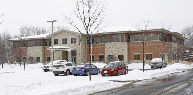
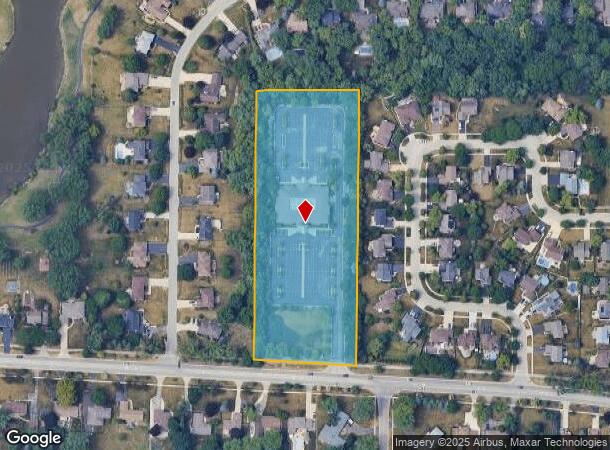
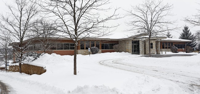
864 W Stearns Rd
01-03-307-089
Edgewood Estates
Commercialnec
E 300FT MEAS AT RT ANG TO E LN LYG N OF STEARNS RD SW1/4 SW1/4 /EX HWY DESC R97-68992/
X
DuPage
17043C0027J
Illinois
2024
5.45 AC
2024
Far Northwest
841316
Chicago
30,000 SF
Chicago-Naperville-Elgin, IL-IN
DEMOGRAPHICS near 864 W Stearns Rd
1 mile
3 mile
5 mile
2024 Total Population
7,438
68,404
190,773
2029 Population
7,257
66,542
185,486
Pop Growth 2024-2029
(2.43%)
(2.72%)
(2.77%)
Average Age
42
40
40
2024 Total Households
2,515
22,662
64,401
HH Growth 2024-2029
(2.70%)
(2.99%)
(3.05%)
Median Household Inc
$124,100
$103,569
$97,383
Avg Household Size
2.90
2.90
2.90
2024 Avg HH Vehicles
2.00
2.00
2.00
Median Home Value
$324,127
$278,113
$268,900
Median Year Built
1980
1985
1983
Nearby Places
Map Layers
Map Styles
 Street
 Aerial
Transit
 Traffic
 Biking
Places
Listings with unknown addresses are not visible on the map
- Restaurants
- Banks
- Shops
- Fitness
- Groceries
PUBLIC TRANSPORTATION
COMMUTER RAIL
Bartlett Station (Milwaukee District West Line - Northeast Illinois Regional Commuter Railroad (Metra))
Drive
Walk
Distance
Bartlett Station (Milwaukee District West Line - Northeast Illinois Regional Commuter Railroad (Metra))
7 min
2.6 mi
Hanover Park Station (Milwaukee District West Line - Northeast Illinois Regional Commuter Railroad (Metra))
Drive
Walk
Distance
Hanover Park Station (Milwaukee District West Line - Northeast Illinois Regional Commuter Railroad (Metra))
9 min
4.0 mi
AIRPORT
Chicago O'Hare International
Drive
Walk
Distance
Chicago O'Hare International
38 min
27.5 mi
Chicago Midway International
Drive
Walk
Distance
Chicago Midway International
51 min
33.7 mi
Nearby Properties
Address
Land Use
TOTAL SIZE
Lot Size
Zoning
Address
Land Use
TOTAL SIZE
Lot Size
Zoning
421,722 SF
34.61 AC
Address
Land Use
TOTAL SIZE
Lot Size
Zoning
400,000 SF
31.67 AC
I
Address
Land Use
TOTAL SIZE
Lot Size
Zoning
328,208 SF
5.62 AC
Address
Land Use
TOTAL SIZE
Lot Size
Zoning
300,000 SF
16.56 AC
I
Address
Land Use
TOTAL SIZE
Lot Size
Zoning
271,200 SF
14.23 AC
Address
Land Use
TOTAL SIZE
Lot Size
Zoning
272,606 SF
15.92 AC
I
Address
Land Use
TOTAL SIZE
Lot Size
Zoning
261,725 SF
15.88 AC
I
Address
Land Use
TOTAL SIZE
Lot Size
Zoning
94,497 SF
9.43 AC
C
Address
Land Use
TOTAL SIZE
Lot Size
Zoning
401,250 SF
73.98 AC
Address
Land Use
TOTAL SIZE
Lot Size
Zoning
64,182 SF
2.62 AC
Address
Land Use
TOTAL SIZE
Lot Size
Zoning
207,000 SF
11.72 AC
Address
Land Use
TOTAL SIZE
Lot Size
Zoning
348,500 SF
23.57 AC
Address
Land Use
TOTAL SIZE
Lot Size
Zoning
76,744 SF
2.41 AC
Address
Land Use
TOTAL SIZE
Lot Size
Zoning
207,000 SF
11.80 AC
Address
Land Use
TOTAL SIZE
Lot Size
Zoning
436,500 SF
Address
Land Use
TOTAL SIZE
Lot Size
Zoning
209,628 SF
11.44 AC
Address
Land Use
TOTAL SIZE
Lot Size
Zoning
423,726 SF
35.97 AC
Address
Land Use
TOTAL SIZE
Lot Size
Zoning
186,000 SF
10.50 AC
Address
Land Use
TOTAL SIZE
Lot Size
Zoning
Address
Land Use
TOTAL SIZE
Lot Size
Zoning
11,132 SF
2 AC
Address
Land Use
TOTAL SIZE
Lot Size
Zoning
167,449 SF
11.15 AC
Address
Land Use
TOTAL SIZE
Lot Size
Zoning
167,166 SF
12.85 AC
Address
Land Use
TOTAL SIZE
Lot Size
Zoning
462,984 SF
19 AC
Address
Land Use
TOTAL SIZE
Lot Size
Zoning
105,493 SF
16.26 AC
I
Address
Land Use
TOTAL SIZE
Lot Size
Zoning
123,484 SF
7.92 AC
Address
Land Use
TOTAL SIZE
Lot Size
Zoning
86,781 SF
8.80 AC
C
Address
Land Use
TOTAL SIZE
Lot Size
Zoning
154,730 SF
8.76 AC
Address
Land Use
TOTAL SIZE
Lot Size
Zoning
Address
Land Use
TOTAL SIZE
Lot Size
Zoning
115,673 SF
5.95 AC
I
Address
Land Use
TOTAL SIZE
Lot Size
Zoning
147,305 SF
9.25 AC
The World's #1 Commercial Real Estate Marketplace
Connect with us
© 2026 CoStar Group
The information above has been obtained from sources believed reliable. While we do not doubt its accuracy we have not verified it and make no guarantee, warranty or representation about it. It is your responsibility to independently confirm its accuracy and completeness. Any projections, opinions, assumptions, or estimates used are for example only and do not represent the current or future performance of the property. The value of this transaction to you depends on tax and other factors which should be evaluated by your tax, financial, and legal advisors. You and your advisors should conduct a careful, independent investigation of the property to determine to your satisfaction the suitability of the property for your needs.