Property Record
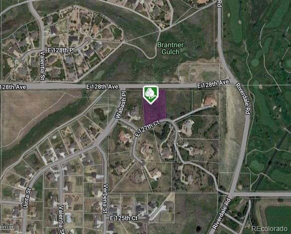
8645 E 127Th Ct, Brighton, CO 80602

Property Detail
8645 E 127Th Ct
Denver-Aurora-Centennial, CO
SUB:RIVERDALE PEAKS LOT:12
1571-33-0-13-002
Adams
Residentialacreage
Colorado
RE
12
A Areas with a 1% annual chance of flooding and a 26% chance of flooding over the life of a 30-year mortgage.
2.33 AC
2024
Northeast Denver
2025
Denver
008551
NEARBY LISTINGS FOR SALE OR LEASE
DEMOGRAPHICS near 8645 E 127Th Ct
1 mile
3 mile
5 mile
2025 Total Population
4,108
58,282
153,128
2030 Population
4,340
60,488
159,432
Pop Growth 2025-2030
+ 5.65%
+ 3.79%
+ 4.12%
Average Age
36
38
37
2025 Total Households
1,245
19,139
52,269
HH Growth 2025-2030
+ 5.94%
+ 4.09%
+ 4.48%
Median Household Inc
$164,339
$129,801
$118,036
Avg Household Size
3.30
3.00
2.90
2025 Avg HH Vehicles
3.00
2.00
2.00
Median Home Value
$728,795
$621,352
$595,538
Median Year Built
2010
2002
2000
Nearby Places
Map Layers
Map Styles
 Street
 Aerial
Layers
 Traffic
 Biking
Places
Listings with unknown addresses are not visible on the map
- Restaurants
- Banks
- Shops
- Fitness
- Groceries
PUBLIC TRANSPORTATION
COMMUTER RAIL
Drive
Walk
Distance
9 min
4.5 mi
Drive
Walk
Distance
11 min
5.4 mi
AIRPORT
Denver International
Drive
Walk
Distance
Denver International
27 min
19.7 mi
SALE & LEASE HISTORY
LISTING DATE
SALE/LEASE

Mar 14, 2023
For Sale
Nearby Properties
Address
Land Use
TOTAL SIZE
Lot Size
Zoning
Address
Land Use
TOTAL SIZE
Lot Size
Zoning
8,556 SF
382.73 AC
A3
Address
Land Use
TOTAL SIZE
Lot Size
Zoning
358,386 SF
76.08 AC
Address
Land Use
TOTAL SIZE
Lot Size
Zoning
290,566 SF
54.61 AC
Address
Land Use
TOTAL SIZE
Lot Size
Zoning
330,176 SF
17.12 AC
Address
Land Use
TOTAL SIZE
Lot Size
Zoning
153,301 SF
26.75 AC
Address
Land Use
TOTAL SIZE
Lot Size
Zoning
109,685 SF
11.51 AC
Address
Land Use
TOTAL SIZE
Lot Size
Zoning
64,750 SF
11.91 AC
Address
Land Use
TOTAL SIZE
Lot Size
Zoning
86,977 SF
4.14 AC
Address
Land Use
TOTAL SIZE
Lot Size
Zoning
158,001 SF
20.40 AC
Address
Land Use
TOTAL SIZE
Lot Size
Zoning
67,395 SF
13.38 AC
Address
Land Use
TOTAL SIZE
Lot Size
Zoning
96,628 SF
4.35 AC
Address
Land Use
TOTAL SIZE
Lot Size
Zoning
174.45 AC
Address
Land Use
TOTAL SIZE
Lot Size
Zoning
207,453 SF
26.66 AC
Address
Land Use
TOTAL SIZE
Lot Size
Zoning
121,275 SF
6.56 AC
Address
Land Use
TOTAL SIZE
Lot Size
Zoning
48,359 SF
278.79 AC
A3
Address
Land Use
TOTAL SIZE
Lot Size
Zoning
2,796 SF
134 AC
Address
Land Use
TOTAL SIZE
Lot Size
Zoning
65,462 SF
7.06 AC
Address
Land Use
TOTAL SIZE
Lot Size
Zoning
106,530 SF
7.04 AC
Address
Land Use
TOTAL SIZE
Lot Size
Zoning
70,573 SF
6.42 AC
Address
Land Use
TOTAL SIZE
Lot Size
Zoning
176,222 SF
7.99 AC
Address
Land Use
TOTAL SIZE
Lot Size
Zoning
63,602 SF
10.09 AC
Address
Land Use
TOTAL SIZE
Lot Size
Zoning
62,418 SF
23.44 AC
Address
Land Use
TOTAL SIZE
Lot Size
Zoning
89,219 SF
11.79 AC
Address
Land Use
TOTAL SIZE
Lot Size
Zoning
56,697 SF
9.97 AC
PUD
Address
Land Use
TOTAL SIZE
Lot Size
Zoning
55,810 SF
14.52 AC
Address
Land Use
TOTAL SIZE
Lot Size
Zoning
82,239 SF
7.02 AC
Address
Land Use
TOTAL SIZE
Lot Size
Zoning
75,398 SF
8.82 AC
I2
Address
Land Use
TOTAL SIZE
Lot Size
Zoning
106.69 AC
RE
Address
Land Use
TOTAL SIZE
Lot Size
Zoning
44,215 SF
21.32 AC
Address
Land Use
TOTAL SIZE
Lot Size
Zoning
42,177 SF
17.73 AC
A3
The World's #1 Commercial Real Estate Marketplace
Connect with us
© 2026 CoStar Group
The information above has been obtained from sources believed reliable. While we do not doubt its accuracy we have not verified it and make no guarantee, warranty or representation about it. It is your responsibility to independently confirm its accuracy and completeness. Any projections, opinions, assumptions, or estimates used are for example only and do not represent the current or future performance of the property. The value of this transaction to you depends on tax and other factors which should be evaluated by your tax, financial, and legal advisors. You and your advisors should conduct a careful, independent investigation of the property to determine to your satisfaction the suitability of the property for your needs.