Property Record
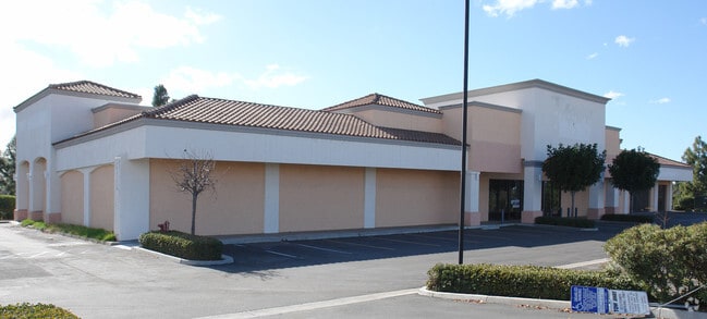
865 E H St, Chula Vista, CA 91910


Property Detail
865 E H St
640-292-39
LOT 4 TR 013032
Regionalshoppingcenterormallwithanchorstore
San Diego
PC2C1
California
B and X Area of moderate flood hazard, usually the area between the limits of the 100-year and 500-year floods.
4
2024
1.21 AC
2025
Chula Vista
013420
San Diego
14,271 SF
San Diego-Chula Vista-Carlsbad, CA
NEARBY LISTINGS FOR SALE OR LEASE
DEMOGRAPHICS near 865 E H St
1 mile
3 mile
5 mile
2025 Total Population
15,645
153,879
435,017
2030 Population
15,439
153,712
435,155
Pop Growth 2025-2030
(1.32%)
(0.11%)
+ 0.03%
Average Age
41
39
39
2025 Total Households
4,725
46,121
129,468
HH Growth 2025-2030
(1.65%)
(0.30%)
(0.12%)
Median Household Inc
$132,758
$121,760
$101,344
Avg Household Size
3.20
3.20
3.20
2025 Avg HH Vehicles
3.00
2.00
2.00
Median Home Value
$812,197
$774,793
$736,886
Median Year Built
1989
1982
1980
Nearby Places
Map Layers
Map Styles
 Street
 Aerial
Layers
 Traffic
 Biking
Places
Listings with unknown addresses are not visible on the map
- Restaurants
- Banks
- Shops
- Fitness
- Groceries
PUBLIC TRANSPORTATION
AIRPORT
San Diego International
Drive
Walk
Distance
San Diego International
22 min
14.8 mi
SALE & LEASE HISTORY
LISTING DATE
SALE/LEASE

Apr 10, 2018
For Lease
Nearby Properties
Address
Land Use
TOTAL SIZE
Lot Size
Zoning
Address
Land Use
TOTAL SIZE
Lot Size
Zoning
16.49 AC
COP
Address
Land Use
TOTAL SIZE
Lot Size
Zoning
6.55 AC
MXD-2
Address
Land Use
TOTAL SIZE
Lot Size
Zoning
9.93 AC
PC15RM2
Address
Land Use
TOTAL SIZE
Lot Size
Zoning
14.59 AC
PC9RC
Address
Land Use
TOTAL SIZE
Lot Size
Zoning
Address
Land Use
TOTAL SIZE
Lot Size
Zoning
8.89 AC
PC15RM2
Address
Land Use
TOTAL SIZE
Lot Size
Zoning
9,999 SF
7.04 AC
R-3
Address
Land Use
TOTAL SIZE
Lot Size
Zoning
9,999 SF
18.26 AC
PC10RM2
Address
Land Use
TOTAL SIZE
Lot Size
Zoning
8.56 AC
PC10RM2
Address
Land Use
TOTAL SIZE
Lot Size
Zoning
67,372 SF
4.67 AC
PC10C/RM2/
Address
Land Use
TOTAL SIZE
Lot Size
Zoning
7.67 AC
R-4
Address
Land Use
TOTAL SIZE
Lot Size
Zoning
5.85 AC
PC15RM2
Address
Land Use
TOTAL SIZE
Lot Size
Zoning
8.79 AC
R3
Address
Land Use
TOTAL SIZE
Lot Size
Zoning
7.41 AC
40
Address
Land Use
TOTAL SIZE
Lot Size
Zoning
7.60 AC
PC10RM2
Address
Land Use
TOTAL SIZE
Lot Size
Zoning
6.94 AC
PC10RM2
Address
Land Use
TOTAL SIZE
Lot Size
Zoning
10.34 AC
PC15RM2
Address
Land Use
TOTAL SIZE
Lot Size
Zoning
68,471 SF
4.31 AC
PC11MU
Address
Land Use
TOTAL SIZE
Lot Size
Zoning
5.18 AC
PC15RM2
Address
Land Use
TOTAL SIZE
Lot Size
Zoning
97,298 SF
10 AC
COP
Address
Land Use
TOTAL SIZE
Lot Size
Zoning
6.32 AC
PC10RM2
Address
Land Use
TOTAL SIZE
Lot Size
Zoning
34,200 SF
1.38 AC
CCPD-R
Address
Land Use
TOTAL SIZE
Lot Size
Zoning
5.50 AC
R-4
Address
Land Use
TOTAL SIZE
Lot Size
Zoning
5.76 AC
PC15RM2
Address
Land Use
TOTAL SIZE
Lot Size
Zoning
8.42 AC
PC2RC
Address
Land Use
TOTAL SIZE
Lot Size
Zoning
7.96 AC
PC9RM
Address
Land Use
TOTAL SIZE
Lot Size
Zoning
4.80 AC
MXD-2
Address
Land Use
TOTAL SIZE
Lot Size
Zoning
1.05 AC
C-1
Address
Land Use
TOTAL SIZE
Lot Size
Zoning
9.44 AC
PC
Address
Land Use
TOTAL SIZE
Lot Size
Zoning
5.91 AC
PC2RC
The World's #1 Commercial Real Estate Marketplace
Connect with us
© 2026 CoStar Group
The information above has been obtained from sources believed reliable. While we do not doubt its accuracy we have not verified it and make no guarantee, warranty or representation about it. It is your responsibility to independently confirm its accuracy and completeness. Any projections, opinions, assumptions, or estimates used are for example only and do not represent the current or future performance of the property. The value of this transaction to you depends on tax and other factors which should be evaluated by your tax, financial, and legal advisors. You and your advisors should conduct a careful, independent investigation of the property to determine to your satisfaction the suitability of the property for your needs.