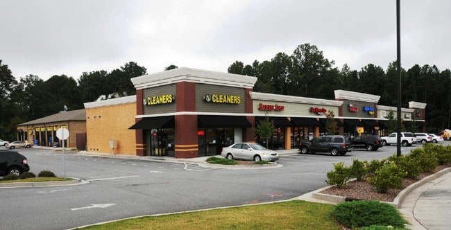
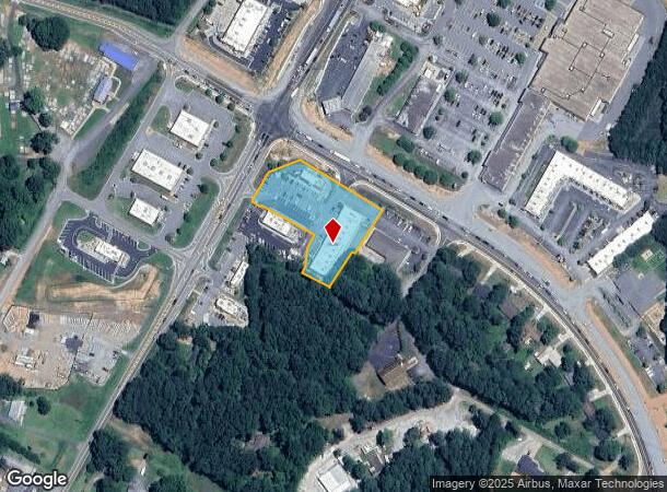
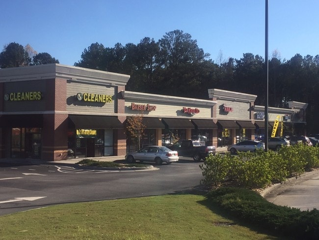
Property Record
8651 Hiram Acworth Hwy, Dallas, GA 30157
NEARBY LISTINGS FOR SALE OR LEASE
Property Detail
8651 Hiram Acworth Hwy
Atlanta-Sandy Springs-Roswell, GA
Commercial Nh County
055.4.4.028.0000
REAL PROPERTY
Restaurantdrivein
Paulding
X
Georgia
13223C0044C
687
2024
1.59 AC
2024
Paulding Cnty/Dallas
120109
Atlanta
14,438 SF
DEMOGRAPHICS near 8651 Hiram Acworth Hwy
1 Mile
3 Mile
5 Mile
2024 Total Population
4,677
44,082
94,381
2029 Population
5,369
48,986
103,668
Pop Growth 2024-2029
+ 14.80%
+ 11.12%
+ 9.84%
Average Age
36
37
38
2024 Total Households
1,464
13,725
30,145
HH Growth 2024-2029
+ 14.82%
+ 11.15%
+ 9.80%
Median Household Inc
$113,580
$126,451
$124,002
Avg Household Size
3.10
3.20
3.10
2024 Avg HH Vehicles
2.00
2.00
2.00
Median Home Value
$310,985
$347,839
$346,793
Median Year Built
2004
2003
2001
Nearby Places
- Restaurants
- Banks
- Shops
- Fitness
- Groceries
SALE & LEASE HISTORY
LISTING DATE
SALE/LEASE

Sep 25, 2016
For Lease
Jan 20, 2017
For Lease
Jan 09, 2017
For Lease
Nearby Properties
Address
Land Use
TOTAL SIZE
Lot Size
Zoning
Address
Land Use
TOTAL SIZE
Lot Size
Zoning
Address
Land Use
TOTAL SIZE
Lot Size
Zoning
Address
Land Use
TOTAL SIZE
Lot Size
Zoning
2,584 SF
6.20 AC
RSL
Address
Land Use
TOTAL SIZE
Lot Size
Zoning
78,984 SF
17.01 AC
B1
Address
Land Use
TOTAL SIZE
Lot Size
Zoning
70,038 SF
8.67 AC
B2
Address
Land Use
TOTAL SIZE
Lot Size
Zoning
62,292 SF
8.41 AC
GC/WS
Address
Land Use
TOTAL SIZE
Lot Size
Zoning
30,804 SF
2.29 AC
B2
Address
Land Use
TOTAL SIZE
Lot Size
Zoning
38,652 SF
1.07 AC
B1
Address
Land Use
TOTAL SIZE
Lot Size
Zoning
30,600 SF
4.28 AC
B2
Address
Land Use
TOTAL SIZE
Lot Size
Zoning
58,100 SF
6.74 AC
B2
Address
Land Use
TOTAL SIZE
Lot Size
Zoning
13,546 SF
1.49 AC
NB
Address
Land Use
TOTAL SIZE
Lot Size
Zoning
33,778 SF
59.02 AC
PD
Address
Land Use
TOTAL SIZE
Lot Size
Zoning
17,426 SF
20.97 AC
Address
Land Use
TOTAL SIZE
Lot Size
Zoning
17,253 SF
3.45 AC
B1
Address
Land Use
TOTAL SIZE
Lot Size
Zoning
80,550 SF
7.87 AC
B2
Address
Land Use
TOTAL SIZE
Lot Size
Zoning
16,250 SF
2.34 AC
B1
Address
Land Use
TOTAL SIZE
Lot Size
Zoning
32,223 SF
3.91 AC
B2
Address
Land Use
TOTAL SIZE
Lot Size
Zoning
766.99 AC
Address
Land Use
TOTAL SIZE
Lot Size
Zoning
17,610 SF
2.47 AC
B2
Address
Land Use
TOTAL SIZE
Lot Size
Zoning
20,940 SF
4.15 AC
B1
Address
Land Use
TOTAL SIZE
Lot Size
Zoning
Address
Land Use
TOTAL SIZE
Lot Size
Zoning
3.29 AC
GC/O&I
Address
Land Use
TOTAL SIZE
Lot Size
Zoning
11,042 SF
2 AC
B1
Address
Land Use
TOTAL SIZE
Lot Size
Zoning
30,106 SF
6.72 AC
B1
Address
Land Use
TOTAL SIZE
Lot Size
Zoning
14,000 SF
1.96 AC
GC/O&I
Address
Land Use
TOTAL SIZE
Lot Size
Zoning
17,538 SF
2.74 AC
B1
Address
Land Use
TOTAL SIZE
Lot Size
Zoning
10,190 SF
1.33 AC
GC
Address
Land Use
TOTAL SIZE
Lot Size
Zoning
10,720 SF
7.45 AC
B2-70
Address
Land Use
TOTAL SIZE
Lot Size
Zoning
15,022 SF
2.34 AC
NRC
The World's #1 Commercial Real Estate Marketplace
Connect with us
© 2025 CoStar Group
The information above has been obtained from sources believed reliable. While we do not doubt its accuracy we have not verified it and make no guarantee, warranty or representation about it. It is your responsibility to independently confirm its accuracy and completeness. Any projections, opinions, assumptions, or estimates used are for example only and do not represent the current or future performance of the property. The value of this transaction to you depends on tax and other factors which should be evaluated by your tax, financial, and legal advisors. You and your advisors should conduct a careful, independent investigation of the property to determine to your satisfaction the suitability of the property for your needs.