Property Record
8652 Jake Carlton Rd, Yulee, FL 32097


NEARBY LISTINGS FOR SALE OR LEASE
-
-
View all Yulee listings for sale on LoopNet.com
Property Detail
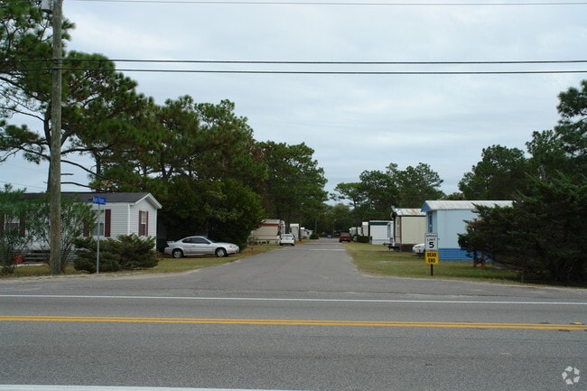
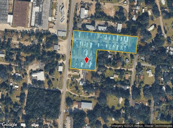
8652 Jake Carlton Rd
Jacksonville, FL
Yulee Farms Unit 4
42-2N-27-4600-0001-0010
N 50 FT OF W 300 FT OF LOT 1 & WEST 300 FT OF LOT 2,LOT 3, & S 58 FT OF LOT 4 IN OR 2561/1618 YULEE FARMS UNIT 4 PBK 3/32
Parkinglot
Nassau
X
Florida
12031C0055J
1
2023
5.24 AC
2025
Nassau County
050304
Jacksonville (Florida)
17,209 SF
DEMOGRAPHICS near 8652 Jake Carlton Rd
1 Mile
3 Mile
5 Mile
2024 Total Population
3,524
14,671
36,101
2029 Population
4,277
17,821
43,418
Pop Growth 2024-2029
+ 21.37%
+ 21.47%
+ 20.27%
Average Age
39
41
41
2024 Total Households
1,269
5,492
13,486
HH Growth 2024-2029
+ 22.70%
+ 22.72%
+ 21.48%
Median Household Inc
$72,633
$73,952
$81,396
Avg Household Size
2.70
2.60
2.60
2024 Avg HH Vehicles
2.00
2.00
2.00
Median Home Value
$246,146
$267,042
$285,610
Median Year Built
2006
2005
2007
Nearby Places
Map Layers
Map Styles
 Street
 Aerial
- Restaurants
- Banks
- Shops
- Fitness
- Groceries
PUBLIC TRANSPORTATION
AIRPORT
Jacksonville International
DRIVE
WALK
Distance
Jacksonville International
21 min
11.9 mi
Freight Ports
Jacksonville Port
DRIVE
WALK
Distance
Jacksonville Port
31 min
22.2 mi
Nearby Properties
Address
Land Use
TOTAL SIZE
Lot Size
Zoning
Address
Land Use
TOTAL SIZE
Lot Size
Zoning
249,913 SF
160.04 AC
OR
Address
Land Use
TOTAL SIZE
Lot Size
Zoning
297,748 SF
92.23 AC
OR
Address
Land Use
TOTAL SIZE
Lot Size
Zoning
291,580 SF
12.56 AC
PD - ENCPA
Address
Land Use
TOTAL SIZE
Lot Size
Zoning
327,682 SF
24.09 AC
RG-2
Address
Land Use
TOTAL SIZE
Lot Size
Zoning
493,661 SF
49.08 AC
PUD
Address
Land Use
TOTAL SIZE
Lot Size
Zoning
91,196 SF
86.52 AC
OR
Address
Land Use
TOTAL SIZE
Lot Size
Zoning
112,634 SF
16 AC
GPU
Address
Land Use
TOTAL SIZE
Lot Size
Zoning
83,799 SF
13.18 AC
PD - ENCPA
Address
Land Use
TOTAL SIZE
Lot Size
Zoning
42,189 SF
7.69 AC
PD - ENCPA
Address
Land Use
TOTAL SIZE
Lot Size
Zoning
92,327 SF
22.06 AC
OR
Address
Land Use
TOTAL SIZE
Lot Size
Zoning
23,934 SF
20.45 AC
CN
Address
Land Use
TOTAL SIZE
Lot Size
Zoning
13,472 SF
Address
Land Use
TOTAL SIZE
Lot Size
Zoning
81,960 SF
2.90 AC
PD - ENCPA
Address
Land Use
TOTAL SIZE
Lot Size
Zoning
59,703 SF
12.06 AC
GPU
Address
Land Use
TOTAL SIZE
Lot Size
Zoning
48,863 SF
40.38 AC
RG-1
Address
Land Use
TOTAL SIZE
Lot Size
Zoning
12,594 SF
Address
Land Use
TOTAL SIZE
Lot Size
Zoning
25,920 SF
14.72 AC
GPU
Address
Land Use
TOTAL SIZE
Lot Size
Zoning
89.52 AC
PD - ENCPA
Address
Land Use
TOTAL SIZE
Lot Size
Zoning
95,332 SF
23.03 AC
PUD
Address
Land Use
TOTAL SIZE
Lot Size
Zoning
83.12 AC
PD - ENCPA
Address
Land Use
TOTAL SIZE
Lot Size
Zoning
18,750 SF
4.58 AC
CI
Address
Land Use
TOTAL SIZE
Lot Size
Zoning
18,276 SF
1.57 AC
PD - ENCPA
Address
Land Use
TOTAL SIZE
Lot Size
Zoning
12,927 SF
8.03 AC
OR
Address
Land Use
TOTAL SIZE
Lot Size
Zoning
48,321 SF
8.18 AC
IW
Address
Land Use
TOTAL SIZE
Lot Size
Zoning
1,491 SF
129.83 AC
RSF-2
Address
Land Use
TOTAL SIZE
Lot Size
Zoning
6,285 SF
Address
Land Use
TOTAL SIZE
Lot Size
Zoning
25,635 SF
4.24 AC
CI
Address
Land Use
TOTAL SIZE
Lot Size
Zoning
19,000 SF
21.27 AC
PUD
Address
Land Use
TOTAL SIZE
Lot Size
Zoning
11,598 SF
1.03 AC
PD - ENCPA
Address
Land Use
TOTAL SIZE
Lot Size
Zoning
7.40 AC
CHT
The World's #1 Commercial Real Estate Marketplace
Connect with us
© 2025 CoStar Group
The information above has been obtained from sources believed reliable. While we do not doubt its accuracy we have not verified it and make no guarantee, warranty or representation about it. It is your responsibility to independently confirm its accuracy and completeness. Any projections, opinions, assumptions, or estimates used are for example only and do not represent the current or future performance of the property. The value of this transaction to you depends on tax and other factors which should be evaluated by your tax, financial, and legal advisors. You and your advisors should conduct a careful, independent investigation of the property to determine to your satisfaction the suitability of the property for your needs.