Property Record
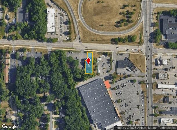
866 3 Mile Rd Nw, Grand Rapids, MI 49544


NEARBY LISTINGS FOR SALE OR LEASE
Property Detail
866 3 Mile Rd Nw
41-13-11-228-045
411311228045 N 132 FT OF E 50 FT OF W 742.50 FT OF NE 1/4 NE 1/4 EX N 50 FT ALSO S 132 FT OF N 264 FT OF E 75.0 FT OF W
Officebuilding
Kent
X
Michigan
26081C0289D
0.38 AC
2024
Central Grand Rapids
2025
West Michigan
011502
Grand Rapids-Wyoming, MI
2,795 SF
DEMOGRAPHICS near 866 3 Mile Rd Nw
1 Mile
3 Mile
5 Mile
2024 Total Population
4,497
68,050
167,501
2029 Population
4,505
68,082
168,110
Pop Growth 2024-2029
+ 0.18%
+ 0.05%
+ 0.36%
Average Age
39
37
37
2024 Total Households
1,978
28,768
71,454
HH Growth 2024-2029
+ 0.25%
+ 0.12%
+ 0.45%
Median Household Inc
$66,713
$60,776
$63,688
Avg Household Size
2.20
2.30
2.30
2024 Avg HH Vehicles
2.00
2.00
2.00
Median Home Value
$220,342
$201,814
$223,164
Median Year Built
1977
1958
1961
Nearby Places
Map Layers
Map Styles
 Street
 Aerial
- Restaurants
- Banks
- Shops
- Fitness
- Groceries
PUBLIC TRANSPORTATION
COMMUTER RAIL
DRIVE
WALK
Distance
8 min
5.0 mi
AIRPORT
Gerald R Ford International
DRIVE
WALK
Distance
Gerald R Ford International
26 min
18.1 mi
SALE & LEASE HISTORY
LISTING DATE
SALE/LEASE

Mar 08, 2019
For Lease
Feb 01, 2021
For Lease
Nearby Properties
Address
Land Use
TOTAL SIZE
Lot Size
Zoning
Address
Land Use
TOTAL SIZE
Lot Size
Zoning
226,925 SF
1.32 AC
TN-CC
Address
Land Use
TOTAL SIZE
Lot Size
Zoning
537,080 SF
46.61 AC
RPUD - 2
Address
Land Use
TOTAL SIZE
Lot Size
Zoning
352,362 SF
61.33 AC
IPUD
Address
Land Use
TOTAL SIZE
Lot Size
Zoning
546,366 SF
28.40 AC
MH
Address
Land Use
TOTAL SIZE
Lot Size
Zoning
451,792 SF
32.60 AC
ARM - MULT
Address
Land Use
TOTAL SIZE
Lot Size
Zoning
455,639 SF
42.06 AC
MH
Address
Land Use
TOTAL SIZE
Lot Size
Zoning
Address
Land Use
TOTAL SIZE
Lot Size
Zoning
340,744 SF
69.50 AC
RPUD - 2
Address
Land Use
TOTAL SIZE
Lot Size
Zoning
337,324 SF
10.15 AC
C-3
Address
Land Use
TOTAL SIZE
Lot Size
Zoning
Address
Land Use
TOTAL SIZE
Lot Size
Zoning
278,832 SF
NOT APP
Address
Land Use
TOTAL SIZE
Lot Size
Zoning
18.65 AC
MCN-MDR
Address
Land Use
TOTAL SIZE
Lot Size
Zoning
68,560 SF
2.76 AC
TN-TCC
Address
Land Use
TOTAL SIZE
Lot Size
Zoning
33.06 AC
R-3
Address
Land Use
TOTAL SIZE
Lot Size
Zoning
0.92 AC
TN-CC
Address
Land Use
TOTAL SIZE
Lot Size
Zoning
183,517 SF
44.93 AC
ML
Address
Land Use
TOTAL SIZE
Lot Size
Zoning
190,882 SF
30.17 AC
MP
Address
Land Use
TOTAL SIZE
Lot Size
Zoning
670,966 SF
40.67 AC
C-3
Address
Land Use
TOTAL SIZE
Lot Size
Zoning
Address
Land Use
TOTAL SIZE
Lot Size
Zoning
136,468 SF
13.34 AC
CPUD
Address
Land Use
TOTAL SIZE
Lot Size
Zoning
165,184 SF
14.85 AC
CPUD
Address
Land Use
TOTAL SIZE
Lot Size
Zoning
32.63 AC
R-3
Address
Land Use
TOTAL SIZE
Lot Size
Zoning
81,421 SF
1.44 AC
TN-TCC
Address
Land Use
TOTAL SIZE
Lot Size
Zoning
116,764 SF
0.98 AC
TN-CC
Address
Land Use
TOTAL SIZE
Lot Size
Zoning
214,046 SF
31.31 AC
C-2
Address
Land Use
TOTAL SIZE
Lot Size
Zoning
118,085 SF
10.94 AC
CPUD
Address
Land Use
TOTAL SIZE
Lot Size
Zoning
332,315 SF
17.71 AC
MP
Address
Land Use
TOTAL SIZE
Lot Size
Zoning
113,950 SF
0.84 AC
TN-TCC
Address
Land Use
TOTAL SIZE
Lot Size
Zoning
250,469 SF
14.11 AC
ML
Address
Land Use
TOTAL SIZE
Lot Size
Zoning
69,764 SF
3.18 AC
TN-TCC
The World's #1 Commercial Real Estate Marketplace
Connect with us
© 2025 CoStar Group
The information above has been obtained from sources believed reliable. While we do not doubt its accuracy we have not verified it and make no guarantee, warranty or representation about it. It is your responsibility to independently confirm its accuracy and completeness. Any projections, opinions, assumptions, or estimates used are for example only and do not represent the current or future performance of the property. The value of this transaction to you depends on tax and other factors which should be evaluated by your tax, financial, and legal advisors. You and your advisors should conduct a careful, independent investigation of the property to determine to your satisfaction the suitability of the property for your needs.