Property Record
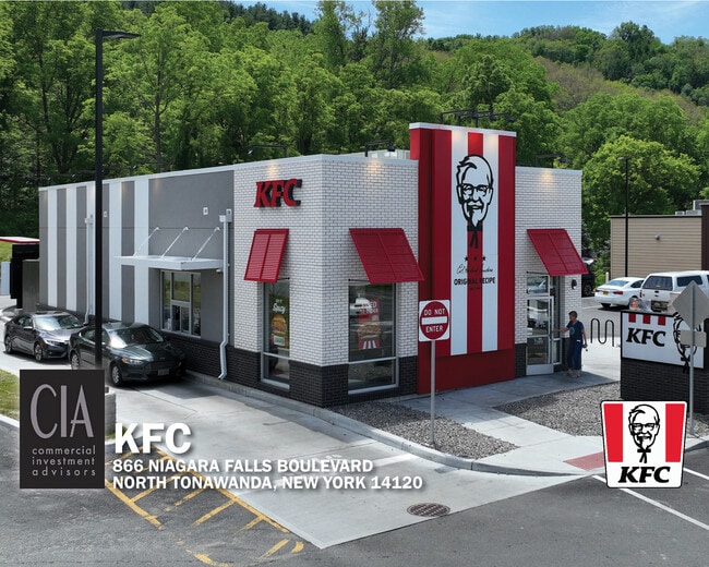
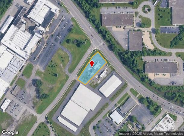
866 Niagara Falls Blvd, North Tonawanda, NY 14120
NEARBY LISTINGS FOR SALE OR LEASE
Property Detail
866 Niagara Falls Blvd
291200-176-016-0002-054-011
Quick Service Realco
Restaurantdrivein
Niagara
X
New York
36029C0062H
54.011
2025
0.82 AC
2024
North
022804
Buffalo/Niagara Falls
2,200 SF
Buffalo-Cheektowaga-Niagara Falls, NY
DEMOGRAPHICS near 866 Niagara Falls Blvd
1 Mile
3 Mile
5 Mile
2024 Total Population
7,537
46,205
118,882
2029 Population
7,378
45,263
117,548
Pop Growth 2024-2029
(2.11%)
(2.04%)
(1.12%)
Average Age
45
43
42
2024 Total Households
3,165
19,975
49,669
HH Growth 2024-2029
(2.15%)
(2.07%)
(1.13%)
Median Household Inc
$80,617
$70,028
$67,894
Avg Household Size
2.30
2.30
2.20
2024 Avg HH Vehicles
2.00
2.00
2.00
Median Home Value
$188,074
$180,317
$186,136
Median Year Built
1965
1960
1964
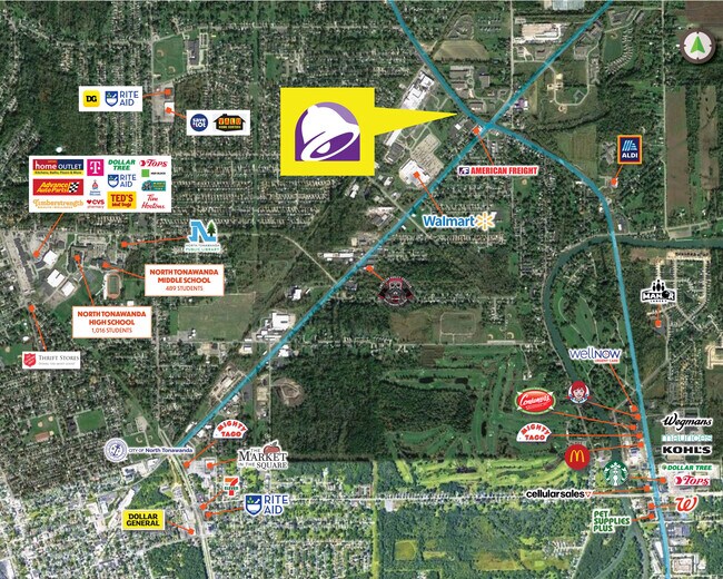
Nearby Places
- Restaurants
- Banks
- Shops
- Fitness
- Groceries
PUBLIC TRANSPORTATION
AIRPORT
Niagara Falls International
DRIVE
WALK
Distance
Niagara Falls International
11 min
6.3 mi
Buffalo Niagara International
DRIVE
WALK
Distance
Buffalo Niagara International
23 min
12.3 mi
Freight Ports
Port of Toledo
DRIVE
WALK
Distance
Port of Toledo
377 min
316.9 mi
SALE & LEASE HISTORY
LISTING DATE
SALE/LEASE

Oct 05, 2022
For Sale
Dec 05, 2022
For Sale
Aug 12, 2022
For Sale
Nearby Properties
Address
Land Use
TOTAL SIZE
Lot Size
Zoning
Address
Land Use
TOTAL SIZE
Lot Size
Zoning
5,472 SF
70.10 AC
Address
Land Use
TOTAL SIZE
Lot Size
Zoning
223,916 SF
8.25 AC
R-C
Address
Land Use
TOTAL SIZE
Lot Size
Zoning
4,707 SF
13.60 AC
WD NT
Address
Land Use
TOTAL SIZE
Lot Size
Zoning
11,248 SF
21.70 AC
MFR-5
Address
Land Use
TOTAL SIZE
Lot Size
Zoning
173,303 SF
24.40 AC
R1-2
Address
Land Use
TOTAL SIZE
Lot Size
Zoning
112,256 SF
38.33 AC
00000
Address
Land Use
TOTAL SIZE
Lot Size
Zoning
96,554 SF
10.90 AC
Address
Land Use
TOTAL SIZE
Lot Size
Zoning
270,320 SF
12.20 AC
Address
Land Use
TOTAL SIZE
Lot Size
Zoning
137,878 SF
23.60 AC
R1-2
Address
Land Use
TOTAL SIZE
Lot Size
Zoning
Address
Land Use
TOTAL SIZE
Lot Size
Zoning
Address
Land Use
TOTAL SIZE
Lot Size
Zoning
97,580 SF
8.43 AC
Address
Land Use
TOTAL SIZE
Lot Size
Zoning
175,793 SF
27.30 AC
M-1
Address
Land Use
TOTAL SIZE
Lot Size
Zoning
137,200 SF
3.56 AC
WD
Address
Land Use
TOTAL SIZE
Lot Size
Zoning
28,448 SF
4.30 AC
GB
Address
Land Use
TOTAL SIZE
Lot Size
Zoning
1,323 SF
26.39 AC
R-2
Address
Land Use
TOTAL SIZE
Lot Size
Zoning
98,114 SF
7 AC
Address
Land Use
TOTAL SIZE
Lot Size
Zoning
57,000 SF
4.02 AC
Address
Land Use
TOTAL SIZE
Lot Size
Zoning
96,458 SF
7.94 AC
GB
Address
Land Use
TOTAL SIZE
Lot Size
Zoning
67,285 SF
6.73 AC
RD
Address
Land Use
TOTAL SIZE
Lot Size
Zoning
47,400 SF
10.03 AC
MS
Address
Land Use
TOTAL SIZE
Lot Size
Zoning
34,100 SF
15.75 AC
C-1
Address
Land Use
TOTAL SIZE
Lot Size
Zoning
51,232 SF
2.55 AC
WD
Address
Land Use
TOTAL SIZE
Lot Size
Zoning
51,232 SF
1.62 AC
WD
Address
Land Use
TOTAL SIZE
Lot Size
Zoning
217,735 SF
34.80 AC
Address
Land Use
TOTAL SIZE
Lot Size
Zoning
125,869 SF
6.82 AC
RD
Address
Land Use
TOTAL SIZE
Lot Size
Zoning
39,654 SF
4.33 AC
R-2
Address
Land Use
TOTAL SIZE
Lot Size
Zoning
28,960 SF
5.83 AC
Address
Land Use
TOTAL SIZE
Lot Size
Zoning
74,511 SF
6 AC
Address
Land Use
TOTAL SIZE
Lot Size
Zoning
352 SF
16.90 AC
RD
The World's #1 Commercial Real Estate Marketplace
Connect with us
© 2025 CoStar Group
The information above has been obtained from sources believed reliable. While we do not doubt its accuracy we have not verified it and make no guarantee, warranty or representation about it. It is your responsibility to independently confirm its accuracy and completeness. Any projections, opinions, assumptions, or estimates used are for example only and do not represent the current or future performance of the property. The value of this transaction to you depends on tax and other factors which should be evaluated by your tax, financial, and legal advisors. You and your advisors should conduct a careful, independent investigation of the property to determine to your satisfaction the suitability of the property for your needs.