Property Record
8680 Highway 72 W, Madison, AL 35758


NEARBY LISTINGS FOR SALE OR LEASE
Property Detail
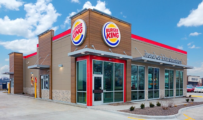
8680 Highway 72 W
Huntsville, AL
Colonial Promenade Huntsville
15-09-30-1-000-068.007
LOT 4B COLONIAL PROMENADE HUNTSVILLE PHASE 2 PB # 20120425000248340
Restaurantdrivein
Madison
X
Alabama
01089C0282E
4b
2025
1.33 AC
2025
North Huntsville
010612
Huntsville
3,474 SF
DEMOGRAPHICS near 8680 Highway 72 W
1 Mile
3 Mile
5 Mile
2024 Total Population
8,909
43,962
105,708
2029 Population
10,108
49,409
118,772
Pop Growth 2024-2029
+ 13.46%
+ 12.39%
+ 12.36%
Average Age
39
39
39
2024 Total Households
3,300
15,761
40,628
HH Growth 2024-2029
+ 14.12%
+ 12.92%
+ 12.71%
Median Household Inc
$101,822
$115,244
$104,532
Avg Household Size
2.60
2.70
2.60
2024 Avg HH Vehicles
2.00
2.00
2.00
Median Home Value
$270,389
$294,245
$289,201
Median Year Built
2006
2002
2001
Nearby Places
Map Layers
Map Styles
 Street
 Aerial
- Restaurants
- Banks
- Shops
- Fitness
- Groceries
PUBLIC TRANSPORTATION
AIRPORT
Huntsville International-Carl T Jones Field
DRIVE
WALK
Distance
Huntsville International-Carl T Jones Field
20 min
10.3 mi
Freight Ports
Port of Mobile
DRIVE
WALK
Distance
Port of Mobile
386 min
349.3 mi
SALE & LEASE HISTORY
LISTING DATE
SALE/LEASE

Mar 12, 2024
For Sale
Nearby Properties
Address
Land Use
TOTAL SIZE
Lot Size
Zoning
Address
Land Use
TOTAL SIZE
Lot Size
Zoning
25,692 SF
11.77 AC
Address
Land Use
TOTAL SIZE
Lot Size
Zoning
14,008 SF
19 AC
Address
Land Use
TOTAL SIZE
Lot Size
Zoning
7,055 SF
19 AC
Address
Land Use
TOTAL SIZE
Lot Size
Zoning
3,746 SF
22.08 AC
Address
Land Use
TOTAL SIZE
Lot Size
Zoning
8,868 SF
25 AC
Address
Land Use
TOTAL SIZE
Lot Size
Zoning
3,363 SF
26.88 AC
Address
Land Use
TOTAL SIZE
Lot Size
Zoning
9,138 SF
27 AC
Address
Land Use
TOTAL SIZE
Lot Size
Zoning
2,774 SF
16 AC
Address
Land Use
TOTAL SIZE
Lot Size
Zoning
7,529 SF
16 AC
Address
Land Use
TOTAL SIZE
Lot Size
Zoning
4,324 SF
38 AC
Address
Land Use
TOTAL SIZE
Lot Size
Zoning
8,468 SF
5.80 AC
Address
Land Use
TOTAL SIZE
Lot Size
Zoning
8,096 SF
7.15 AC
Address
Land Use
TOTAL SIZE
Lot Size
Zoning
5,062 SF
20 AC
Address
Land Use
TOTAL SIZE
Lot Size
Zoning
49,380 SF
6.18 AC
Address
Land Use
TOTAL SIZE
Lot Size
Zoning
5,600 SF
17.16 AC
Address
Land Use
TOTAL SIZE
Lot Size
Zoning
86,280 SF
18.90 AC
Address
Land Use
TOTAL SIZE
Lot Size
Zoning
22,171 SF
Address
Land Use
TOTAL SIZE
Lot Size
Zoning
56,025 SF
9.34 AC
Address
Land Use
TOTAL SIZE
Lot Size
Zoning
62,384 SF
31.04 AC
Address
Land Use
TOTAL SIZE
Lot Size
Zoning
178,255 SF
19.39 AC
Address
Land Use
TOTAL SIZE
Lot Size
Zoning
138,920 SF
9.53 AC
Address
Land Use
TOTAL SIZE
Lot Size
Zoning
12,510 SF
2.76 AC
Address
Land Use
TOTAL SIZE
Lot Size
Zoning
82,310 SF
4.24 AC
Address
Land Use
TOTAL SIZE
Lot Size
Zoning
516 SF
12.13 AC
Address
Land Use
TOTAL SIZE
Lot Size
Zoning
48,200 SF
4.05 AC
Address
Land Use
TOTAL SIZE
Lot Size
Zoning
21,084 SF
10.06 AC
Address
Land Use
TOTAL SIZE
Lot Size
Zoning
10,160 SF
3.13 AC
Address
Land Use
TOTAL SIZE
Lot Size
Zoning
6,170 SF
3.98 AC
Address
Land Use
TOTAL SIZE
Lot Size
Zoning
136,218 SF
16.36 AC
Address
Land Use
TOTAL SIZE
Lot Size
Zoning
86,047 SF
6.29 AC
The World's #1 Commercial Real Estate Marketplace
Connect with us
© 2026 CoStar Group
The information above has been obtained from sources believed reliable. While we do not doubt its accuracy we have not verified it and make no guarantee, warranty or representation about it. It is your responsibility to independently confirm its accuracy and completeness. Any projections, opinions, assumptions, or estimates used are for example only and do not represent the current or future performance of the property. The value of this transaction to you depends on tax and other factors which should be evaluated by your tax, financial, and legal advisors. You and your advisors should conduct a careful, independent investigation of the property to determine to your satisfaction the suitability of the property for your needs.