Property Record
8670 W Rockport Rd, Von Ormy, TX 78073
Property Detail
8670 W Rockport Rd
San Antonio-New Braunfels, TX
CB 4232F BLK 1 LOT 1 (LUNA RV SUBD) REFER TO:80400-000-0631 2018-NEW PER PLAT 9716/140-143 FILED 6-7-2017. JLF/GIS/6-28-2017
04232-601-0010
BEXAR
Multifamilydwelling
Texas
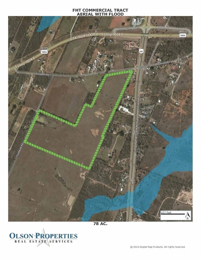
B and X Area of moderate flood hazard, usually the area between the limits of the 100-year and 500-year floods.
631
2024
5.36 AC
2025
South
162001
San Antonio
383 SF
NEARBY LISTINGS FOR SALE OR LEASE
DEMOGRAPHICS near 8670 W Rockport Rd
1 mile
3 mile
5 mile
2025 Total Population
476
7,853
21,433
2030 Population
507
8,427
22,877
Pop Growth 2025-2030
+ 6.51%
+ 7.31%
+ 6.74%
Average Age
38
37
37
2025 Total Households
148
2,378
6,552
HH Growth 2025-2030
+ 6.76%
+ 7.36%
+ 6.82%
Median Household Inc
$46,250
$45,817
$54,224
Avg Household Size
3.10
3.20
3.20
2025 Avg HH Vehicles
2.00
2.00
2.00
Median Home Value
$192,307
$178,078
$167,744
Median Year Built
1995
1997
1996
Nearby Places
Map Layers
Map Styles
 Street
 Aerial
Transit
 Traffic
 Biking
Places
Listings with unknown addresses are not visible on the map
- Restaurants
- Banks
- Shops
- Fitness
- Groceries
PUBLIC TRANSPORTATION
AIRPORT
San Antonio International
Drive
Walk
Distance
San Antonio International
35 min
26.6 mi
Freight Ports
Port of Corpus Christi
Drive
Walk
Distance
Port of Corpus Christi
151 min
142.6 mi
SALE & LEASE HISTORY
LISTING DATE
SALE/LEASE

Sep 19, 2017
For Sale
Nearby Properties
Address
Land Use
TOTAL SIZE
Lot Size
Zoning
Address
Land Use
TOTAL SIZE
Lot Size
Zoning
48,846 SF
8.62 AC
Address
Land Use
TOTAL SIZE
Lot Size
Zoning
1,596 SF
349.51 AC
Address
Land Use
TOTAL SIZE
Lot Size
Zoning
380.06 AC
Address
Land Use
TOTAL SIZE
Lot Size
Zoning
2,030 SF
248.90 AC
Address
Land Use
TOTAL SIZE
Lot Size
Zoning
7,571 SF
1.79 AC
Address
Land Use
TOTAL SIZE
Lot Size
Zoning
11,770 SF
143.84 AC
Address
Land Use
TOTAL SIZE
Lot Size
Zoning
105.75 AC
Address
Land Use
TOTAL SIZE
Lot Size
Zoning
2,002 SF
166.41 AC
Address
Land Use
TOTAL SIZE
Lot Size
Zoning
15,600 SF
5.19 AC
Address
Land Use
TOTAL SIZE
Lot Size
Zoning
5,663 SF
127.02 AC
Address
Land Use
TOTAL SIZE
Lot Size
Zoning
224.29 AC
Address
Land Use
TOTAL SIZE
Lot Size
Zoning
84.38 AC
Address
Land Use
TOTAL SIZE
Lot Size
Zoning
152.30 AC
Address
Land Use
TOTAL SIZE
Lot Size
Zoning
720 SF
104 AC
Address
Land Use
TOTAL SIZE
Lot Size
Zoning
4,400 SF
1.50 AC
Address
Land Use
TOTAL SIZE
Lot Size
Zoning
142.78 AC
Address
Land Use
TOTAL SIZE
Lot Size
Zoning
936 SF
145.46 AC
Address
Land Use
TOTAL SIZE
Lot Size
Zoning
68,056 SF
2.45 AC
Address
Land Use
TOTAL SIZE
Lot Size
Zoning
128.48 AC
Address
Land Use
TOTAL SIZE
Lot Size
Zoning
1,368 SF
68.46 AC
Address
Land Use
TOTAL SIZE
Lot Size
Zoning
151.78 AC
Address
Land Use
TOTAL SIZE
Lot Size
Zoning
Address
Land Use
TOTAL SIZE
Lot Size
Zoning
188.89 AC
Address
Land Use
TOTAL SIZE
Lot Size
Zoning
2,766 SF
156.23 AC
Address
Land Use
TOTAL SIZE
Lot Size
Zoning
148.50 AC
Address
Land Use
TOTAL SIZE
Lot Size
Zoning
137.60 AC
Address
Land Use
TOTAL SIZE
Lot Size
Zoning
112.40 AC
Address
Land Use
TOTAL SIZE
Lot Size
Zoning
70.93 AC
Address
Land Use
TOTAL SIZE
Lot Size
Zoning
8,240 SF
1.16 AC
Address
Land Use
TOTAL SIZE
Lot Size
Zoning
3,652 SF
38.84 AC
The World's #1 Commercial Real Estate Marketplace
Connect with us
© 2026 CoStar Group
The information above has been obtained from sources believed reliable. While we do not doubt its accuracy we have not verified it and make no guarantee, warranty or representation about it. It is your responsibility to independently confirm its accuracy and completeness. Any projections, opinions, assumptions, or estimates used are for example only and do not represent the current or future performance of the property. The value of this transaction to you depends on tax and other factors which should be evaluated by your tax, financial, and legal advisors. You and your advisors should conduct a careful, independent investigation of the property to determine to your satisfaction the suitability of the property for your needs.