Property Record
8675 Memorial Dr, Plain City, OH 43064


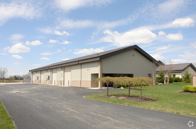
Property Detail
8675 Memorial Dr
Columbus, OH
JEROME INDUSTRIAL PARK 2 VMS 6420 LOT 5 2017 LAND CONTRACT TT 202004140003364
15-0039017-5000
Union
Publicstorage
Ohio
B and X Area of moderate flood hazard, usually the area between the limits of the 100-year and 500-year floods.
5
2025
1.03 AC
2025
Union County
050601
Columbus
7,712 SF
NEARBY LISTINGS FOR SALE OR LEASE
DEMOGRAPHICS near 8675 Memorial Dr
1 mile
3 mile
5 mile
2025 Total Population
1,191
29,641
96,558
2030 Population
1,387
31,367
101,779
Pop Growth 2025-2030
+ 16.46%
+ 5.82%
+ 5.41%
Average Age
36
39
39
2025 Total Households
377
10,188
36,914
HH Growth 2025-2030
+ 16.71%
+ 5.80%
+ 5.16%
Median Household Inc
$204,167
$156,581
$123,247
Avg Household Size
3.20
2.90
2.60
2025 Avg HH Vehicles
2.00
2.00
2.00
Median Home Value
$698,198
$578,146
$496,220
Median Year Built
2011
1999
1999
Nearby Places
Map Layers
Map Styles
 Street
 Aerial
Layers
 Traffic
 Biking
Places
Listings with unknown addresses are not visible on the map
- Restaurants
- Banks
- Shops
- Fitness
- Groceries
PUBLIC TRANSPORTATION
AIRPORT
John Glenn Columbus International
Drive
Walk
Distance
John Glenn Columbus International
37 min
26.3 mi
Rickenbacker International
Drive
Walk
Distance
Rickenbacker International
46 min
31.9 mi
SALE & LEASE HISTORY
LISTING DATE
SALE/LEASE

Dec 08, 2016
For Sale
Nearby Properties
Address
Land Use
TOTAL SIZE
Lot Size
Zoning
Address
Land Use
TOTAL SIZE
Lot Size
Zoning
464,088 SF
45.57 AC
Address
Land Use
TOTAL SIZE
Lot Size
Zoning
768,498 SF
66.96 AC
Address
Land Use
TOTAL SIZE
Lot Size
Zoning
256,984 SF
10.49 AC
Address
Land Use
TOTAL SIZE
Lot Size
Zoning
86.18 AC
Address
Land Use
TOTAL SIZE
Lot Size
Zoning
Address
Land Use
TOTAL SIZE
Lot Size
Zoning
4,788 SF
96.85 AC
Address
Land Use
TOTAL SIZE
Lot Size
Zoning
129,283 SF
56.69 AC
Address
Land Use
TOTAL SIZE
Lot Size
Zoning
143,277 SF
15.54 AC
Address
Land Use
TOTAL SIZE
Lot Size
Zoning
59,144 SF
87.61 AC
Address
Land Use
TOTAL SIZE
Lot Size
Zoning
131,940 SF
34.46 AC
Address
Land Use
TOTAL SIZE
Lot Size
Zoning
133,091 SF
15.01 AC
Address
Land Use
TOTAL SIZE
Lot Size
Zoning
105,694 SF
14.51 AC
Address
Land Use
TOTAL SIZE
Lot Size
Zoning
134,901 SF
15.51 AC
Address
Land Use
TOTAL SIZE
Lot Size
Zoning
121,104 SF
Address
Land Use
TOTAL SIZE
Lot Size
Zoning
57,876 SF
15.56 AC
Address
Land Use
TOTAL SIZE
Lot Size
Zoning
58,481 SF
26.99 AC
Address
Land Use
TOTAL SIZE
Lot Size
Zoning
64,147 SF
28.90 AC
Address
Land Use
TOTAL SIZE
Lot Size
Zoning
55,622 SF
8.98 AC
Address
Land Use
TOTAL SIZE
Lot Size
Zoning
130,839 SF
13.35 AC
Address
Land Use
TOTAL SIZE
Lot Size
Zoning
1,642 SF
92.78 AC
Address
Land Use
TOTAL SIZE
Lot Size
Zoning
50,238 SF
5 AC
Address
Land Use
TOTAL SIZE
Lot Size
Zoning
148,906 SF
13.46 AC
Address
Land Use
TOTAL SIZE
Lot Size
Zoning
44,648 SF
38.47 AC
Address
Land Use
TOTAL SIZE
Lot Size
Zoning
103,368 SF
13.48 AC
Address
Land Use
TOTAL SIZE
Lot Size
Zoning
18,325 SF
19.45 AC
Address
Land Use
TOTAL SIZE
Lot Size
Zoning
190,783 SF
15.59 AC
Address
Land Use
TOTAL SIZE
Lot Size
Zoning
9,720 SF
13.18 AC
Address
Land Use
TOTAL SIZE
Lot Size
Zoning
486,569 SF
96.85 AC
Address
Land Use
TOTAL SIZE
Lot Size
Zoning
52,451 SF
13.95 AC
Address
Land Use
TOTAL SIZE
Lot Size
Zoning
480 SF
52.07 AC
The World's #1 Commercial Real Estate Marketplace
Connect with us
© 2026 CoStar Group
The information above has been obtained from sources believed reliable. While we do not doubt its accuracy we have not verified it and make no guarantee, warranty or representation about it. It is your responsibility to independently confirm its accuracy and completeness. Any projections, opinions, assumptions, or estimates used are for example only and do not represent the current or future performance of the property. The value of this transaction to you depends on tax and other factors which should be evaluated by your tax, financial, and legal advisors. You and your advisors should conduct a careful, independent investigation of the property to determine to your satisfaction the suitability of the property for your needs.