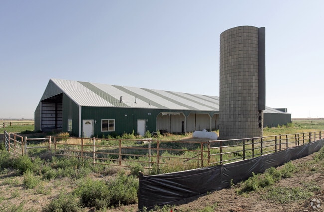
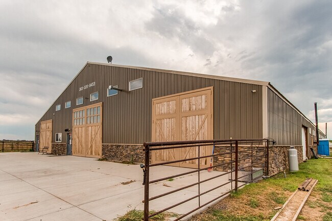
Property Record
8677 State Highway 66, Platteville, CO 80651

Property Detail
8677 State Highway 66
Greeley, CO
PT SE4 21-3-67 LOT B REC EXEMPT RECX19-0047
R8965179
WELD
Miscellaneous
Colorado
B and X Area of moderate flood hazard, usually the area between the limits of the 100-year and 500-year floods.
b
2024
6.43 AC
2025
Weld County
001800
Denver
14,400 SF
NEARBY LISTINGS FOR SALE OR LEASE
-
-
View all Platteville listings for sale on LoopNet.com
DEMOGRAPHICS near 8677 State Highway 66
1 mile
3 mile
5 mile
2025 Total Population
94
1,136
17,214
2030 Population
103
1,242
18,790
Pop Growth 2025-2030
+ 9.57%
+ 9.33%
+ 9.16%
Average Age
41
42
38
2025 Total Households
33
407
5,918
HH Growth 2025-2030
+ 12.12%
+ 9.83%
+ 9.60%
Median Household Inc
$106,250
$93,882
$112,584
Avg Household Size
2.90
2.80
2.90
2025 Avg HH Vehicles
3.00
2.00
2.00
Median Home Value
$609,375
$629,771
$615,384
Median Year Built
1989
1991
2004
Nearby Places
Map Layers
Map Styles
 Street
 Aerial
Transit
 Traffic
 Biking
Places
Listings with unknown addresses are not visible on the map
- Restaurants
- Banks
- Shops
- Fitness
- Groceries
PUBLIC TRANSPORTATION
AIRPORT
Denver International
Drive
Walk
Distance
Denver International
51 min
44.7 mi
Freight Ports
Tulsa Port Of Catoosa
Drive
Walk
Distance
Tulsa Port Of Catoosa
758 min
738.8 mi
SALE & LEASE HISTORY
LISTING DATE
SALE/LEASE

Jul 05, 2024
For Sale
Jan 21, 2025
For Sale
Nearby Properties
Address
Land Use
TOTAL SIZE
Lot Size
Zoning
Address
Land Use
TOTAL SIZE
Lot Size
Zoning
125,978 SF
118.07 AC
Address
Land Use
TOTAL SIZE
Lot Size
Zoning
42,765 SF
23.90 AC
Address
Land Use
TOTAL SIZE
Lot Size
Zoning
4,799 SF
133.29 AC
Address
Land Use
TOTAL SIZE
Lot Size
Zoning
12,000 SF
10.78 AC
Address
Land Use
TOTAL SIZE
Lot Size
Zoning
40,250 SF
15.59 AC
Address
Land Use
TOTAL SIZE
Lot Size
Zoning
2,575 SF
30.11 AC
Address
Land Use
TOTAL SIZE
Lot Size
Zoning
8,099 SF
4.85 AC
Address
Land Use
TOTAL SIZE
Lot Size
Zoning
2,080 SF
65.83 AC
Address
Land Use
TOTAL SIZE
Lot Size
Zoning
44,250 SF
18.08 AC
Address
Land Use
TOTAL SIZE
Lot Size
Zoning
5,144 SF
1 AC
Address
Land Use
TOTAL SIZE
Lot Size
Zoning
1,296 SF
0.51 AC
Address
Land Use
TOTAL SIZE
Lot Size
Zoning
8,235 SF
140.58 AC
Address
Land Use
TOTAL SIZE
Lot Size
Zoning
600 SF
77.69 AC
Address
Land Use
TOTAL SIZE
Lot Size
Zoning
6,873 SF
43.62 AC
Address
Land Use
TOTAL SIZE
Lot Size
Zoning
191.87 AC
Address
Land Use
TOTAL SIZE
Lot Size
Zoning
4,117 SF
154.18 AC
Address
Land Use
TOTAL SIZE
Lot Size
Zoning
600 SF
77.69 AC
Address
Land Use
TOTAL SIZE
Lot Size
Zoning
7,635 SF
19.55 AC
Address
Land Use
TOTAL SIZE
Lot Size
Zoning
Address
Land Use
TOTAL SIZE
Lot Size
Zoning
7,618 SF
77 AC
Address
Land Use
TOTAL SIZE
Lot Size
Zoning
3,282 SF
52 AC
Address
Land Use
TOTAL SIZE
Lot Size
Zoning
7,103 SF
276 AC
Address
Land Use
TOTAL SIZE
Lot Size
Zoning
7,976 SF
163 AC
Address
Land Use
TOTAL SIZE
Lot Size
Zoning
7,378 SF
7.95 AC
Address
Land Use
TOTAL SIZE
Lot Size
Zoning
4,799 SF
133.29 AC
Address
Land Use
TOTAL SIZE
Lot Size
Zoning
3,668 SF
129.07 AC
Address
Land Use
TOTAL SIZE
Lot Size
Zoning
2,904 SF
146.99 AC
Address
Land Use
TOTAL SIZE
Lot Size
Zoning
5,768 SF
184 AC
Address
Land Use
TOTAL SIZE
Lot Size
Zoning
6,268 SF
5.62 AC
The World's #1 Commercial Real Estate Marketplace
Connect with us
© 2026 CoStar Group
The information above has been obtained from sources believed reliable. While we do not doubt its accuracy we have not verified it and make no guarantee, warranty or representation about it. It is your responsibility to independently confirm its accuracy and completeness. Any projections, opinions, assumptions, or estimates used are for example only and do not represent the current or future performance of the property. The value of this transaction to you depends on tax and other factors which should be evaluated by your tax, financial, and legal advisors. You and your advisors should conduct a careful, independent investigation of the property to determine to your satisfaction the suitability of the property for your needs.