Property Record
8682 Garvey Ave, Rosemead, CA 91770


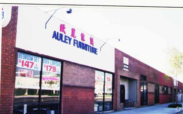
Property Detail
8682 Garvey Ave
5282-003-003
TRACT # 14146 LOTS 22.23 AND LOT 24
Lightindustrial
Los Angeles
RMM1*
California
B and X Area of moderate flood hazard, usually the area between the limits of the 100-year and 500-year floods.
22,24
2024
0.97 AC
2025
Western SGV
433602
Los Angeles
26,314 SF
Los Angeles-Long Beach-Glendale, CA
NEARBY LISTINGS FOR SALE OR LEASE
DEMOGRAPHICS near 8682 Garvey Ave
1 mile
3 mile
5 mile
2025 Total Population
22,772
214,463
591,699
2030 Population
22,494
211,715
584,064
Pop Growth 2025-2030
(1.22%)
(1.28%)
(1.29%)
Average Age
42
42
42
2025 Total Households
6,296
63,637
181,918
HH Growth 2025-2030
(1.45%)
(1.54%)
(1.51%)
Median Household Inc
$67,602
$76,103
$83,335
Avg Household Size
3.50
3.20
3.20
2025 Avg HH Vehicles
2.00
2.00
2.00
Median Home Value
$763,336
$780,746
$811,903
Median Year Built
1963
1962
1960
Nearby Places
Map Layers
Map Styles
 Street
 Aerial
Layers
 Traffic
 Biking
Places
Listings with unknown addresses are not visible on the map
- Restaurants
- Banks
- Shops
- Fitness
- Groceries
PUBLIC TRANSPORTATION
COMMUTER RAIL
El Monte (San Bernardino Line - Southern California Regional Rail Authority (Metrolink))
Drive
Walk
Distance
El Monte (San Bernardino Line - Southern California Regional Rail Authority (Metrolink))
7 min
4.1 mi
Montebello/Commerce (Riverside Line - Southern California Regional Rail Authority (Metrolink))
Drive
Walk
Distance
Montebello/Commerce (Riverside Line - Southern California Regional Rail Authority (Metrolink))
13 min
6.2 mi
AIRPORT
Long Beach (Daugherty Field)
Drive
Walk
Distance
Long Beach (Daugherty Field)
36 min
23.0 mi
Bob Hope
Drive
Walk
Distance
Bob Hope
34 min
25.2 mi
Los Angeles International
Drive
Walk
Distance
Los Angeles International
40 min
26.7 mi
Freight Ports
Port of Long Beach
Drive
Walk
Distance
Port of Long Beach
39 min
28.5 mi
Nearby Properties
Address
Land Use
TOTAL SIZE
Lot Size
Zoning
Address
Land Use
TOTAL SIZE
Lot Size
Zoning
884,553 SF
13.63 AC
RMC3*
Address
Land Use
TOTAL SIZE
Lot Size
Zoning
665,195 SF
29.38 AC
EMM2*
Address
Land Use
TOTAL SIZE
Lot Size
Zoning
247,960 SF
1.99 AC
SLC3
Address
Land Use
TOTAL SIZE
Lot Size
Zoning
572,320 SF
25.65 AC
EMM2*
Address
Land Use
TOTAL SIZE
Lot Size
Zoning
593,133 SF
SLR1YY
Address
Land Use
TOTAL SIZE
Lot Size
Zoning
334,580 SF
8.01 AC
EMM2
Address
Land Use
TOTAL SIZE
Lot Size
Zoning
220,142 SF
9.92 AC
SLR1VV
Address
Land Use
TOTAL SIZE
Lot Size
Zoning
155,920 SF
12.13 AC
MPM*
Address
Land Use
TOTAL SIZE
Lot Size
Zoning
193,192 SF
9.37 AC
EMM2*
Address
Land Use
TOTAL SIZE
Lot Size
Zoning
198,728 SF
2.50 AC
SLR3YY
Address
Land Use
TOTAL SIZE
Lot Size
Zoning
16.15 AC
EMM2*
Address
Land Use
TOTAL SIZE
Lot Size
Zoning
150,670 SF
6.18 AC
SEM*
Address
Land Use
TOTAL SIZE
Lot Size
Zoning
116,898 SF
4.36 AC
EMR3*
Address
Land Use
TOTAL SIZE
Lot Size
Zoning
107,778 SF
8.87 AC
MPM*
Address
Land Use
TOTAL SIZE
Lot Size
Zoning
621,229 SF
7.98 AC
MPM*
Address
Land Use
TOTAL SIZE
Lot Size
Zoning
227,731 SF
20.80 AC
RMC3-R3*
Address
Land Use
TOTAL SIZE
Lot Size
Zoning
331,660 SF
7.34 AC
RMC3*
Address
Land Use
TOTAL SIZE
Lot Size
Zoning
203,491 SF
15.84 AC
MPM*
Address
Land Use
TOTAL SIZE
Lot Size
Zoning
168,334 SF
7.41 AC
EMM2*
Address
Land Use
TOTAL SIZE
Lot Size
Zoning
121,746 SF
4.91 AC
EMR4*
Address
Land Use
TOTAL SIZE
Lot Size
Zoning
66,102 SF
1.90 AC
MPCM*
Address
Land Use
TOTAL SIZE
Lot Size
Zoning
95,187 SF
3.10 AC
EMC4*
Address
Land Use
TOTAL SIZE
Lot Size
Zoning
85,890 SF
2.33 AC
MPR2SCH*
Address
Land Use
TOTAL SIZE
Lot Size
Zoning
107,394 SF
4.40 AC
EMR4*
Address
Land Use
TOTAL SIZE
Lot Size
Zoning
189,263 SF
2.81 AC
EMM2*
Address
Land Use
TOTAL SIZE
Lot Size
Zoning
213,932 SF
7.03 AC
EMM2*
Address
Land Use
TOTAL SIZE
Lot Size
Zoning
48,018 SF
2.64 AC
SLC3*
Address
Land Use
TOTAL SIZE
Lot Size
Zoning
54,368 SF
1.20 AC
SLR3YY
Address
Land Use
TOTAL SIZE
Lot Size
Zoning
41,761 SF
3.25 AC
ALCPD-R1*
The World's #1 Commercial Real Estate Marketplace
Connect with us
© 2026 CoStar Group
The information above has been obtained from sources believed reliable. While we do not doubt its accuracy we have not verified it and make no guarantee, warranty or representation about it. It is your responsibility to independently confirm its accuracy and completeness. Any projections, opinions, assumptions, or estimates used are for example only and do not represent the current or future performance of the property. The value of this transaction to you depends on tax and other factors which should be evaluated by your tax, financial, and legal advisors. You and your advisors should conduct a careful, independent investigation of the property to determine to your satisfaction the suitability of the property for your needs.