Property Record
8683 Main St, Barker, NY 14012


Property Detail
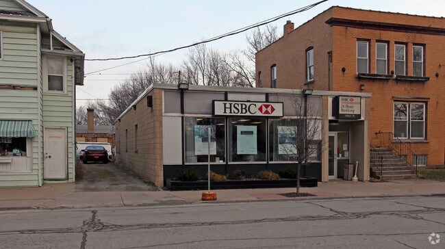
8683 Main St
Buffalo-Cheektowaga, NY
8 3 16 5
293801-018-006-0001-037-000
NIAGARA
Warehouse
New York
B and X Area of moderate flood hazard, usually the area between the limits of the 100-year and 500-year floods.
37.000
2025
0.09 AC
2025
Outlying Niagara County
024102
Buffalo/Niagara Falls
2,607 SF
NEARBY LISTINGS FOR SALE OR LEASE
-
-
View all Barker listings for sale on LoopNet.com
DEMOGRAPHICS near 8683 Main St
1 mile
3 mile
5 mile
2025 Total Population
770
2,156
4,057
2030 Population
752
2,146
4,035
Pop Growth 2025-2030
(2.34%)
(0.46%)
(0.54%)
Average Age
39
42
43
2025 Total Households
281
826
1,582
HH Growth 2025-2030
(2.14%)
(0.36%)
(0.51%)
Median Household Inc
$72,655
$74,463
$74,226
Avg Household Size
2.80
2.60
2.50
2025 Avg HH Vehicles
2.00
2.00
2.00
Median Home Value
$161,578
$178,598
$178,630
Median Year Built
1948
1955
1960
Nearby Places
Map Layers
Map Styles
 Street
 Aerial
Layers
 Traffic
 Biking
Places
Listings with unknown addresses are not visible on the map
- Restaurants
- Banks
- Shops
- Fitness
- Groceries
PUBLIC TRANSPORTATION
AIRPORT
Niagara Falls International
Drive
Walk
Distance
Niagara Falls International
48 min
33.3 mi
Buffalo Niagara International
Drive
Walk
Distance
Buffalo Niagara International
49 min
34.6 mi
SALE & LEASE HISTORY
LISTING DATE
SALE/LEASE

Sep 24, 2016
For Sale
Apr 03, 2017
For Sale
Nearby Properties
Address
Land Use
TOTAL SIZE
Lot Size
Zoning
Address
Land Use
TOTAL SIZE
Lot Size
Zoning
96,146 SF
12.10 AC
Address
Land Use
TOTAL SIZE
Lot Size
Zoning
99,168 SF
160.60 AC
Address
Land Use
TOTAL SIZE
Lot Size
Zoning
0.01 AC
Address
Land Use
TOTAL SIZE
Lot Size
Zoning
Address
Land Use
TOTAL SIZE
Lot Size
Zoning
5,222 SF
34.20 AC
Address
Land Use
TOTAL SIZE
Lot Size
Zoning
815 AC
Address
Land Use
TOTAL SIZE
Lot Size
Zoning
12,289 SF
11.60 AC
Address
Land Use
TOTAL SIZE
Lot Size
Zoning
14,100 SF
6.82 AC
Address
Land Use
TOTAL SIZE
Lot Size
Zoning
3,146 SF
46.30 AC
Address
Land Use
TOTAL SIZE
Lot Size
Zoning
11,012 SF
3.44 AC
Address
Land Use
TOTAL SIZE
Lot Size
Zoning
2,000 SF
94.50 AC
RES/AG
Address
Land Use
TOTAL SIZE
Lot Size
Zoning
153,789 SF
12.43 AC
Address
Land Use
TOTAL SIZE
Lot Size
Zoning
14,152 SF
1.90 AC
Address
Land Use
TOTAL SIZE
Lot Size
Zoning
1,360 SF
127 AC
Address
Land Use
TOTAL SIZE
Lot Size
Zoning
2,850 SF
0.87 AC
Address
Land Use
TOTAL SIZE
Lot Size
Zoning
6,944 SF
4.50 AC
Address
Land Use
TOTAL SIZE
Lot Size
Zoning
195.10 AC
RES/AG
Address
Land Use
TOTAL SIZE
Lot Size
Zoning
2,940 SF
1.43 AC
Address
Land Use
TOTAL SIZE
Lot Size
Zoning
4,406 SF
17 AC
Address
Land Use
TOTAL SIZE
Lot Size
Zoning
9,100 SF
2.35 AC
03
Address
Land Use
TOTAL SIZE
Lot Size
Zoning
540 SF
100.40 AC
RES/AG
Address
Land Use
TOTAL SIZE
Lot Size
Zoning
121.19 AC
Address
Land Use
TOTAL SIZE
Lot Size
Zoning
21,298 SF
1.63 AC
07 - MIXED
Address
Land Use
TOTAL SIZE
Lot Size
Zoning
132.10 AC
RES/AG
Address
Land Use
TOTAL SIZE
Lot Size
Zoning
1,698 SF
8.10 AC
RES/AG
Address
Land Use
TOTAL SIZE
Lot Size
Zoning
4.92 AC
Address
Land Use
TOTAL SIZE
Lot Size
Zoning
520 SF
23.50 AC
RES/AG
Address
Land Use
TOTAL SIZE
Lot Size
Zoning
6,918 SF
7.37 AC
Address
Land Use
TOTAL SIZE
Lot Size
Zoning
3,352 SF
1.13 AC
Address
Land Use
TOTAL SIZE
Lot Size
Zoning
95.10 AC
RES/AG
The World's #1 Commercial Real Estate Marketplace
Connect with us
© 2026 CoStar Group
The information above has been obtained from sources believed reliable. While we do not doubt its accuracy we have not verified it and make no guarantee, warranty or representation about it. It is your responsibility to independently confirm its accuracy and completeness. Any projections, opinions, assumptions, or estimates used are for example only and do not represent the current or future performance of the property. The value of this transaction to you depends on tax and other factors which should be evaluated by your tax, financial, and legal advisors. You and your advisors should conduct a careful, independent investigation of the property to determine to your satisfaction the suitability of the property for your needs.