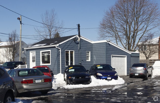
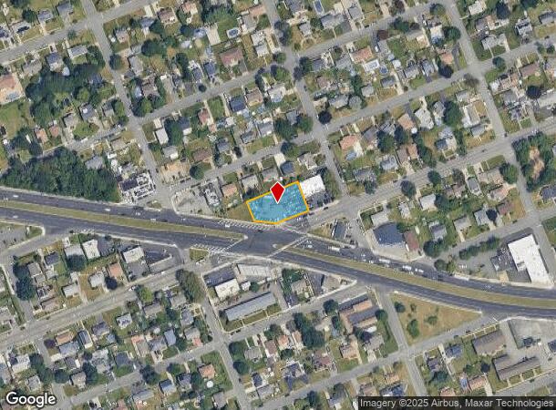
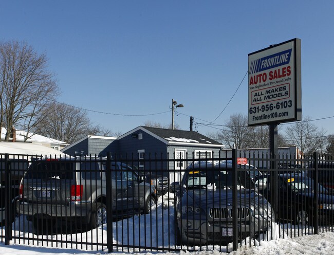
Property Record
869 Route 109, West Babylon, NY 11704
NEARBY LISTINGS FOR SALE OR LEASE
Property Detail
869 Route 109
Nassau County-Suffolk County, NY
FILED MAP 108 SEC.2 BLK. 4 LOTS 31-39 INC.
0100-129-00-01-00-062-000
Suffolk
Vehiclerentalsvehiclesales
New York
X
62
36103C0835H
0.37 AC
2024
Southwestern Suffolk
2024
Long Island (New York)
122408
DEMOGRAPHICS near 869 Route 109
1 Mile
3 Mile
5 Mile
2024 Total Population
13,684
133,564
312,570
2029 Population
13,244
130,243
305,829
Pop Growth 2024-2029
(3.22%)
(2.49%)
(2.16%)
Average Age
40
40
41
2024 Total Households
4,273
41,942
103,252
HH Growth 2024-2029
(3.51%)
(2.69%)
(2.34%)
Median Household Inc
$110,225
$105,406
$115,561
Avg Household Size
3.10
3.00
2.90
2024 Avg HH Vehicles
2.00
2.00
2.00
Median Home Value
$431,371
$439,679
$481,961
Median Year Built
1958
1961
1959
Nearby Places
- Restaurants
- Banks
- Shops
- Fitness
- Groceries
PUBLIC TRANSPORTATION
COMMUTER RAIL
Pinelawn Station (Ronkonkoma Branch - Long Island Rail Road)
DRIVE
WALK
Distance
Pinelawn Station (Ronkonkoma Branch - Long Island Rail Road)
4 min
2.4 mi
Lindenhurst Station (Babylon Branch - Long Island Rail Road)
DRIVE
WALK
Distance
Lindenhurst Station (Babylon Branch - Long Island Rail Road)
5 min
2.8 mi
AIRPORT
Long Island MacArthur
DRIVE
WALK
Distance
Long Island MacArthur
27 min
18.8 mi
John F Kennedy International
DRIVE
WALK
Distance
John F Kennedy International
36 min
25.9 mi
LaGuardia
DRIVE
WALK
Distance
LaGuardia
46 min
32.9 mi
Freight Ports
NY - Red Hook Container Terminal
DRIVE
WALK
Distance
NY - Red Hook Container Terminal
57 min
37.3 mi
Nearby Properties
Address
Land Use
TOTAL SIZE
Lot Size
Zoning
Address
Land Use
TOTAL SIZE
Lot Size
Zoning
9.95 AC
BUS3
Address
Land Use
TOTAL SIZE
Lot Size
Zoning
24.90 AC
B
Address
Land Use
TOTAL SIZE
Lot Size
Zoning
6.37 AC
BUS3
Address
Land Use
TOTAL SIZE
Lot Size
Zoning
77,270 SF
21.67 AC
Address
Land Use
TOTAL SIZE
Lot Size
Zoning
336,442 SF
43.50 AC
G
Address
Land Use
TOTAL SIZE
Lot Size
Zoning
22.10 AC
Address
Land Use
TOTAL SIZE
Lot Size
Zoning
7.15 AC
Address
Land Use
TOTAL SIZE
Lot Size
Zoning
400 AC
A
Address
Land Use
TOTAL SIZE
Lot Size
Zoning
13.63 AC
B
Address
Land Use
TOTAL SIZE
Lot Size
Zoning
Address
Land Use
TOTAL SIZE
Lot Size
Zoning
44 AC
E
Address
Land Use
TOTAL SIZE
Lot Size
Zoning
9.68 AC
SC
Address
Land Use
TOTAL SIZE
Lot Size
Zoning
3.80 AC
BUS1
Address
Land Use
TOTAL SIZE
Lot Size
Zoning
74.90 AC
G
Address
Land Use
TOTAL SIZE
Lot Size
Zoning
157,191 SF
17.70 AC
G
Address
Land Use
TOTAL SIZE
Lot Size
Zoning
114.70 AC
A
Address
Land Use
TOTAL SIZE
Lot Size
Zoning
0.46 AC
R40
Address
Land Use
TOTAL SIZE
Lot Size
Zoning
292.40 AC
A
Address
Land Use
TOTAL SIZE
Lot Size
Zoning
248.60 AC
A
Address
Land Use
TOTAL SIZE
Lot Size
Zoning
49,004 SF
13.34 AC
Address
Land Use
TOTAL SIZE
Lot Size
Zoning
12.50 AC
C
Address
Land Use
TOTAL SIZE
Lot Size
Zoning
9.39 AC
SC
Address
Land Use
TOTAL SIZE
Lot Size
Zoning
Address
Land Use
TOTAL SIZE
Lot Size
Zoning
2,318 SF
73.46 AC
Address
Land Use
TOTAL SIZE
Lot Size
Zoning
135,605 SF
15.05 AC
E
Address
Land Use
TOTAL SIZE
Lot Size
Zoning
611,060 SF
22.85 AC
GA
Address
Land Use
TOTAL SIZE
Lot Size
Zoning
1,450 SF
0.08 AC
Address
Land Use
TOTAL SIZE
Lot Size
Zoning
207,937 SF
15.41 AC
Address
Land Use
TOTAL SIZE
Lot Size
Zoning
14,162 SF
8.15 AC
Address
Land Use
TOTAL SIZE
Lot Size
Zoning
10.10 AC
SC
The World's #1 Commercial Real Estate Marketplace
Connect with us
© 2025 CoStar Group
The information above has been obtained from sources believed reliable. While we do not doubt its accuracy we have not verified it and make no guarantee, warranty or representation about it. It is your responsibility to independently confirm its accuracy and completeness. Any projections, opinions, assumptions, or estimates used are for example only and do not represent the current or future performance of the property. The value of this transaction to you depends on tax and other factors which should be evaluated by your tax, financial, and legal advisors. You and your advisors should conduct a careful, independent investigation of the property to determine to your satisfaction the suitability of the property for your needs.