Property Record
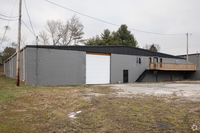
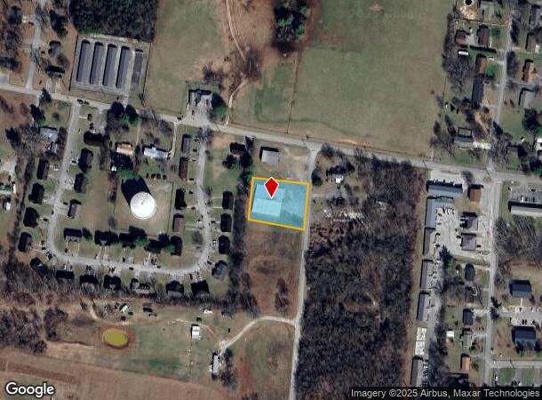
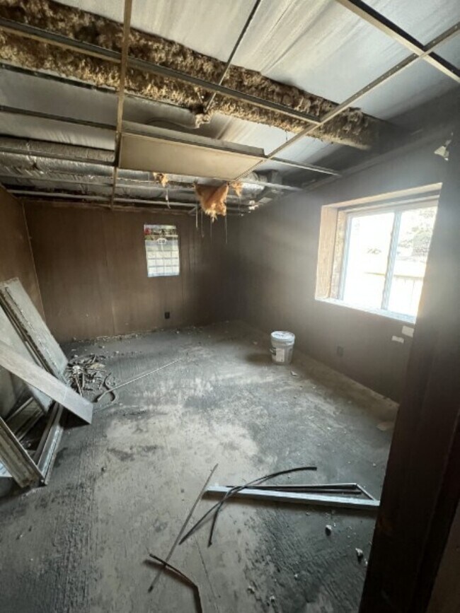
869 Underwood Rd, Mcminnville, TN 37110
This Property Is For Sale
NEARBY LISTINGS FOR SALE OR LEASE
Property Detail
869 Underwood Rd
McMinnville, TN
James & Dana Milstead Plat
089059 01207
Warren
Warehouse
Tennessee
0
3
2025
0.72 AC
930400
Tennessee Central Area
11,050 SF
Other Market Areas
DEMOGRAPHICS near 869 Underwood Rd
1 Mile
3 Mile
5 Mile
2024 Total Population
3,261
17,432
25,230
2029 Population
3,475
18,496
26,819
Pop Growth 2024-2029
+ 6.56%
+ 6.10%
+ 6.30%
Average Age
39
40
41
2024 Total Households
1,416
7,155
10,273
HH Growth 2024-2029
+ 6.50%
+ 6.09%
+ 6.28%
Median Household Inc
$37,581
$41,070
$43,929
Avg Household Size
2.30
2.40
2.40
2024 Avg HH Vehicles
2.00
2.00
2.00
Median Home Value
$132,485
$136,710
$144,310
Median Year Built
1976
1972
1975
Nearby Places
Map Layers
Map Styles
 Street
 Aerial
- Restaurants
- Banks
- Shops
- Fitness
- Groceries
Nearby Properties
Address
Land Use
TOTAL SIZE
Lot Size
Zoning
Address
Land Use
TOTAL SIZE
Lot Size
Zoning
205,937 SF
20 AC
C3
Address
Land Use
TOTAL SIZE
Lot Size
Zoning
9,194 SF
6.58 AC
R3
Address
Land Use
TOTAL SIZE
Lot Size
Zoning
5,629 SF
5.01 AC
Address
Land Use
TOTAL SIZE
Lot Size
Zoning
21,815 SF
8.10 AC
R3
Address
Land Use
TOTAL SIZE
Lot Size
Zoning
266,131 SF
20 AC
I1
Address
Land Use
TOTAL SIZE
Lot Size
Zoning
145,748 SF
13.39 AC
C3
Address
Land Use
TOTAL SIZE
Lot Size
Zoning
3,356 SF
11.61 AC
R2
Address
Land Use
TOTAL SIZE
Lot Size
Zoning
13,166 SF
5.60 AC
Address
Land Use
TOTAL SIZE
Lot Size
Zoning
7,536 SF
3 AC
R2
Address
Land Use
TOTAL SIZE
Lot Size
Zoning
275.50 AC
Address
Land Use
TOTAL SIZE
Lot Size
Zoning
12,958 SF
5.08 AC
Address
Land Use
TOTAL SIZE
Lot Size
Zoning
118,238 SF
14.24 AC
C3
Address
Land Use
TOTAL SIZE
Lot Size
Zoning
94,978 SF
5.20 AC
C2
Address
Land Use
TOTAL SIZE
Lot Size
Zoning
11,086 SF
0.31 AC
C1
Address
Land Use
TOTAL SIZE
Lot Size
Zoning
14,530 SF
0.44 AC
C1
Address
Land Use
TOTAL SIZE
Lot Size
Zoning
Address
Land Use
TOTAL SIZE
Lot Size
Zoning
8,472 SF
7.70 AC
R3
Address
Land Use
TOTAL SIZE
Lot Size
Zoning
49,470 SF
11.75 AC
I1
Address
Land Use
TOTAL SIZE
Lot Size
Zoning
38,583 SF
4.76 AC
R2
Address
Land Use
TOTAL SIZE
Lot Size
Zoning
37,091 SF
0.23 AC
C1
Address
Land Use
TOTAL SIZE
Lot Size
Zoning
20,572 SF
0.50 AC
C1
Address
Land Use
TOTAL SIZE
Lot Size
Zoning
89,131 SF
9.20 AC
C3
Address
Land Use
TOTAL SIZE
Lot Size
Zoning
13,734 SF
3 AC
R1
Address
Land Use
TOTAL SIZE
Lot Size
Zoning
1,765 SF
2.27 AC
R2
Address
Land Use
TOTAL SIZE
Lot Size
Zoning
5,408 SF
5.96 AC
R3
Address
Land Use
TOTAL SIZE
Lot Size
Zoning
9,000 SF
3 AC
Address
Land Use
TOTAL SIZE
Lot Size
Zoning
10,734 SF
2.25 AC
R3
Address
Land Use
TOTAL SIZE
Lot Size
Zoning
12,000 SF
10.55 AC
C2
Address
Land Use
TOTAL SIZE
Lot Size
Zoning
13,230 SF
0.60 AC
C1
Address
Land Use
TOTAL SIZE
Lot Size
Zoning
8,448 SF
2.62 AC
R3
The World's #1 Commercial Real Estate Marketplace
Connect with us
© 2026 CoStar Group
The information above has been obtained from sources believed reliable. While we do not doubt its accuracy we have not verified it and make no guarantee, warranty or representation about it. It is your responsibility to independently confirm its accuracy and completeness. Any projections, opinions, assumptions, or estimates used are for example only and do not represent the current or future performance of the property. The value of this transaction to you depends on tax and other factors which should be evaluated by your tax, financial, and legal advisors. You and your advisors should conduct a careful, independent investigation of the property to determine to your satisfaction the suitability of the property for your needs.