Property Record
8691 Jesse B Smith Ct, Jacksonville, FL 32219


NEARBY LISTINGS FOR SALE OR LEASE
Property Detail
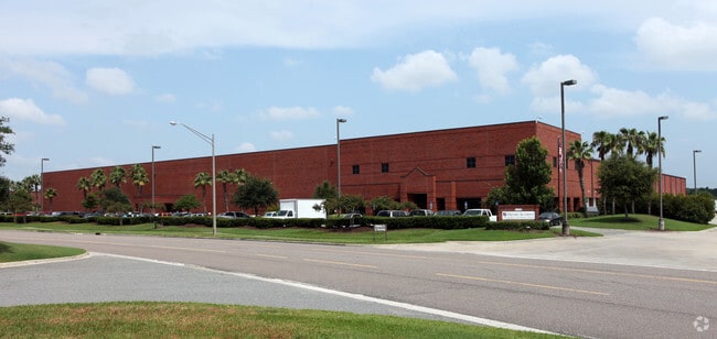
8691 Jesse B Smith Ct
Jacksonville (Florida)
Pickett Land Co Farms
Jacksonville, FL
5-93 34-1S-25E 15.36 PICKETT LAND CO FARMS PT TRACTS 3,4,5,6 BLK 2, PT SW1/4 SEC 27 RECD O/R 19444-615
003444-0710
Duval
Warehouse
Florida
2025
3
2026
15.36 AC
010601
West Side
216,022 SF
DEMOGRAPHICS near 8691 Jesse B Smith Ct
1 mile
3 mile
5 mile
2024 Total Population
240
8,312
45,890
2029 Population
258
8,943
48,641
Pop Growth 2024-2029
+ 7.50%
+ 7.59%
+ 5.99%
Average Age
43
40
40
2024 Total Households
94
3,053
17,288
HH Growth 2024-2029
+ 7.45%
+ 7.73%
+ 6.09%
Median Household Inc
$80,113
$66,395
$53,250
Avg Household Size
2.60
2.70
2.60
2024 Avg HH Vehicles
2.00
2.00
2.00
Median Home Value
$240,000
$230,360
$165,247
Median Year Built
1998
2000
1977
Nearby Places
Map Layers
Map Styles
 Street
 Aerial
Transit
 Traffic
 Biking
Places
Listings with unknown addresses are not visible on the map
- Restaurants
- Banks
- Shops
- Fitness
- Groceries
PUBLIC TRANSPORTATION
COMMUTER RAIL
Jacksonville (Silver Meteor - Amtrak, Silver Star - Amtrak)
Drive
Walk
Distance
Jacksonville (Silver Meteor - Amtrak, Silver Star - Amtrak)
13 min
6.2 mi
AIRPORT
Jacksonville International
Drive
Walk
Distance
Jacksonville International
27 min
15.3 mi
Freight Ports
Jacksonville Port
Drive
Walk
Distance
Jacksonville Port
24 min
12.3 mi
Nearby Properties
Address
Land Use
TOTAL SIZE
Lot Size
Zoning
Address
Land Use
TOTAL SIZE
Lot Size
Zoning
1,013,036 SF
51.67 AC
PUD
Address
Land Use
TOTAL SIZE
Lot Size
Zoning
973,797 SF
105.79 AC
PUD
Address
Land Use
TOTAL SIZE
Lot Size
Zoning
773,806 SF
68.14 AC
PUD
Address
Land Use
TOTAL SIZE
Lot Size
Zoning
548,235 SF
64.22 AC
PUD
Address
Land Use
TOTAL SIZE
Lot Size
Zoning
600,857 SF
38.14 AC
IL
Address
Land Use
TOTAL SIZE
Lot Size
Zoning
491,247 SF
30.77 AC
PUD
Address
Land Use
TOTAL SIZE
Lot Size
Zoning
449,967 SF
23.08 AC
IL
Address
Land Use
TOTAL SIZE
Lot Size
Zoning
874,178 SF
46.91 AC
PBF-2
Address
Land Use
TOTAL SIZE
Lot Size
Zoning
457,353 SF
250.89 AC
PUD
Address
Land Use
TOTAL SIZE
Lot Size
Zoning
435,150 SF
21.92 AC
PUD
Address
Land Use
TOTAL SIZE
Lot Size
Zoning
397,865 SF
42 AC
IL
Address
Land Use
TOTAL SIZE
Lot Size
Zoning
496,042 SF
120 AC
PUD
Address
Land Use
TOTAL SIZE
Lot Size
Zoning
449,367 SF
26.16 AC
PUD
Address
Land Use
TOTAL SIZE
Lot Size
Zoning
414,674 SF
21.03 AC
PUD
Address
Land Use
TOTAL SIZE
Lot Size
Zoning
392,050 SF
50.22 AC
PUD
Address
Land Use
TOTAL SIZE
Lot Size
Zoning
343,650 SF
9.45 AC
PUD
Address
Land Use
TOTAL SIZE
Lot Size
Zoning
267,204 SF
25.05 AC
PUD
Address
Land Use
TOTAL SIZE
Lot Size
Zoning
307,322 SF
19.31 AC
PUD
Address
Land Use
TOTAL SIZE
Lot Size
Zoning
299,588 SF
75.26 AC
IBP
Address
Land Use
TOTAL SIZE
Lot Size
Zoning
311,382 SF
18.57 AC
PUD
Address
Land Use
TOTAL SIZE
Lot Size
Zoning
302,066 SF
15.70 AC
IL
Address
Land Use
TOTAL SIZE
Lot Size
Zoning
277,582 SF
16.49 AC
IL
Address
Land Use
TOTAL SIZE
Lot Size
Zoning
262,792 SF
15.23 AC
PUD
Address
Land Use
TOTAL SIZE
Lot Size
Zoning
249,082 SF
31.28 AC
PUD
Address
Land Use
TOTAL SIZE
Lot Size
Zoning
240,050 SF
28.53 AC
IBP
Address
Land Use
TOTAL SIZE
Lot Size
Zoning
237,368 SF
14.55 AC
PUD
Address
Land Use
TOTAL SIZE
Lot Size
Zoning
235,950 SF
18.10 AC
PUD
Address
Land Use
TOTAL SIZE
Lot Size
Zoning
263,550 SF
29.32 AC
PUD
Address
Land Use
TOTAL SIZE
Lot Size
Zoning
1,265.67 AC
PUD
Address
Land Use
TOTAL SIZE
Lot Size
Zoning
189,832 SF
13.08 AC
PUD
The World's #1 Commercial Real Estate Marketplace
Connect with us
© 2026 CoStar Group
The information above has been obtained from sources believed reliable. While we do not doubt its accuracy we have not verified it and make no guarantee, warranty or representation about it. It is your responsibility to independently confirm its accuracy and completeness. Any projections, opinions, assumptions, or estimates used are for example only and do not represent the current or future performance of the property. The value of this transaction to you depends on tax and other factors which should be evaluated by your tax, financial, and legal advisors. You and your advisors should conduct a careful, independent investigation of the property to determine to your satisfaction the suitability of the property for your needs.