Property Record
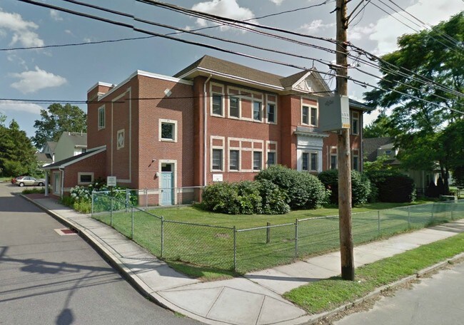
87 Gerrish Ave, East Haven, CT 06512

Property Detail
87 Gerrish Ave
EHAV-000200-002712-000001
South Central Ct
Apartmenthouse5plusunits
Connecticut
RA-1
1
B and X Area of moderate flood hazard, usually the area between the limits of the 100-year and 500-year floods.
0.80 AC
2025
Outer East Haven
2025
Westchester/So Connecticut
180200
New Haven, CT
NEARBY LISTINGS FOR SALE OR LEASE
DEMOGRAPHICS near 87 Gerrish Ave
1 mile
3 mile
5 mile
2025 Total Population
13,100
74,920
215,521
2030 Population
13,161
75,499
217,387
Pop Growth 2025-2030
+ 0.47%
+ 0.77%
+ 0.87%
Average Age
41
41
39
2025 Total Households
5,243
31,976
87,076
HH Growth 2025-2030
+ 0.36%
+ 1.29%
+ 1.09%
Median Household Inc
$71,662
$64,450
$63,152
Avg Household Size
2.40
2.30
2.30
2025 Avg HH Vehicles
2.00
1.00
1.00
Median Home Value
$268,912
$286,969
$295,341
Median Year Built
1962
1964
1958
Nearby Places
Map Layers
Map Styles
 Street
 Aerial
Layers
 Traffic
 Biking
Places
Listings with unknown addresses are not visible on the map
- Restaurants
- Banks
- Shops
- Fitness
- Groceries
PUBLIC TRANSPORTATION
COMMUTER RAIL
New Haven (New Haven - Metro-North Railroad)
Drive
Walk
Distance
New Haven (New Haven - Metro-North Railroad)
7 min
3.7 mi
New Haven Union Station (Hartford Line - CONN DOT)
Drive
Walk
Distance
New Haven Union Station (Hartford Line - CONN DOT)
7 min
3.7 mi
AIRPORT
Tweed/New Haven
Drive
Walk
Distance
Tweed/New Haven
5 min
1.6 mi
Freight Ports
Port of New Haven
Drive
Walk
Distance
Port of New Haven
6 min
2.3 mi
Nearby Properties
Address
Land Use
TOTAL SIZE
Lot Size
Zoning
Address
Land Use
TOTAL SIZE
Lot Size
Zoning
83,314 SF
2.14 AC
BA
Address
Land Use
TOTAL SIZE
Lot Size
Zoning
446,320 SF
BD1
Address
Land Use
TOTAL SIZE
Lot Size
Zoning
318,210 SF
2.73 AC
BA
Address
Land Use
TOTAL SIZE
Lot Size
Zoning
68,706 SF
3.34 AC
BA1
Address
Land Use
TOTAL SIZE
Lot Size
Zoning
7,345 SF
3.09 AC
IL/RM2
Address
Land Use
TOTAL SIZE
Lot Size
Zoning
117,066 SF
71.34 AC
IH
Address
Land Use
TOTAL SIZE
Lot Size
Zoning
287,844 SF
2.11 AC
IL
Address
Land Use
TOTAL SIZE
Lot Size
Zoning
8,655 SF
107.61 AC
AIRPOR
Address
Land Use
TOTAL SIZE
Lot Size
Zoning
163,505 SF
3.96 AC
BA1
Address
Land Use
TOTAL SIZE
Lot Size
Zoning
17,462 SF
86.34 AC
PARK
Address
Land Use
TOTAL SIZE
Lot Size
Zoning
205,756 SF
1.27 AC
PDD 15
Address
Land Use
TOTAL SIZE
Lot Size
Zoning
85,679 SF
14.23 AC
RM1
Address
Land Use
TOTAL SIZE
Lot Size
Zoning
111,576 SF
2.51 AC
RM2
Address
Land Use
TOTAL SIZE
Lot Size
Zoning
185,600 SF
1.44 AC
BA
Address
Land Use
TOTAL SIZE
Lot Size
Zoning
194,140 SF
1.50 AC
BD3
Address
Land Use
TOTAL SIZE
Lot Size
Zoning
197.78 AC
LI-3
Address
Land Use
TOTAL SIZE
Lot Size
Zoning
97,057 SF
2.78 AC
RM2
Address
Land Use
TOTAL SIZE
Lot Size
Zoning
297,601 SF
16.70 AC
PDD 10
Address
Land Use
TOTAL SIZE
Lot Size
Zoning
25,590 SF
4.50 AC
BE
Address
Land Use
TOTAL SIZE
Lot Size
Zoning
64,240 SF
7.33 AC
BE
Address
Land Use
TOTAL SIZE
Lot Size
Zoning
132,592 SF
4.61 AC
PDD 23
Address
Land Use
TOTAL SIZE
Lot Size
Zoning
5,946 SF
0.09 AC
RM1
Address
Land Use
TOTAL SIZE
Lot Size
Zoning
407,320 SF
2.31 AC
PDD 53
Address
Land Use
TOTAL SIZE
Lot Size
Zoning
7.72 AC
RA-1
Address
Land Use
TOTAL SIZE
Lot Size
Zoning
98,475 SF
2.83 AC
PDD 99
Address
Land Use
TOTAL SIZE
Lot Size
Zoning
29,872 SF
Address
Land Use
TOTAL SIZE
Lot Size
Zoning
98,422 SF
1.78 AC
PDU 93
Address
Land Use
TOTAL SIZE
Lot Size
Zoning
306,943 SF
1.92 AC
PDD 23
Address
Land Use
TOTAL SIZE
Lot Size
Zoning
1,932 SF
64.06 AC
PARK
Address
Land Use
TOTAL SIZE
Lot Size
Zoning
5,820 SF
RM2
The World's #1 Commercial Real Estate Marketplace
Connect with us
© 2026 CoStar Group
The information above has been obtained from sources believed reliable. While we do not doubt its accuracy we have not verified it and make no guarantee, warranty or representation about it. It is your responsibility to independently confirm its accuracy and completeness. Any projections, opinions, assumptions, or estimates used are for example only and do not represent the current or future performance of the property. The value of this transaction to you depends on tax and other factors which should be evaluated by your tax, financial, and legal advisors. You and your advisors should conduct a careful, independent investigation of the property to determine to your satisfaction the suitability of the property for your needs.