Property Record
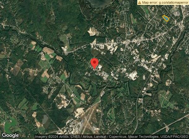
87 Kassbohrer Way, Auburn, ME 04210
NEARBY LISTINGS FOR SALE OR LEASE
-
-
View all Auburn listings for sale on LoopNet.com
Property Detail
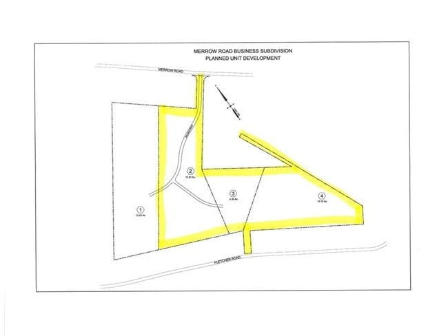
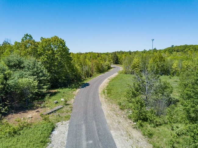
87 Kassbohrer Way
AUBN-000186-000000-000017
Androscoggin
Industrialgeneral
Maine
X
17
23001C0309E
38.07 AC
2024
Portland Surrounding
2024
Other Market Areas
010700
Lewiston-Auburn, ME
21,150 SF
DEMOGRAPHICS near 87 Kassbohrer Way
1 Mile
3 Mile
5 Mile
2024 Total Population
657
11,715
47,416
2029 Population
664
11,831
48,038
Pop Growth 2024-2029
+ 1.07%
+ 0.99%
+ 1.31%
Average Age
44
44
40
2024 Total Households
280
4,810
19,561
HH Growth 2024-2029
+ 1.07%
+ 1.04%
+ 1.26%
Median Household Inc
$65,172
$69,350
$48,184
Avg Household Size
2.30
2.30
2.20
2024 Avg HH Vehicles
2.00
2.00
1.00
Median Home Value
$204,444
$231,462
$212,516
Median Year Built
1961
1963
1949
Nearby Places
Map Layers
Map Styles
 Street
 Aerial
- Restaurants
- Banks
- Shops
- Fitness
- Groceries
PUBLIC TRANSPORTATION
AIRPORT
Portland International Jetport
DRIVE
WALK
Distance
Portland International Jetport
48 min
33.8 mi
Freight Ports
Portland, ME
DRIVE
WALK
Distance
Portland, ME
50 min
33.5 mi
SALE & LEASE HISTORY
LISTING DATE
SALE/LEASE

Mar 28, 2017
For Sale
Nearby Properties
Address
Land Use
TOTAL SIZE
Lot Size
Zoning
Address
Land Use
TOTAL SIZE
Lot Size
Zoning
601,694 SF
62.88 AC
Address
Land Use
TOTAL SIZE
Lot Size
Zoning
290,822 SF
61.58 AC
Address
Land Use
TOTAL SIZE
Lot Size
Zoning
34,797 SF
10.98 AC
Address
Land Use
TOTAL SIZE
Lot Size
Zoning
511,690 SF
139.18 AC
Address
Land Use
TOTAL SIZE
Lot Size
Zoning
129,113 SF
7.50 AC
Address
Land Use
TOTAL SIZE
Lot Size
Zoning
300,870 SF
18.55 AC
Address
Land Use
TOTAL SIZE
Lot Size
Zoning
3,027 SF
13.19 AC
Address
Land Use
TOTAL SIZE
Lot Size
Zoning
153,752 SF
132.60 AC
Address
Land Use
TOTAL SIZE
Lot Size
Zoning
82,748 SF
26.27 AC
Address
Land Use
TOTAL SIZE
Lot Size
Zoning
278,946 SF
16.83 AC
Address
Land Use
TOTAL SIZE
Lot Size
Zoning
41,771 SF
17.10 AC
Address
Land Use
TOTAL SIZE
Lot Size
Zoning
53,768 SF
11.72 AC
Address
Land Use
TOTAL SIZE
Lot Size
Zoning
71,000 SF
10.02 AC
Address
Land Use
TOTAL SIZE
Lot Size
Zoning
101,876 SF
12.42 AC
Address
Land Use
TOTAL SIZE
Lot Size
Zoning
142,868 SF
39.52 AC
Address
Land Use
TOTAL SIZE
Lot Size
Zoning
37,835 SF
2,071.44 AC
Address
Land Use
TOTAL SIZE
Lot Size
Zoning
163,052 SF
32.10 AC
Address
Land Use
TOTAL SIZE
Lot Size
Zoning
68,094 SF
26.82 AC
Address
Land Use
TOTAL SIZE
Lot Size
Zoning
7.54 AC
Address
Land Use
TOTAL SIZE
Lot Size
Zoning
104,830 SF
44.56 AC
Address
Land Use
TOTAL SIZE
Lot Size
Zoning
64,446 SF
53.50 AC
Address
Land Use
TOTAL SIZE
Lot Size
Zoning
80,500 SF
7.66 AC
Address
Land Use
TOTAL SIZE
Lot Size
Zoning
29,000 SF
3.84 AC
Address
Land Use
TOTAL SIZE
Lot Size
Zoning
103,250 SF
Address
Land Use
TOTAL SIZE
Lot Size
Zoning
31,582 SF
11.59 AC
Address
Land Use
TOTAL SIZE
Lot Size
Zoning
54,800 SF
9.38 AC
Address
Land Use
TOTAL SIZE
Lot Size
Zoning
14,755 SF
1.33 AC
Address
Land Use
TOTAL SIZE
Lot Size
Zoning
32,838 SF
3.90 AC
Address
Land Use
TOTAL SIZE
Lot Size
Zoning
61,090 SF
10.19 AC
Address
Land Use
TOTAL SIZE
Lot Size
Zoning
120,339 SF
72.67 AC
The World's #1 Commercial Real Estate Marketplace
Connect with us
© 2026 CoStar Group
The information above has been obtained from sources believed reliable. While we do not doubt its accuracy we have not verified it and make no guarantee, warranty or representation about it. It is your responsibility to independently confirm its accuracy and completeness. Any projections, opinions, assumptions, or estimates used are for example only and do not represent the current or future performance of the property. The value of this transaction to you depends on tax and other factors which should be evaluated by your tax, financial, and legal advisors. You and your advisors should conduct a careful, independent investigation of the property to determine to your satisfaction the suitability of the property for your needs.