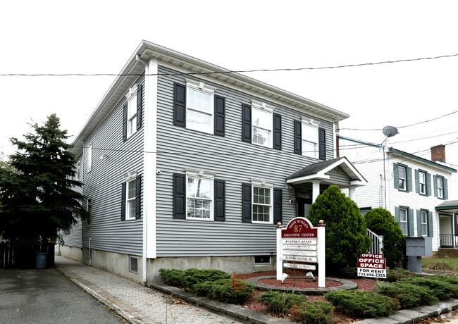
Property Record
87 Main St, Matawan, NJ 07747

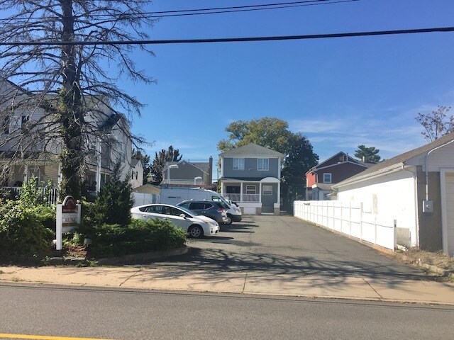
NEARBY LISTINGS FOR SALE OR LEASE
-
-
-
-
-
No Photo
-
-
-
View all Matawan listings for lease on LoopNet.com
Property Detail
87 Main St
31-00009-0000-00004
Monmouth
Officebuilding
New Jersey
X
4
34025C0036G
0.22 AC
2024
Eastern Monmouth
2025
Northern New Jersey
803100
New York-Jersey City-White Plains, NY-NJ
3,136 SF
DEMOGRAPHICS near 87 Main St
1 Mile
3 Mile
5 Mile
2024 Total Population
11,452
70,783
146,095
2029 Population
11,417
70,336
145,023
Pop Growth 2024-2029
(0.31%)
(0.63%)
(0.73%)
Average Age
39
42
42
2024 Total Households
4,566
26,906
54,903
HH Growth 2024-2029
(0.44%)
(0.79%)
(0.86%)
Median Household Inc
$113,315
$109,323
$105,480
Avg Household Size
2.50
2.60
2.60
2024 Avg HH Vehicles
2.00
2.00
2.00
Median Home Value
$408,395
$404,106
$415,322
Median Year Built
1968
1971
1972
Nearby Places
Map Layers
Map Styles
 Street
 Aerial
- Restaurants
- Banks
- Shops
- Fitness
- Groceries
PUBLIC TRANSPORTATION
TRANSIT/SUBWAY
Aberdeen Matawan (North Jersey Coast Line - NJ Transit Commuter Rail (NJ Transit))
DRIVE
WALK
Distance
Aberdeen Matawan (North Jersey Coast Line - NJ Transit Commuter Rail (NJ Transit))
1 min
6 min
0.3 mi
COMMUTER RAIL
Aberdeen Matawan (North Jersey Coast Line - NJ Transit Commuter Rail (NJ Transit))
DRIVE
WALK
Distance
Aberdeen Matawan (North Jersey Coast Line - NJ Transit Commuter Rail (NJ Transit))
1 min
6 min
0.3 mi
Hazlet (North Jersey Coast Line - NJ Transit Commuter Rail (NJ Transit))
DRIVE
WALK
Distance
Hazlet (North Jersey Coast Line - NJ Transit Commuter Rail (NJ Transit))
4 min
2.9 mi
AIRPORT
Newark Liberty International
DRIVE
WALK
Distance
Newark Liberty International
39 min
30.6 mi
LaGuardia
DRIVE
WALK
Distance
LaGuardia
69 min
45.9 mi
John F Kennedy International
DRIVE
WALK
Distance
John F Kennedy International
71 min
48.3 mi
Freight Ports
New York Container Terminal
DRIVE
WALK
Distance
New York Container Terminal
33 min
23.7 mi
SALE & LEASE HISTORY
LISTING DATE
SALE/LEASE

Sep 29, 2016
For Lease
Oct 24, 2017
For Sale
Oct 23, 2017
For Lease
Oct 23, 2017
For Sale
Nov 05, 2018
For Sale
Mar 02, 2023
For Lease
Jun 09, 2025
For Lease
Jun 01, 2023
For Sale
Jul 11, 2019
For Lease
Nearby Properties
Address
Land Use
TOTAL SIZE
Lot Size
Zoning
Address
Land Use
TOTAL SIZE
Lot Size
Zoning
197,568 SF
1.39 AC
Address
Land Use
TOTAL SIZE
Lot Size
Zoning
Address
Land Use
TOTAL SIZE
Lot Size
Zoning
157,615 SF
17.08 AC
M
Address
Land Use
TOTAL SIZE
Lot Size
Zoning
Address
Land Use
TOTAL SIZE
Lot Size
Zoning
70,624 SF
1.56 AC
WD
Address
Land Use
TOTAL SIZE
Lot Size
Zoning
3.98 AC
MUD
Address
Land Use
TOTAL SIZE
Lot Size
Zoning
30.96 AC
MFD
Address
Land Use
TOTAL SIZE
Lot Size
Zoning
2.70 AC
LI
Address
Land Use
TOTAL SIZE
Lot Size
Zoning
192,538 SF
45.11 AC
R100
Address
Land Use
TOTAL SIZE
Lot Size
Zoning
10.58 AC
APTH
Address
Land Use
TOTAL SIZE
Lot Size
Zoning
4.23 AC
LI
Address
Land Use
TOTAL SIZE
Lot Size
Zoning
186,567 SF
2.31 AC
RC
Address
Land Use
TOTAL SIZE
Lot Size
Zoning
94,150 SF
13.62 AC
M
Address
Land Use
TOTAL SIZE
Lot Size
Zoning
70,854 SF
14.30 AC
MF0
Address
Land Use
TOTAL SIZE
Lot Size
Zoning
196,948 SF
19.80 AC
BH
Address
Land Use
TOTAL SIZE
Lot Size
Zoning
9.12 AC
APTH
Address
Land Use
TOTAL SIZE
Lot Size
Zoning
7,902 SF
62.41 AC
R20
Address
Land Use
TOTAL SIZE
Lot Size
Zoning
81.64 AC
R70
Address
Land Use
TOTAL SIZE
Lot Size
Zoning
26.84 AC
CF
Address
Land Use
TOTAL SIZE
Lot Size
Zoning
420 SF
87.76 AC
OL2
Address
Land Use
TOTAL SIZE
Lot Size
Zoning
8.99 AC
MF0
Address
Land Use
TOTAL SIZE
Lot Size
Zoning
8.62 AC
RC
Address
Land Use
TOTAL SIZE
Lot Size
Zoning
6 AC
RC
Address
Land Use
TOTAL SIZE
Lot Size
Zoning
109,643 SF
1.87 AC
SB
Address
Land Use
TOTAL SIZE
Lot Size
Zoning
287,915 SF
31.10 AC
I
Address
Land Use
TOTAL SIZE
Lot Size
Zoning
162,250 SF
2.80 AC
RC
Address
Land Use
TOTAL SIZE
Lot Size
Zoning
85,752 SF
8.92 AC
Address
Land Use
TOTAL SIZE
Lot Size
Zoning
6.80 AC
RM
Address
Land Use
TOTAL SIZE
Lot Size
Zoning
142,360 SF
16.50 AC
BH
Address
Land Use
TOTAL SIZE
Lot Size
Zoning
42,681 SF
10.34 AC
P
The World's #1 Commercial Real Estate Marketplace
Connect with us
© 2025 CoStar Group
The information above has been obtained from sources believed reliable. While we do not doubt its accuracy we have not verified it and make no guarantee, warranty or representation about it. It is your responsibility to independently confirm its accuracy and completeness. Any projections, opinions, assumptions, or estimates used are for example only and do not represent the current or future performance of the property. The value of this transaction to you depends on tax and other factors which should be evaluated by your tax, financial, and legal advisors. You and your advisors should conduct a careful, independent investigation of the property to determine to your satisfaction the suitability of the property for your needs.