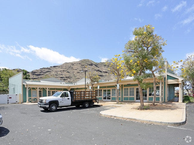
Property Record
87 Pakeke St, Waianae, HI 96792

NEARBY LISTINGS FOR SALE OR LEASE
Property Detail
87 Pakeke St
Urban Honolulu, HI
Sea Country Areas 3 & 4
1-8-7-047-075-0000
LOT 75 FP 2387 SEA COUNTRY AREAS 3 & 4 TOG/RIGHT TO USE BUFFER AREA SUBJ/ESMTS
Commercialnec
Honolulu
X
Hawaii
15003C0192J
75
2024
0.71 AC
2025
Waianae
009609
Hawaii
7,038 SF
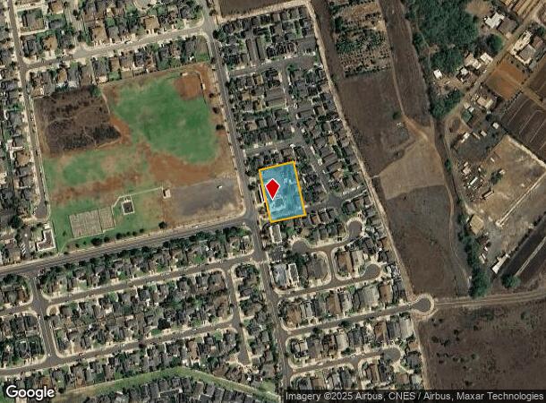
DEMOGRAPHICS near 87 Pakeke St
1 Mile
3 Mile
5 Mile
2024 Total Population
8,931
27,622
38,771
2029 Population
8,318
26,023
36,694
Pop Growth 2024-2029
(6.86%)
(5.79%)
(5.36%)
Average Age
35
36
36
2024 Total Households
2,167
6,343
9,193
HH Growth 2024-2029
(8.08%)
(6.97%)
(6.19%)
Median Household Inc
$101,883
$88,823
$79,859
Avg Household Size
3.70
3.90
3.70
2024 Avg HH Vehicles
2.00
2.00
2.00
Median Home Value
$541,118
$523,081
$508,244
Median Year Built
1993
1979
1978
Nearby Places
Map Layers
Map Styles
 Street
 Aerial
- Restaurants
- Banks
- Shops
- Fitness
- Groceries
PUBLIC TRANSPORTATION
AIRPORT
Daniel K Inouye International
DRIVE
WALK
Distance
Daniel K Inouye International
43 min
26.2 mi
Freight Ports
Honolulu Harbor, Oahu
DRIVE
WALK
Distance
Honolulu Harbor, Oahu
52 min
30.4 mi
SALE & LEASE HISTORY
LISTING DATE
SALE/LEASE

Nov 30, 2021
For Lease
Nearby Properties
Address
Land Use
TOTAL SIZE
Lot Size
Zoning
Address
Land Use
TOTAL SIZE
Lot Size
Zoning
89,685 SF
14.35 AC
B-2
Address
Land Use
TOTAL SIZE
Lot Size
Zoning
177,221 SF
11 AC
B-2
Address
Land Use
TOTAL SIZE
Lot Size
Zoning
63,315 SF
3.06 AC
B-2
Address
Land Use
TOTAL SIZE
Lot Size
Zoning
672.13 AC
F-1
Address
Land Use
TOTAL SIZE
Lot Size
Zoning
18.04 AC
I-2
Address
Land Use
TOTAL SIZE
Lot Size
Zoning
18,877 SF
1.72 AC
B-2
Address
Land Use
TOTAL SIZE
Lot Size
Zoning
38,236 SF
2.52 AC
R-5
Address
Land Use
TOTAL SIZE
Lot Size
Zoning
38,282 SF
25 AC
I-2
Address
Land Use
TOTAL SIZE
Lot Size
Zoning
26,311 SF
4.26 AC
R-5
Address
Land Use
TOTAL SIZE
Lot Size
Zoning
81,920 SF
1.93 AC
B-2
Address
Land Use
TOTAL SIZE
Lot Size
Zoning
448.48 AC
AG-2
Address
Land Use
TOTAL SIZE
Lot Size
Zoning
24,958 SF
0.57 AC
R-5
Address
Land Use
TOTAL SIZE
Lot Size
Zoning
76,085 SF
5.66 AC
B-2
Address
Land Use
TOTAL SIZE
Lot Size
Zoning
18,846 SF
0.39 AC
B-2
Address
Land Use
TOTAL SIZE
Lot Size
Zoning
37,465 SF
12.38 AC
AG-1
Address
Land Use
TOTAL SIZE
Lot Size
Zoning
179.11 AC
AG-2
Address
Land Use
TOTAL SIZE
Lot Size
Zoning
6,349 SF
2.69 AC
B-2
Address
Land Use
TOTAL SIZE
Lot Size
Zoning
15,210 SF
1.44 AC
B-2
Address
Land Use
TOTAL SIZE
Lot Size
Zoning
18,198 SF
1.69 AC
R-5
Address
Land Use
TOTAL SIZE
Lot Size
Zoning
12,417 SF
0.49 AC
R-5
Address
Land Use
TOTAL SIZE
Lot Size
Zoning
4,168 SF
113.07 AC
AG-2
Address
Land Use
TOTAL SIZE
Lot Size
Zoning
18,204 SF
1.27 AC
B-2
Address
Land Use
TOTAL SIZE
Lot Size
Zoning
7.69 AC
I-2
Address
Land Use
TOTAL SIZE
Lot Size
Zoning
12,788 SF
1.03 AC
B-2
Address
Land Use
TOTAL SIZE
Lot Size
Zoning
31,514 SF
1.03 AC
B-2
Address
Land Use
TOTAL SIZE
Lot Size
Zoning
18,416 SF
1.06 AC
B-2
Address
Land Use
TOTAL SIZE
Lot Size
Zoning
9,084 SF
0.97 AC
B-2
Address
Land Use
TOTAL SIZE
Lot Size
Zoning
1,728 SF
23.96 AC
P-1
Address
Land Use
TOTAL SIZE
Lot Size
Zoning
236.15 AC
P-2
Address
Land Use
TOTAL SIZE
Lot Size
Zoning
17,568 SF
0.72 AC
B-2
The World's #1 Commercial Real Estate Marketplace
Connect with us
© 2025 CoStar Group
The information above has been obtained from sources believed reliable. While we do not doubt its accuracy we have not verified it and make no guarantee, warranty or representation about it. It is your responsibility to independently confirm its accuracy and completeness. Any projections, opinions, assumptions, or estimates used are for example only and do not represent the current or future performance of the property. The value of this transaction to you depends on tax and other factors which should be evaluated by your tax, financial, and legal advisors. You and your advisors should conduct a careful, independent investigation of the property to determine to your satisfaction the suitability of the property for your needs.