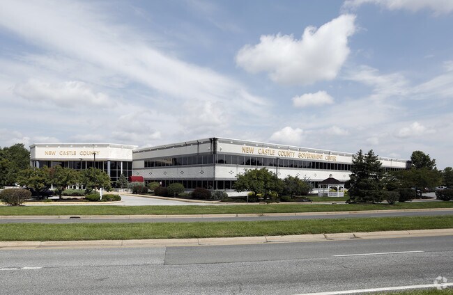
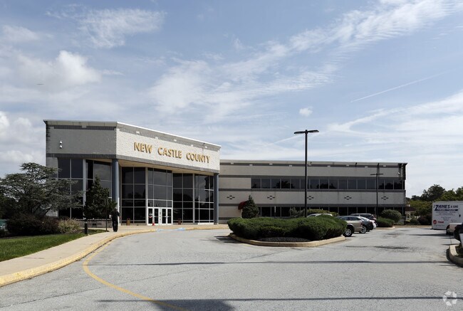
Property Record
87 Reads Way, New Castle, DE 19720
NEARBY LISTINGS FOR SALE OR LEASE
Property Detail
87 Reads Way
10-013.00-033
New Castle County Gov Center
Officebuilding
New Castle
AE
Delaware
10003C0161L
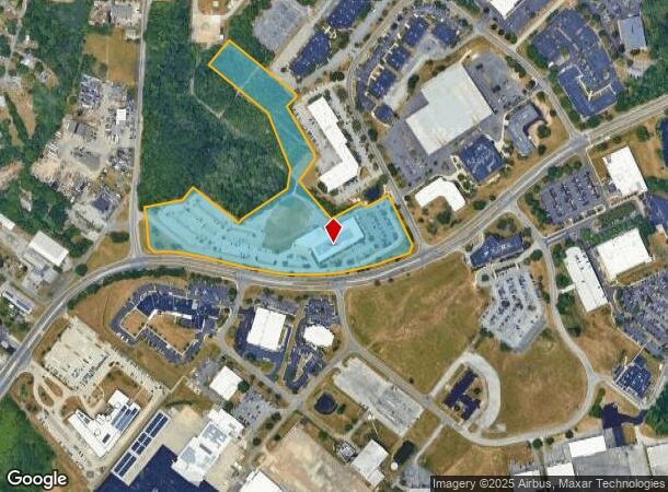
14.21 AC
0
South New Castle County
2024
Philadelphia
015000
Philadelphia-Camden-Wilmington, PA-NJ-DE-MD
83,500 SF
DEMOGRAPHICS near 87 Reads Way
1 Mile
3 Mile
5 Mile
2024 Total Population
741
57,047
189,018
2029 Population
752
57,761
191,675
Pop Growth 2024-2029
+ 1.48%
+ 1.25%
+ 1.41%
Average Age
42
40
40
2024 Total Households
282
22,421
74,559
HH Growth 2024-2029
+ 1.77%
+ 1.28%
+ 1.44%
Median Household Inc
$63,600
$64,560
$63,314
Avg Household Size
2.50
2.50
2.50
2024 Avg HH Vehicles
2.00
2.00
2.00
Median Home Value
$214,960
$221,619
$232,188
Median Year Built
1976
1966
1966
Nearby Places
Map Layers
Map Styles
 Street
 Aerial
- Restaurants
- Banks
- Shops
- Fitness
- Groceries
PUBLIC TRANSPORTATION
COMMUTER RAIL
Churchmans Crossing (R2 - Southeastern Pennsylvania Transportation Authority Regional Rail (SEPTA Regional Rail))
DRIVE
WALK
Distance
Churchmans Crossing (R2 - Southeastern Pennsylvania Transportation Authority Regional Rail (SEPTA Regional Rail))
8 min
4.0 mi
Wilmington (R2 - Southeastern Pennsylvania Transportation Authority Regional Rail (SEPTA Regional Rail))
DRIVE
WALK
Distance
Wilmington (R2 - Southeastern Pennsylvania Transportation Authority Regional Rail (SEPTA Regional Rail))
13 min
6.4 mi
AIRPORT
Philadelphia International
DRIVE
WALK
Distance
Philadelphia International
39 min
27.0 mi
Freight Ports
Port of Wilmington, RI
DRIVE
WALK
Distance
Port of Wilmington, RI
13 min
7.0 mi
Nearby Properties
Address
Land Use
TOTAL SIZE
Lot Size
Zoning
Address
Land Use
TOTAL SIZE
Lot Size
Zoning
525,757 SF
189.70 AC
NCPUD
Address
Land Use
TOTAL SIZE
Lot Size
Zoning
819,930 SF
78.51 AC
HI
Address
Land Use
TOTAL SIZE
Lot Size
Zoning
163,588 SF
1,229.95 AC
I
Address
Land Use
TOTAL SIZE
Lot Size
Zoning
624,255 SF
132.95 AC
SR
Address
Land Use
TOTAL SIZE
Lot Size
Zoning
488,637 SF
229.83 AC
NCPUD
Address
Land Use
TOTAL SIZE
Lot Size
Zoning
803,690 SF
155.50 AC
NCPUD
Address
Land Use
TOTAL SIZE
Lot Size
Zoning
324,073 SF
77.78 AC
S
Address
Land Use
TOTAL SIZE
Lot Size
Zoning
467,262 SF
28.74 AC
CR
Address
Land Use
TOTAL SIZE
Lot Size
Zoning
197,726 SF
25 AC
I
Address
Land Use
TOTAL SIZE
Lot Size
Zoning
116,042 SF
108.83 AC
SR
Address
Land Use
TOTAL SIZE
Lot Size
Zoning
25,801 SF
23.84 AC
S
Address
Land Use
TOTAL SIZE
Lot Size
Zoning
3,509 SF
24.91 AC
S
Address
Land Use
TOTAL SIZE
Lot Size
Zoning
242,811 SF
38.77 AC
CR
Address
Land Use
TOTAL SIZE
Lot Size
Zoning
187,286 SF
24.20 AC
CR
Address
Land Use
TOTAL SIZE
Lot Size
Zoning
113,545 SF
22.21 AC
OR
Address
Land Use
TOTAL SIZE
Lot Size
Zoning
76,357 SF
145.10 AC
CR
Address
Land Use
TOTAL SIZE
Lot Size
Zoning
26,443 SF
9.31 AC
CR
Address
Land Use
TOTAL SIZE
Lot Size
Zoning
352,104 SF
16.35 AC
BP
Address
Land Use
TOTAL SIZE
Lot Size
Zoning
216,689 SF
16.44 AC
CR
Address
Land Use
TOTAL SIZE
Lot Size
Zoning
248,554 SF
18.58 AC
CR
Address
Land Use
TOTAL SIZE
Lot Size
Zoning
51,286 SF
15.60 AC
CR
Address
Land Use
TOTAL SIZE
Lot Size
Zoning
203,570 SF
83.85 AC
OR
Address
Land Use
TOTAL SIZE
Lot Size
Zoning
56,352 SF
11.29 AC
I
Address
Land Use
TOTAL SIZE
Lot Size
Zoning
281,611 SF
26.39 AC
NCAP
Address
Land Use
TOTAL SIZE
Lot Size
Zoning
268,661 SF
28.38 AC
NCAP
Address
Land Use
TOTAL SIZE
Lot Size
Zoning
145,312 SF
CR
Address
Land Use
TOTAL SIZE
Lot Size
Zoning
295,200 SF
17.94 AC
NCAP
Address
Land Use
TOTAL SIZE
Lot Size
Zoning
269,354 SF
29.13 AC
NCPUD
Address
Land Use
TOTAL SIZE
Lot Size
Zoning
64,585 SF
14.61 AC
NC6.5
Address
Land Use
TOTAL SIZE
Lot Size
Zoning
2,520 SF
9.03 AC
ST
The World's #1 Commercial Real Estate Marketplace
Connect with us
© 2025 CoStar Group
The information above has been obtained from sources believed reliable. While we do not doubt its accuracy we have not verified it and make no guarantee, warranty or representation about it. It is your responsibility to independently confirm its accuracy and completeness. Any projections, opinions, assumptions, or estimates used are for example only and do not represent the current or future performance of the property. The value of this transaction to you depends on tax and other factors which should be evaluated by your tax, financial, and legal advisors. You and your advisors should conduct a careful, independent investigation of the property to determine to your satisfaction the suitability of the property for your needs.