Property Record
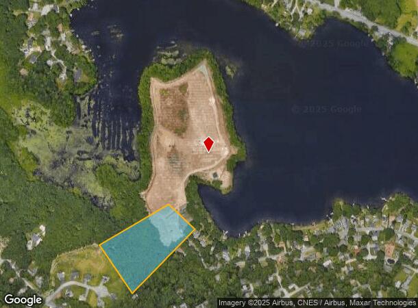
87 Shore Dr, Johnston, RI 02919


NEARBY LISTINGS FOR SALE OR LEASE
Property Detail
87 Shore Dr
JOHN-000046-000000-000103
Providence
Residentialacreage
Rhode Island
X
103
44007C0283H
1.28 AC
2025
Johnston
2025
Providence
012401
Providence-Warwick, RI-MA
1,600 SF
DEMOGRAPHICS near 87 Shore Dr
1 Mile
3 Mile
5 Mile
2024 Total Population
2,996
16,787
110,227
2029 Population
3,024
16,985
110,020
Pop Growth 2024-2029
+ 0.93%
+ 1.18%
(0.19%)
Average Age
43
45
42
2024 Total Households
1,086
6,571
43,396
HH Growth 2024-2029
+ 0.92%
+ 1.13%
(0.20%)
Median Household Inc
$125,483
$96,830
$74,740
Avg Household Size
2.70
2.50
2.40
2024 Avg HH Vehicles
2.00
2.00
2.00
Median Home Value
$387,412
$368,620
$324,106
Median Year Built
1983
1976
1969
Nearby Places
Map Layers
Map Styles
 Street
 Aerial
- Restaurants
- Banks
- Shops
- Fitness
- Groceries
PUBLIC TRANSPORTATION
COMMUTER RAIL
Providence (Providence/Stoughton Line - Massachusetts Bay Transportation Authority Commuter Rail (Purple Line))
DRIVE
WALK
Distance
Providence (Providence/Stoughton Line - Massachusetts Bay Transportation Authority Commuter Rail (Purple Line))
15 min
9.1 mi
AIRPORT
Rhode Island Tf Green International
DRIVE
WALK
Distance
Rhode Island Tf Green International
23 min
13.5 mi
Freight Ports
Port of Davisville, RI
DRIVE
WALK
Distance
Port of Davisville, RI
35 min
22.8 mi
Nearby Properties
Address
Land Use
TOTAL SIZE
Lot Size
Zoning
Address
Land Use
TOTAL SIZE
Lot Size
Zoning
123.25 AC
R40
Address
Land Use
TOTAL SIZE
Lot Size
Zoning
1,792 SF
28.46 AC
Address
Land Use
TOTAL SIZE
Lot Size
Zoning
32.30 AC
I
Address
Land Use
TOTAL SIZE
Lot Size
Zoning
30.14 AC
R40
Address
Land Use
TOTAL SIZE
Lot Size
Zoning
13,542 SF
95.26 AC
R10
Address
Land Use
TOTAL SIZE
Lot Size
Zoning
1 AC
R40
Address
Land Use
TOTAL SIZE
Lot Size
Zoning
96.12 AC
I
Address
Land Use
TOTAL SIZE
Lot Size
Zoning
122,836 SF
15.10 AC
R40
Address
Land Use
TOTAL SIZE
Lot Size
Zoning
8,742 SF
16.26 AC
R40
Address
Land Use
TOTAL SIZE
Lot Size
Zoning
21.86 AC
I
Address
Land Use
TOTAL SIZE
Lot Size
Zoning
80,602 SF
20.30 AC
B2
Address
Land Use
TOTAL SIZE
Lot Size
Zoning
93,878 SF
14.15 AC
B2
Address
Land Use
TOTAL SIZE
Lot Size
Zoning
10.50 AC
B2
Address
Land Use
TOTAL SIZE
Lot Size
Zoning
13.89 AC
B2
Address
Land Use
TOTAL SIZE
Lot Size
Zoning
78,346 SF
10.75 AC
PD
Address
Land Use
TOTAL SIZE
Lot Size
Zoning
133,908 SF
13.26 AC
B2
Address
Land Use
TOTAL SIZE
Lot Size
Zoning
86,428 SF
7.37 AC
B2
Address
Land Use
TOTAL SIZE
Lot Size
Zoning
72,328 SF
4.53 AC
R40
Address
Land Use
TOTAL SIZE
Lot Size
Zoning
32.59 AC
M2
Address
Land Use
TOTAL SIZE
Lot Size
Zoning
51,261 SF
8.29 AC
B3
Address
Land Use
TOTAL SIZE
Lot Size
Zoning
4.57 AC
B2
Address
Land Use
TOTAL SIZE
Lot Size
Zoning
40,586 SF
3.40 AC
RS-1
Address
Land Use
TOTAL SIZE
Lot Size
Zoning
58,613 SF
7.31 AC
B2
Address
Land Use
TOTAL SIZE
Lot Size
Zoning
49,072 SF
6.73 AC
PD
Address
Land Use
TOTAL SIZE
Lot Size
Zoning
4.78 AC
R7
Address
Land Use
TOTAL SIZE
Lot Size
Zoning
33,340 SF
5 AC
PD
Address
Land Use
TOTAL SIZE
Lot Size
Zoning
39,680 SF
2.29 AC
B2
Address
Land Use
TOTAL SIZE
Lot Size
Zoning
30,275 SF
1.42 AC
MU
Address
Land Use
TOTAL SIZE
Lot Size
Zoning
23.22 AC
IL
Address
Land Use
TOTAL SIZE
Lot Size
Zoning
26.52 AC
I
The World's #1 Commercial Real Estate Marketplace
Connect with us
© 2025 CoStar Group
The information above has been obtained from sources believed reliable. While we do not doubt its accuracy we have not verified it and make no guarantee, warranty or representation about it. It is your responsibility to independently confirm its accuracy and completeness. Any projections, opinions, assumptions, or estimates used are for example only and do not represent the current or future performance of the property. The value of this transaction to you depends on tax and other factors which should be evaluated by your tax, financial, and legal advisors. You and your advisors should conduct a careful, independent investigation of the property to determine to your satisfaction the suitability of the property for your needs.