Property Record
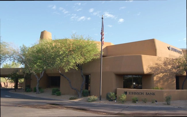
8700 E Pinnacle Peak Rd, Scottsdale, AZ 85255


Current Lease Availabilities
Property Detail
8700 E Pinnacle Peak Rd
212-03-438
CITADEL MCR 686-35
Financialbuilding
Maricopa
C-N
Arizona
B and X Area of moderate flood hazard, usually the area between the limits of the 100-year and 500-year floods.
2
2025
1.41 AC
2025
N Scottsdale/Carefree
216840
Phoenix
12,365 SF
Phoenix-Mesa-Chandler, AZ
NEARBY LISTINGS FOR SALE OR LEASE
DEMOGRAPHICS near 8700 E Pinnacle Peak Rd
1 mile
3 mile
5 mile
2025 Total Population
3,592
31,229
79,850
2030 Population
3,781
33,299
85,411
Pop Growth 2025-2030
+ 5.26%
+ 6.63%
+ 6.96%
Average Age
50
49
47
2025 Total Households
1,475
13,872
36,512
HH Growth 2025-2030
+ 5.36%
+ 6.93%
+ 7.37%
Median Household Inc
$174,856
$148,923
$131,349
Avg Household Size
2.40
2.20
2.10
2025 Avg HH Vehicles
2.00
2.00
2.00
Median Home Value
$1,085,670
$1,022,135
$1,000,165
Median Year Built
1992
2000
2002
Nearby Places
Map Layers
Map Styles
 Street
 Aerial
Layers
 Traffic
 Biking
Places
Listings with unknown addresses are not visible on the map
- Restaurants
- Banks
- Shops
- Fitness
- Groceries
PUBLIC TRANSPORTATION
AIRPORT
Phoenix Sky Harbor International
Drive
Walk
Distance
Phoenix Sky Harbor International
36 min
25.7 mi
Freight Ports
Port of San Diego
Drive
Walk
Distance
Port of San Diego
427 min
379.4 mi
Nearby Properties
Address
Land Use
TOTAL SIZE
Lot Size
Zoning
Address
Land Use
TOTAL SIZE
Lot Size
Zoning
Address
Land Use
TOTAL SIZE
Lot Size
Zoning
229,856 SF
7.71 AC
C-T
Address
Land Use
TOTAL SIZE
Lot Size
Zoning
734,840 SF
33.12 AC
M-H
Address
Land Use
TOTAL SIZE
Lot Size
Zoning
90.73 AC
O-S
Address
Land Use
TOTAL SIZE
Lot Size
Zoning
255,313 SF
22.54 AC
PNC
Address
Land Use
TOTAL SIZE
Lot Size
Zoning
385,376 SF
13.65 AC
PAD
Address
Land Use
TOTAL SIZE
Lot Size
Zoning
41.63 AC
I-1
Address
Land Use
TOTAL SIZE
Lot Size
Zoning
731,843 SF
29.85 AC
M-H
Address
Land Use
TOTAL SIZE
Lot Size
Zoning
328,616 SF
10.56 AC
PAD
Address
Land Use
TOTAL SIZE
Lot Size
Zoning
397,568 SF
16.71 AC
PAD
Address
Land Use
TOTAL SIZE
Lot Size
Zoning
191,639 SF
31.94 AC
O-S
Address
Land Use
TOTAL SIZE
Lot Size
Zoning
58.66 AC
R-43AG
Address
Land Use
TOTAL SIZE
Lot Size
Zoning
570.07 AC
R-43
Address
Land Use
TOTAL SIZE
Lot Size
Zoning
286,776 SF
5.86 AC
C-T
Address
Land Use
TOTAL SIZE
Lot Size
Zoning
270,264 SF
5.84 AC
C-C
Address
Land Use
TOTAL SIZE
Lot Size
Zoning
201,308 SF
3.44 AC
PC
Address
Land Use
TOTAL SIZE
Lot Size
Zoning
66,317 SF
20.82 AC
R-190
Address
Land Use
TOTAL SIZE
Lot Size
Zoning
115,275 SF
12.16 AC
C-C
Address
Land Use
TOTAL SIZE
Lot Size
Zoning
100,378 SF
12.29 AC
C-C
Address
Land Use
TOTAL SIZE
Lot Size
Zoning
80,105 SF
12.35 AC
PAD
Address
Land Use
TOTAL SIZE
Lot Size
Zoning
77,580 SF
9.84 AC
R-7
Address
Land Use
TOTAL SIZE
Lot Size
Zoning
153,809 SF
4.50 AC
C2
Address
Land Use
TOTAL SIZE
Lot Size
Zoning
31.40 AC
R-43AG
Address
Land Use
TOTAL SIZE
Lot Size
Zoning
92,548 SF
16.81 AC
Address
Land Use
TOTAL SIZE
Lot Size
Zoning
78,375 SF
9.28 AC
R-43
Address
Land Use
TOTAL SIZE
Lot Size
Zoning
21.96 AC
C-R
Address
Land Use
TOTAL SIZE
Lot Size
Zoning
1,350 SF
20.41 AC
R-43AG
Address
Land Use
TOTAL SIZE
Lot Size
Zoning
24.24 AC
R4R
The World's #1 Commercial Real Estate Marketplace
Connect with us
© 2026 CoStar Group
The information above has been obtained from sources believed reliable. While we do not doubt its accuracy we have not verified it and make no guarantee, warranty or representation about it. It is your responsibility to independently confirm its accuracy and completeness. Any projections, opinions, assumptions, or estimates used are for example only and do not represent the current or future performance of the property. The value of this transaction to you depends on tax and other factors which should be evaluated by your tax, financial, and legal advisors. You and your advisors should conduct a careful, independent investigation of the property to determine to your satisfaction the suitability of the property for your needs.