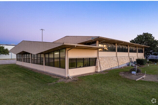
Property Record
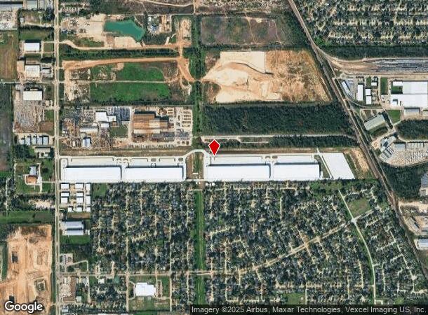
8700 Fairbanks N Houston Rd, Houston, TX 77064

NEARBY LISTINGS FOR SALE OR LEASE
Property Detail
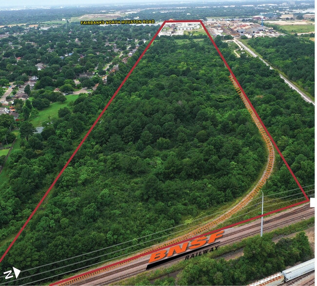
8700 Fairbanks N Houston Rd
0440480000006
Abst 622 W S Powell
Industrialgeneral
TRS 2A 14 & 15 (PC IMPS*0440480000175) ABST 622 W S POWELL
X
Harris
48201C0445M
Texas
2022
88.01 AC
2022
Hwy 290/Tomball Pky
534102
Houston
274,895 SF
Houston-The Woodlands-Sugar Land, TX
DEMOGRAPHICS near 8700 Fairbanks N Houston Rd
1 Mile
3 Mile
5 Mile
2024 Total Population
5,842
92,560
281,247
2029 Population
5,867
92,999
284,623
Pop Growth 2024-2029
+ 0.43%
+ 0.47%
+ 1.20%
Average Age
36
37
36
2024 Total Households
1,647
29,499
94,637
HH Growth 2024-2029
+ 0.30%
+ 0.32%
+ 1.18%
Median Household Inc
$74,917
$66,197
$57,570
Avg Household Size
3.50
3.10
2.90
2024 Avg HH Vehicles
3.00
2.00
2.00
Median Home Value
$156,537
$184,880
$188,647
Median Year Built
1976
1987
1987
Nearby Places
Map Layers
Map Styles
 Street
 Aerial
- Restaurants
- Banks
- Shops
- Fitness
- Groceries
PUBLIC TRANSPORTATION
AIRPORT
George Bush Intcntl/Houston
DRIVE
WALK
Distance
George Bush Intcntl/Houston
27 min
17.4 mi
William P Hobby
DRIVE
WALK
Distance
William P Hobby
53 min
31.4 mi
Freight Ports
Port of Houston
DRIVE
WALK
Distance
Port of Houston
44 min
27.0 mi
SALE & LEASE HISTORY
LISTING DATE
SALE/LEASE

May 18, 2021
For Sale
Nearby Properties
Address
Land Use
TOTAL SIZE
Lot Size
Zoning
Address
Land Use
TOTAL SIZE
Lot Size
Zoning
778,140 SF
40.25 AC
Address
Land Use
TOTAL SIZE
Lot Size
Zoning
682,700 SF
37 AC
Address
Land Use
TOTAL SIZE
Lot Size
Zoning
552,757 SF
32.95 AC
Address
Land Use
TOTAL SIZE
Lot Size
Zoning
546,420 SF
40.07 AC
Address
Land Use
TOTAL SIZE
Lot Size
Zoning
527,744 SF
35.46 AC
Address
Land Use
TOTAL SIZE
Lot Size
Zoning
397,248 SF
26.37 AC
Address
Land Use
TOTAL SIZE
Lot Size
Zoning
365,380 SF
19.17 AC
Address
Land Use
TOTAL SIZE
Lot Size
Zoning
495,024 SF
23.96 AC
Address
Land Use
TOTAL SIZE
Lot Size
Zoning
502,860 SF
40.99 AC
Address
Land Use
TOTAL SIZE
Lot Size
Zoning
399,828 SF
20.32 AC
Address
Land Use
TOTAL SIZE
Lot Size
Zoning
424,122 SF
21.06 AC
Address
Land Use
TOTAL SIZE
Lot Size
Zoning
339,301 SF
68.40 AC
Address
Land Use
TOTAL SIZE
Lot Size
Zoning
361,800 SF
18.20 AC
Address
Land Use
TOTAL SIZE
Lot Size
Zoning
441,000 SF
23.07 AC
Address
Land Use
TOTAL SIZE
Lot Size
Zoning
351,235 SF
20.73 AC
Address
Land Use
TOTAL SIZE
Lot Size
Zoning
347,694 SF
17.61 AC
Address
Land Use
TOTAL SIZE
Lot Size
Zoning
447,480 SF
18.48 AC
Address
Land Use
TOTAL SIZE
Lot Size
Zoning
461,430 SF
22.46 AC
Address
Land Use
TOTAL SIZE
Lot Size
Zoning
275,561 SF
19.78 AC
Address
Land Use
TOTAL SIZE
Lot Size
Zoning
357,300 SF
23.38 AC
Address
Land Use
TOTAL SIZE
Lot Size
Zoning
320,985 SF
14.88 AC
Address
Land Use
TOTAL SIZE
Lot Size
Zoning
297,351 SF
13.47 AC
Address
Land Use
TOTAL SIZE
Lot Size
Zoning
215,968 SF
17.23 AC
Address
Land Use
TOTAL SIZE
Lot Size
Zoning
356,656 SF
23.54 AC
Address
Land Use
TOTAL SIZE
Lot Size
Zoning
299,280 SF
15.71 AC
Address
Land Use
TOTAL SIZE
Lot Size
Zoning
292,112 SF
4.41 AC
Address
Land Use
TOTAL SIZE
Lot Size
Zoning
310,043 SF
15.65 AC
Address
Land Use
TOTAL SIZE
Lot Size
Zoning
272,600 SF
23.27 AC
Address
Land Use
TOTAL SIZE
Lot Size
Zoning
322,226 SF
14.99 AC
Address
Land Use
TOTAL SIZE
Lot Size
Zoning
259,168 SF
13.43 AC
The World's #1 Commercial Real Estate Marketplace
Connect with us
© 2025 CoStar Group
The information above has been obtained from sources believed reliable. While we do not doubt its accuracy we have not verified it and make no guarantee, warranty or representation about it. It is your responsibility to independently confirm its accuracy and completeness. Any projections, opinions, assumptions, or estimates used are for example only and do not represent the current or future performance of the property. The value of this transaction to you depends on tax and other factors which should be evaluated by your tax, financial, and legal advisors. You and your advisors should conduct a careful, independent investigation of the property to determine to your satisfaction the suitability of the property for your needs.