Property Record
8700 State Line Rd, Leawood, KS 66206
Current Lease Availabilities
NEARBY LISTINGS FOR SALE OR LEASE
Property Detail
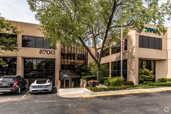
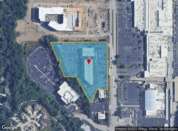
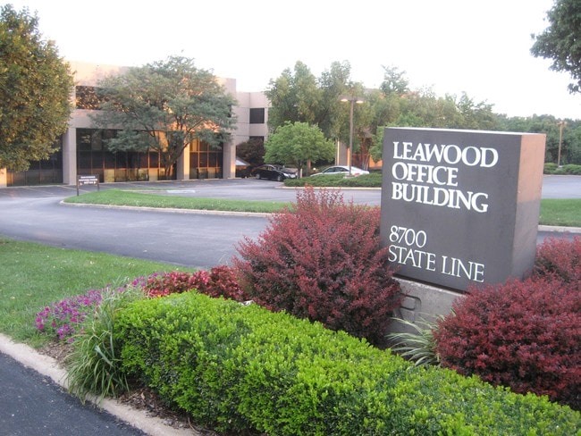
8700 State Line Rd
HF251235-1039
35-12-25 BG 550 S & 342.30 E NW CR FRAC SEC SE 210.60 NE30 SE 14 SW 19 SE 29 SW 11 SE 139.19 E 120.68 SE 300.06 E 65.55 N 18 NE 117.64 E 117 TO WLY/RTWY STATE LINE RD N ALG RTWY 420.49 & 71.97 W 628.77 TO POB 5.963 ACS M/L LWC 687 2
Officebuilding
Johnson
X
Kansas
29095C0376G
5.51 AC
2024
Ward Parkway
2024
Kansas City
051600
Kansas City, MO-KS
96,759 SF
DEMOGRAPHICS near 8700 State Line Rd
1 Mile
3 Mile
5 Mile
2024 Total Population
8,287
91,552
234,123
2029 Population
8,404
93,539
239,918
Pop Growth 2024-2029
+ 1.41%
+ 2.17%
+ 2.48%
Average Age
41
41
41
2024 Total Households
3,566
40,854
103,751
HH Growth 2024-2029
+ 0.95%
+ 2.05%
+ 2.52%
Median Household Inc
$115,267
$86,636
$80,001
Avg Household Size
2.30
2.20
2.20
2024 Avg HH Vehicles
2.00
2.00
2.00
Median Home Value
$361,686
$327,448
$305,441
Median Year Built
1954
1958
1961
Nearby Places
Map Layers
Map Styles
 Street
 Aerial
- Restaurants
- Banks
- Shops
- Fitness
- Groceries
PUBLIC TRANSPORTATION
COMMUTER RAIL
DRIVE
WALK
Distance
22 min
9.1 mi
AIRPORT
Kansas City International
DRIVE
WALK
Distance
Kansas City International
48 min
32.7 mi
Nearby Properties
Address
Land Use
TOTAL SIZE
Lot Size
Zoning
Address
Land Use
TOTAL SIZE
Lot Size
Zoning
47.39 AC
AG
Address
Land Use
TOTAL SIZE
Lot Size
Zoning
183,684 SF
36.94 AC
R-1A
Address
Land Use
TOTAL SIZE
Lot Size
Zoning
616,742 SF
13.59 AC
Address
Land Use
TOTAL SIZE
Lot Size
Zoning
188,248 SF
4.78 AC
C-2
Address
Land Use
TOTAL SIZE
Lot Size
Zoning
81,051 SF
7.17 AC
R-1
Address
Land Use
TOTAL SIZE
Lot Size
Zoning
59,570 SF
8.46 AC
SD-O
Address
Land Use
TOTAL SIZE
Lot Size
Zoning
73,383 SF
9.53 AC
R-1
Address
Land Use
TOTAL SIZE
Lot Size
Zoning
552,475 SF
Address
Land Use
TOTAL SIZE
Lot Size
Zoning
73,793 SF
9.21 AC
R-1A
Address
Land Use
TOTAL SIZE
Lot Size
Zoning
465,394 SF
16.63 AC
Address
Land Use
TOTAL SIZE
Lot Size
Zoning
69,958 SF
10.93 AC
R-1
Address
Land Use
TOTAL SIZE
Lot Size
Zoning
436,499 SF
22.71 AC
Address
Land Use
TOTAL SIZE
Lot Size
Zoning
99,812 SF
3.85 AC
R-1A
Address
Land Use
TOTAL SIZE
Lot Size
Zoning
120,225 SF
9.13 AC
R-1
Address
Land Use
TOTAL SIZE
Lot Size
Zoning
119,320 SF
19.74 AC
R-1
Address
Land Use
TOTAL SIZE
Lot Size
Zoning
387,197 SF
Address
Land Use
TOTAL SIZE
Lot Size
Zoning
124,249 SF
6.13 AC
R-1B
Address
Land Use
TOTAL SIZE
Lot Size
Zoning
457,500 SF
Address
Land Use
TOTAL SIZE
Lot Size
Zoning
157,280 SF
25.10 AC
Address
Land Use
TOTAL SIZE
Lot Size
Zoning
109,553 SF
3.08 AC
Address
Land Use
TOTAL SIZE
Lot Size
Zoning
67,981 SF
7.12 AC
R-1A
Address
Land Use
TOTAL SIZE
Lot Size
Zoning
405,226 SF
6.87 AC
MXD
Address
Land Use
TOTAL SIZE
Lot Size
Zoning
36,324 SF
16.55 AC
R-1A
Address
Land Use
TOTAL SIZE
Lot Size
Zoning
66,378 SF
3.22 AC
R-1
Address
Land Use
TOTAL SIZE
Lot Size
Zoning
213,409 SF
5.20 AC
R-1A
Address
Land Use
TOTAL SIZE
Lot Size
Zoning
85,287 SF
2.35 AC
R-1
Address
Land Use
TOTAL SIZE
Lot Size
Zoning
257,979 SF
14.35 AC
C-2
Address
Land Use
TOTAL SIZE
Lot Size
Zoning
68,004 SF
7.75 AC
R-1B
Address
Land Use
TOTAL SIZE
Lot Size
Zoning
262,727 SF
16.81 AC
C-2
Address
Land Use
TOTAL SIZE
Lot Size
Zoning
53,797 SF
5.47 AC
R-1
The World's #1 Commercial Real Estate Marketplace
Connect with us
© 2025 CoStar Group
The information above has been obtained from sources believed reliable. While we do not doubt its accuracy we have not verified it and make no guarantee, warranty or representation about it. It is your responsibility to independently confirm its accuracy and completeness. Any projections, opinions, assumptions, or estimates used are for example only and do not represent the current or future performance of the property. The value of this transaction to you depends on tax and other factors which should be evaluated by your tax, financial, and legal advisors. You and your advisors should conduct a careful, independent investigation of the property to determine to your satisfaction the suitability of the property for your needs.