Property Record
8707 N Davis Hwy, Pensacola, FL 32514
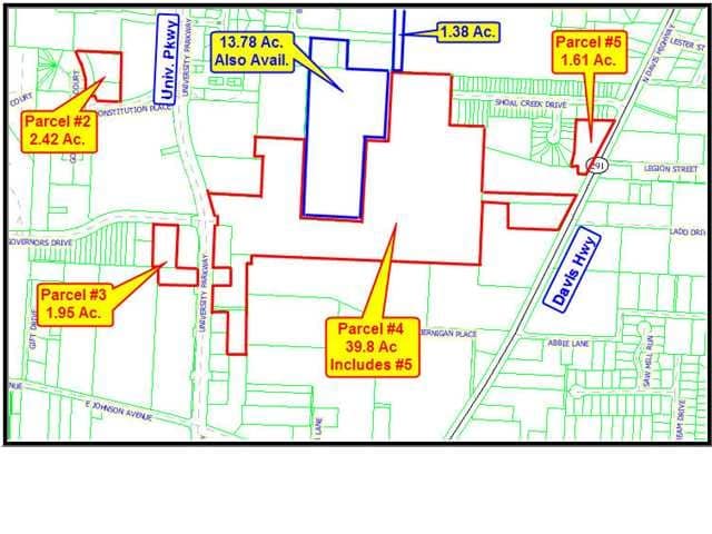


This Property Is For Sale
Property Detail
8707 N Davis Hwy
Pensacola-Ferry Pass-Brent, FL
COM NW COR SE 1/4 OF SEC 14 BEING NW COR OF GOV LT 6 OF SEC 14 S 02 DEG 54 MIN 50 SEC W ALG W LI OF GOV LT 6 AND W LI OF SE 1/4 OF SEC 194.97 FT TO POB S 87 DEG 14 MIN 05 SEC E ALG S LI OF PARCEL IN OR 2559 P 466 AND PARCEL DESCRIBED IN OR 7919 P 134
14-1S-30-6100-000-002
ESCAMBIA
Transportationcommunicationsgeneral
Florida
HC/LI
6
B and X Area of moderate flood hazard, usually the area between the limits of the 100-year and 500-year floods.
0.92 AC
2024
Ferry Pass/N Pensacola
2025
Pensacola
003511
NEARBY LISTINGS FOR SALE OR LEASE
DEMOGRAPHICS near 8707 N Davis Hwy
1 mile
3 mile
5 mile
2025 Total Population
10,147
55,690
109,249
2030 Population
10,708
57,125
111,494
Pop Growth 2025-2030
+ 5.53%
+ 2.58%
+ 2.05%
Average Age
40
40
40
2025 Total Households
5,121
24,401
44,572
HH Growth 2025-2030
+ 6.15%
+ 2.80%
+ 2.22%
Median Household Inc
$75,666
$70,379
$71,618
Avg Household Size
1.90
2.20
2.20
2025 Avg HH Vehicles
1.00
2.00
2.00
Median Home Value
$270,031
$265,591
$271,833
Median Year Built
1995
1984
1982
Nearby Places
Map Layers
Map Styles
 Street
 Aerial
Layers
 Traffic
 Biking
Places
Listings with unknown addresses are not visible on the map
- Restaurants
- Banks
- Shops
- Fitness
- Groceries
PUBLIC TRANSPORTATION
AIRPORT
Pensacola International
Drive
Walk
Distance
Pensacola International
15 min
6.5 mi
Freight Ports
Port of Mobile
Drive
Walk
Distance
Port of Mobile
63 min
54.9 mi
Nearby Properties
Address
Land Use
TOTAL SIZE
Lot Size
Zoning
Address
Land Use
TOTAL SIZE
Lot Size
Zoning
1 AC
PUB
Address
Land Use
TOTAL SIZE
Lot Size
Zoning
784,999 SF
20.06 AC
COM
Address
Land Use
TOTAL SIZE
Lot Size
Zoning
368,851 SF
19.16 AC
HDMU,REC
Address
Land Use
TOTAL SIZE
Lot Size
Zoning
336,376 SF
19.68 AC
HDMU
Address
Land Use
TOTAL SIZE
Lot Size
Zoning
553,808 SF
35.16 AC
HDR
Address
Land Use
TOTAL SIZE
Lot Size
Zoning
266,096 SF
13.46 AC
HDMU
Address
Land Use
TOTAL SIZE
Lot Size
Zoning
314,269 SF
12.53 AC
HDMU
Address
Land Use
TOTAL SIZE
Lot Size
Zoning
269,404 SF
23.85 AC
HDMU
Address
Land Use
TOTAL SIZE
Lot Size
Zoning
238,060 SF
21.93 AC
HDMU
Address
Land Use
TOTAL SIZE
Lot Size
Zoning
262,823 SF
11.57 AC
HDMU
Address
Land Use
TOTAL SIZE
Lot Size
Zoning
240,998 SF
19.61 AC
HDMU
Address
Land Use
TOTAL SIZE
Lot Size
Zoning
210,644 SF
13.14 AC
R-2
Address
Land Use
TOTAL SIZE
Lot Size
Zoning
203,587 SF
20.11 AC
HDR
Address
Land Use
TOTAL SIZE
Lot Size
Zoning
191,157 SF
11.77 AC
MDR
Address
Land Use
TOTAL SIZE
Lot Size
Zoning
275,458 SF
8.29 AC
HDMU
Address
Land Use
TOTAL SIZE
Lot Size
Zoning
329,935 SF
46.34 AC
COM
Address
Land Use
TOTAL SIZE
Lot Size
Zoning
171,283 SF
3.89 AC
HDR
Address
Land Use
TOTAL SIZE
Lot Size
Zoning
202,638 SF
9.43 AC
HDMU
Address
Land Use
TOTAL SIZE
Lot Size
Zoning
517,415 SF
27.78 AC
HC/LI
Address
Land Use
TOTAL SIZE
Lot Size
Zoning
263,938 SF
58.17 AC
C-1,R-1AA,
Address
Land Use
TOTAL SIZE
Lot Size
Zoning
175,834 SF
14.17 AC
COM
Address
Land Use
TOTAL SIZE
Lot Size
Zoning
112,265 SF
25.22 AC
COM
Address
Land Use
TOTAL SIZE
Lot Size
Zoning
193,321 SF
15.03 AC
HDR
Address
Land Use
TOTAL SIZE
Lot Size
Zoning
68,810 SF
182 AC
IND
Address
Land Use
TOTAL SIZE
Lot Size
Zoning
158,190 SF
22.79 AC
HC/LI
Address
Land Use
TOTAL SIZE
Lot Size
Zoning
109,855 SF
16.70 AC
COM
Address
Land Use
TOTAL SIZE
Lot Size
Zoning
176,462 SF
9.51 AC
HDR
Address
Land Use
TOTAL SIZE
Lot Size
Zoning
151,275 SF
6.79 AC
R-2A
Address
Land Use
TOTAL SIZE
Lot Size
Zoning
117,603 SF
4.59 AC
HDR
Address
Land Use
TOTAL SIZE
Lot Size
Zoning
176,574 SF
16.97 AC
HC/LI
The World's #1 Commercial Real Estate Marketplace
Connect with us
© 2026 CoStar Group
The information above has been obtained from sources believed reliable. While we do not doubt its accuracy we have not verified it and make no guarantee, warranty or representation about it. It is your responsibility to independently confirm its accuracy and completeness. Any projections, opinions, assumptions, or estimates used are for example only and do not represent the current or future performance of the property. The value of this transaction to you depends on tax and other factors which should be evaluated by your tax, financial, and legal advisors. You and your advisors should conduct a careful, independent investigation of the property to determine to your satisfaction the suitability of the property for your needs.