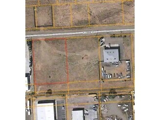
Property Record
8701 E Laredo Dr, Prescott Valley, AZ 86314


NEARBY LISTINGS FOR SALE OR LEASE
Property Detail
8701 E Laredo Dr
103-33-037A
Prescott Valley
Storemultistory
PRESCOTT VALLEY UNIT 16 AND PRESCOTT VALLEY - SANTA FE SUBDIVISIO N REPLAT LOTS 6469-6470 AND 6469A - 6470A AND ADJOINING ABANDONED ALLEY PER MAP 2016-0049073, LOT 6469R
X
Yavapai
04025C1718H
Arizona
2024
0.86 AC
2026
Prescott & Sedona
000608
Other Market Areas
4,950 SF
Prescott, AZ
DEMOGRAPHICS near 8701 E Laredo Dr
1 Mile
3 Mile
5 Mile
2024 Total Population
4,263
37,312
51,149
2029 Population
4,654
41,051
56,518
Pop Growth 2024-2029
+ 9.17%
+ 10.02%
+ 10.50%
Average Age
42
44
45
2024 Total Households
1,616
15,201
21,106
HH Growth 2024-2029
+ 9.59%
+ 10.49%
+ 10.98%
Median Household Inc
$66,384
$61,930
$61,522
Avg Household Size
2.60
2.40
2.40
2024 Avg HH Vehicles
2.00
2.00
2.00
Median Home Value
$278,653
$310,013
$321,018
Median Year Built
1992
1997
1998
Nearby Places
Map Layers
Map Styles
 Street
 Aerial
- Restaurants
- Banks
- Shops
- Fitness
- Groceries
Nearby Properties
Address
Land Use
TOTAL SIZE
Lot Size
Zoning
Address
Land Use
TOTAL SIZE
Lot Size
Zoning
208,851 SF
27.27 AC
Address
Land Use
TOTAL SIZE
Lot Size
Zoning
271,471 SF
60.72 AC
Address
Land Use
TOTAL SIZE
Lot Size
Zoning
124,220 SF
2.85 AC
Address
Land Use
TOTAL SIZE
Lot Size
Zoning
135,064 SF
5.09 AC
Address
Land Use
TOTAL SIZE
Lot Size
Zoning
162,490 SF
18.78 AC
Address
Land Use
TOTAL SIZE
Lot Size
Zoning
80,137 SF
20 AC
Address
Land Use
TOTAL SIZE
Lot Size
Zoning
18,241 SF
66.38 AC
Address
Land Use
TOTAL SIZE
Lot Size
Zoning
68,093 SF
4.78 AC
Address
Land Use
TOTAL SIZE
Lot Size
Zoning
59,348 SF
10.25 AC
Address
Land Use
TOTAL SIZE
Lot Size
Zoning
60,263 SF
18.14 AC
Address
Land Use
TOTAL SIZE
Lot Size
Zoning
51,437 SF
5.90 AC
Address
Land Use
TOTAL SIZE
Lot Size
Zoning
41,251 SF
4.79 AC
Address
Land Use
TOTAL SIZE
Lot Size
Zoning
52,282 SF
9.44 AC
Address
Land Use
TOTAL SIZE
Lot Size
Zoning
54,552 SF
49.31 AC
Address
Land Use
TOTAL SIZE
Lot Size
Zoning
102,281 SF
11.81 AC
Address
Land Use
TOTAL SIZE
Lot Size
Zoning
61,859 SF
18.69 AC
Address
Land Use
TOTAL SIZE
Lot Size
Zoning
67,322 SF
5 AC
Address
Land Use
TOTAL SIZE
Lot Size
Zoning
61,755 SF
10.86 AC
Address
Land Use
TOTAL SIZE
Lot Size
Zoning
109,140 SF
7.47 AC
Address
Land Use
TOTAL SIZE
Lot Size
Zoning
75,556 SF
98.66 AC
Address
Land Use
TOTAL SIZE
Lot Size
Zoning
66,562 SF
16.53 AC
Address
Land Use
TOTAL SIZE
Lot Size
Zoning
45,536 SF
5 AC
Address
Land Use
TOTAL SIZE
Lot Size
Zoning
31,664 SF
5.50 AC
Address
Land Use
TOTAL SIZE
Lot Size
Zoning
42,262 SF
7.32 AC
Address
Land Use
TOTAL SIZE
Lot Size
Zoning
36,927 SF
2.67 AC
Address
Land Use
TOTAL SIZE
Lot Size
Zoning
50,455 SF
7.11 AC
Address
Land Use
TOTAL SIZE
Lot Size
Zoning
33,622 SF
0.43 AC
Address
Land Use
TOTAL SIZE
Lot Size
Zoning
29,411 SF
4.25 AC
Address
Land Use
TOTAL SIZE
Lot Size
Zoning
23,000 SF
5.34 AC
Address
Land Use
TOTAL SIZE
Lot Size
Zoning
21,086 SF
5.31 AC
The World's #1 Commercial Real Estate Marketplace
Connect with us
© 2025 CoStar Group
The information above has been obtained from sources believed reliable. While we do not doubt its accuracy we have not verified it and make no guarantee, warranty or representation about it. It is your responsibility to independently confirm its accuracy and completeness. Any projections, opinions, assumptions, or estimates used are for example only and do not represent the current or future performance of the property. The value of this transaction to you depends on tax and other factors which should be evaluated by your tax, financial, and legal advisors. You and your advisors should conduct a careful, independent investigation of the property to determine to your satisfaction the suitability of the property for your needs.